Land Cover Trends Project Data Download
Important!! Please read this data
description before downloading data. It contains information on what
data is available, land cover codes and file name conventions.
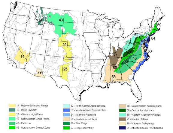
Data is available for 18 ecoregions including Landsat imagery and land
cover classifications for five dates, change images, and ancillary data
such as photos of the region. Click on the ecoregion name or the corresponding
area on the map to go to its data page.
| 14 - Mojave Basin and Range 16 - Montana Valley and Foothill Prairies 25 - Western High Plains 43 - Northwestern Great Plains 45 - Piedmont 59 - Northeastern Coastal Zone 62 - North Central Appalachians 63 - Middle Atlantic Coastal Plain 64 - Northern Piedmont |
65 - Southeastern Plains 66 - Blue Ridge 67 - Ridge and Valley 68 - Southwestern Appalachians 69 - Central Appalachians 70 - Western Allegheny Plateau 71 - Interior Plateau 79 - Madrean Archipelago 84 - Atlantic Coastal Pine Barrens |