Ecoregion 59 - Northeastern Coastal Zone
Click the sample number or box to view the data page for that sample.
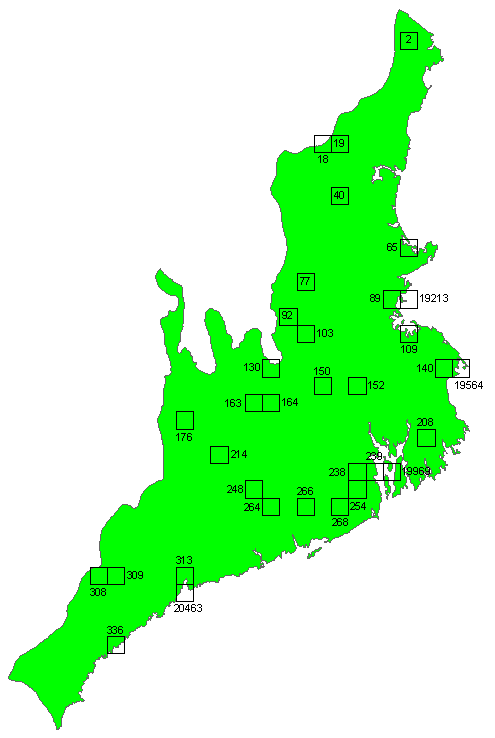
Note: In cases where small land area might affect accuracies, part or
all of the adjacent sample was used; data for both samples will be found
on the same page by clicking either sample in the map. Three instances
occurring in this region are:
Sliver 19213, view with Sample 89
Sliver 19564, view with Sample 140
Sliver 20463, view with Sample 313
You will need Adobe Acrobat Reader, available
as a free download, to view some of the files on this page. See
EPA's PDF page to
learn more about PDF, and for a link to the free Acrobat Reader. |
Data for ecoregion 59:
- Excel spreadsheet summarizing land cover change for all samples and land cover types download
- Shapefile of ecoregion boundary download
- Shapefile of sample boundaries download
- Field trip notes download
To download imagery, land cover data, and change images or to see the
associated ecoregion photos, use the sample ID number or box in the map
above.
Available data includes Landsat imagery and land cover classifications
for five dates, change images, and ancillary data such as photos of the
region.