Pacific Southwest, Region 9
Serving: Arizona, California, Hawaii, Nevada, Pacific Islands, Tribal Nations
Naturally Occurring Asbestos
El Dorado Hills
Multimedia Exposure Assessment
Preliminary Assessment and Site Inspection Report Interim Final
5.5 Soil Sampling
The START conducted soil sampling according to the El Dorado Hills Naturally Occurring Asbestos Multimedia Exposure Assessment, El Dorado Hills, California, Soil Sampling of Community Park, Schools, and Public Areas Field Sampling Plan. At all of the locations where the START conducted soil sampling, surface soil samples were collected. In addition, the START collected subsurface soil samples at the same surface soil sample locations at all three baseball playing fields at the Community Park (i.e., North Field, South Field, and New York Creek Field). Soil sample locations are shown on Figures 5-21 through 5-31. The soil samples are still being analyzed by a laboratory, and U.S. EPA is currently evaluating preliminary data. No results are available for release at the time of this report.
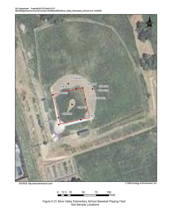
Silva Valley Elementary School Baseball Playing Field Soil Sample Locations
(click image for larger version)
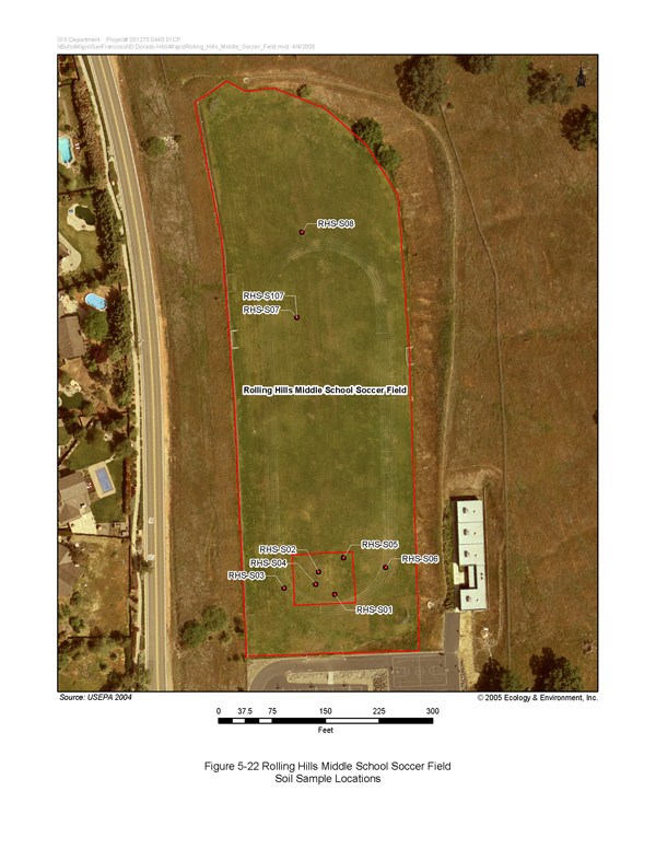
Rolling Hills Middle School Soccer Field Soil Sample Locations
(click image for larger version)
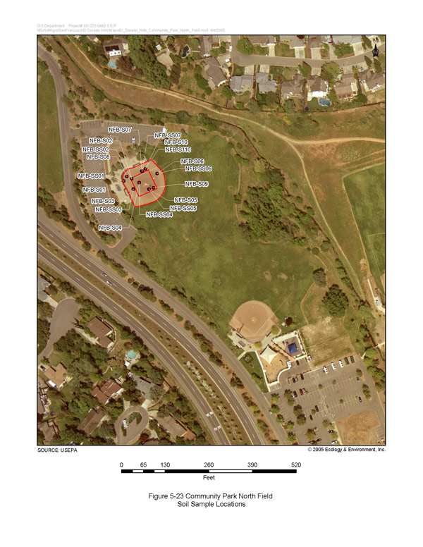
Community Park North Field Soil Sample Locations
(click image for larger version)
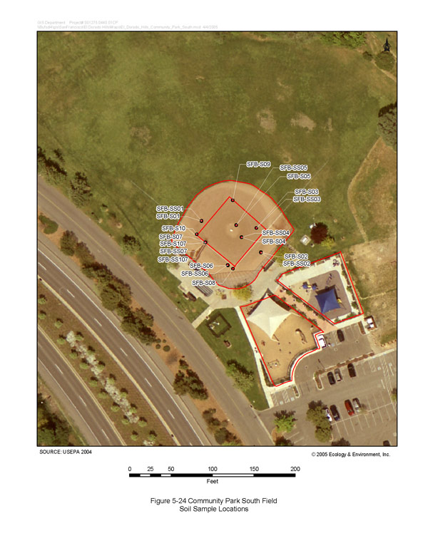
Community Park South Field Soil Sample Locations
(click image for larger version)
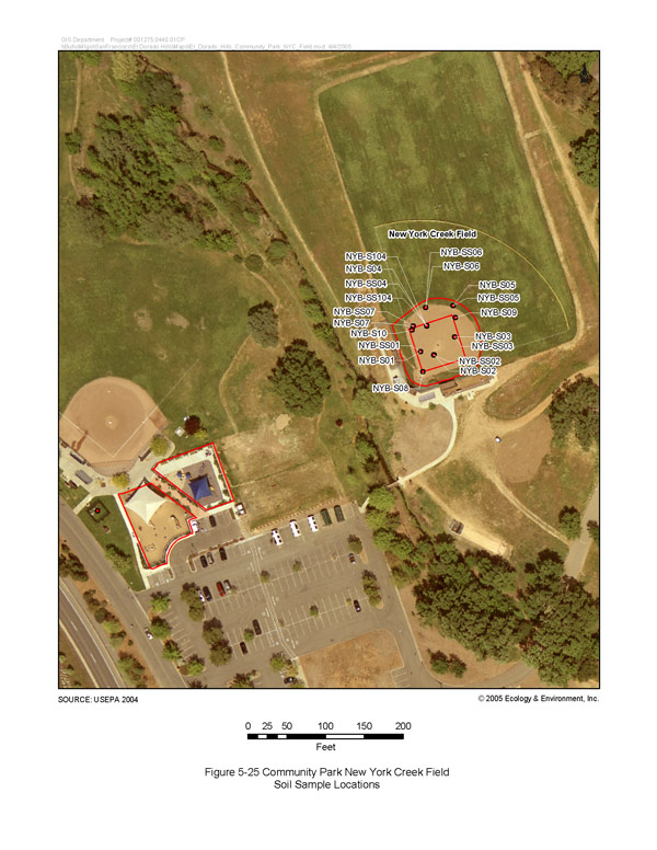
Community Park New York Creek Field Soil Sample Locations
(click image for larger version)
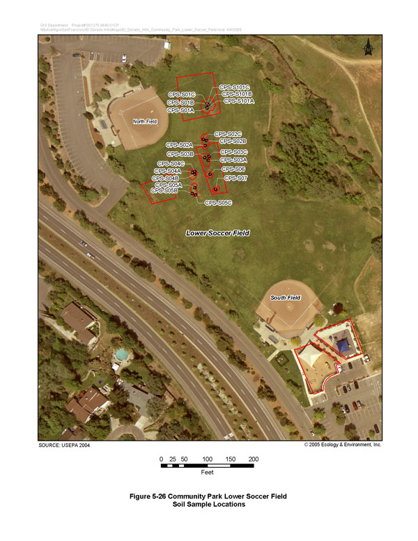
Community Park Lower Soccer Field Soil Sample Locations
(click image for larger version)
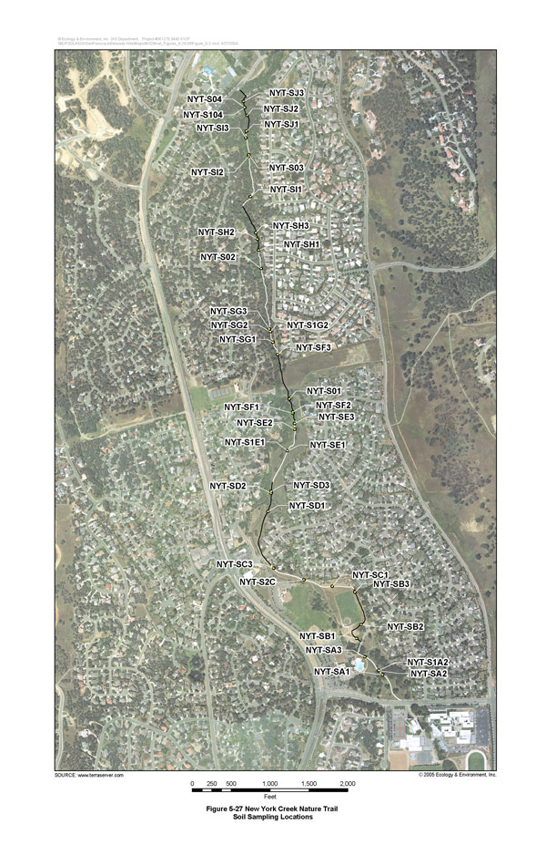
New York Creek Nature Trail Soil Sample Locations
(click image for larger version)
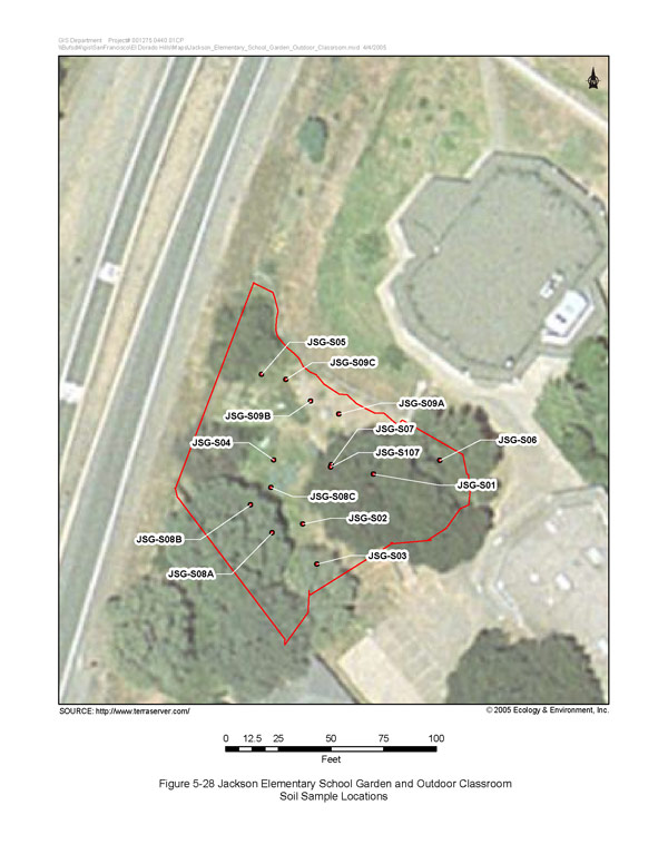
Jackson Elementary School Garden and Outdoor Classroom Soil Sample Locations
(click image for larger version)
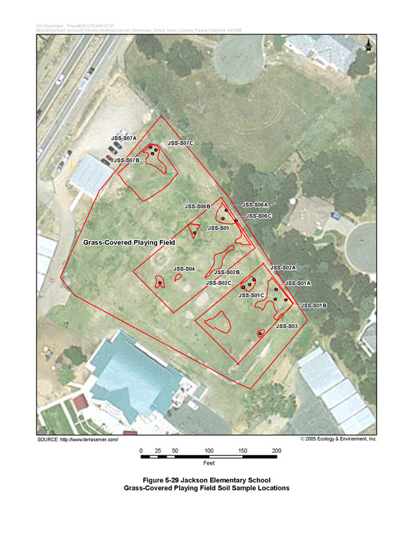
Jackson Elementary School Grass‑Covered Playing Field Soil Sample Locations
(click image for larger version)
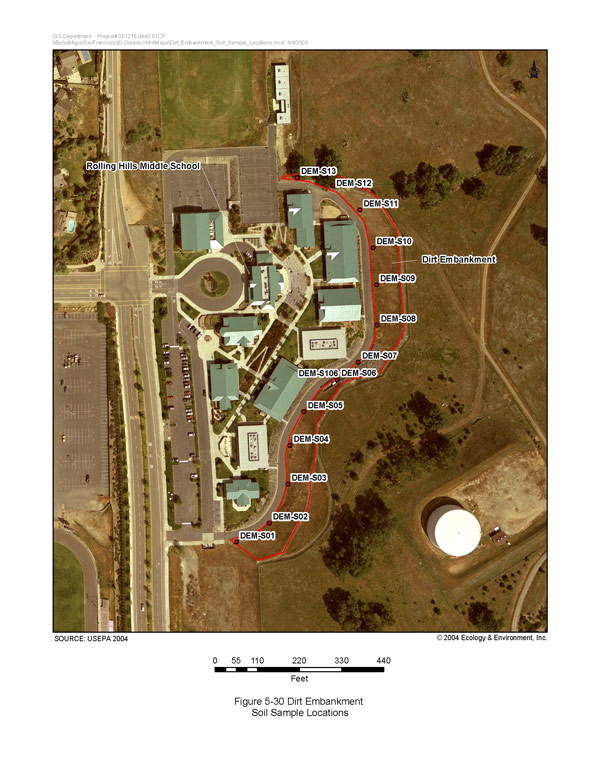
Dirt Embankment Soil Sample Locations
(click image for larger version)
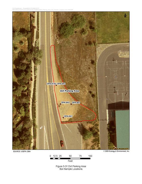
Dirt Parking Area Soil Sample Locations
(click image for larger version)
| Region 9 NewsroomRegion 9 Programs | Grants & FundingUS-Mexico Border | Media CenterCareers | About Region 9A-Z Index |