Components
As a result of peer reviews during its initial six years, EMAP has redefined its component structure. Each component has a working group to develop and guide its activities. The Information Management and Working Group components provide infrastructure for EMAP to carry out its mission. The remaining components are parts of a national monitoring network that EMAP is developing.
EMAP West |
EMAP National Coastal Assessment |
| The EMAP West will advance the science of ecosystem health monitoring and will demonstrate the application of core tools from EMAP in monitoring and assessment across the West. |
To answer broad-scale questions on environmental conditions, EMAP and its partners have collected estuarine and coastal data from hundreds of stations along the coasts of the continental United States. EMAP's National Coastal Assessment comprises all the estuarine and coastal sampling done by EMAP beginning in 1990. |
Landscape Ecology Working Group |
|
| EMAP Aquatic Resource Monitoring. The Monitoring Design & Analysis component will bring the integration issues associated with regional-scale assessment to the forefront of research. Being revised. | The Landscape Ecology Working Group aims to develop landscape assessment approaches to enhance the ability of environmental managers to answer questions on environmental status and trends. Review their product: An Ecological Assessment of the United States Mid-Atlantic Region: A Landscape Atlas. |
Great Rivers Study |
EMAP Information Management |
| EMAP's Information Management component develops the information management infrastructure that enables EMAP to achieve its program objectives. | |
Regional EMAP |
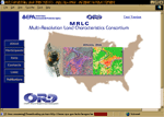
MRLC Project |
Regional EMAP was initiated to test the applicability of the EMAP approach to answer questions about ecological conditions and regional and local scales. |
Six Federal Environmental monitoring programs, EMAP (US EPA), GAP (USGS), NAWQA(USGS), C-CAP (NOAA), NALC (US EPA/USGS), and the RSA Center (USFS) have formed a partnership with the EROS Data Center (USGS) to facilitate the development of comprehensive land characteristics information for the United States. This partnership established the Multi-Resolution Land Characteristics Interagency Consortium (MRLC). |
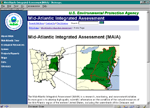
Mid-Atlantic Integrated Assessment |
MAIA ORD |
The Mid-Atlantic Integrated Assessment (MAIA) project incorporates data from state, regional and national environmental monitoring programs into regional assessments. |
Research to fill data gaps was conducted by three EMAP MAIA research groups (Landscapes, estuaries, and Surface Waters) |
PRIMENet Index Sites |
STAR Eagle |
In the Park Research and Intensive Monitoring of Ecosystems Network (PRIMENet, formerly known as DISPro) component, the National Park Service and EMAP will co-develop a 10-15 site terrestrial intensive monitoring/research network. |
EPA's STAR Estuarine and Great Lakes (EAGLES) Programs will attempt to develop indicators and/or procedures useful for evaluating the ‘health' or condition of important coastal natural resources. |
Ecological Indicator Development |
|
| The Ecological Indicator Development component will develop and understand new indicators that allow the detection and tracking of changes in integrity and sustainability as well as indicators that lead to the causes of impairment. |
![[logo] US EPA](../gif/logo_epaseal.gif)
