Aerial Surveillance of the Mid-Atlantic Coast
Others Doing Aerial Surveillance of Our Coast
- Virginia's Coastal Zone Mgmt. Program
 - have an annual Submerged Aquatic Vegetation aerial
survey &
helicopter surveys of Phragmites patches on the seaside of Virginia's
- have an annual Submerged Aquatic Vegetation aerial
survey &
helicopter surveys of Phragmites patches on the seaside of Virginia's
Eastern Shore
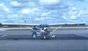
A plane used to survey the mid-Atlantic coast
During the beach season, the mid-Atlantic office of EPA conducts aerial surveillance of the near coastal marine waters of the Mid-Atlantic Bight. The area extends from approximately two miles just north of the mouth of the Delaware River, off of New Jersey, south to the Virginia - North Carolina border (map of route). Flights originate out of the Summit Aviation Airport in Delaware. From there the plane flies to Ocean City, New Jersey and begins surveillance there. The round-trip distance of each flight is approximately 500 nautical miles and takes between six and seven hours of flight time.
Typically, there are two observers on board to record sightings of:
- dolphins
- turtles
- whales
- schools of fish
- water color / algal blooms
- boats
- floating debris
- oil slicks
- beach use
- other activities of interest
All the information is obtained from visual observation by EPA employees and summer interns. In order to ensure consistency from flight to flight, standard operational procedures are followed, including using a standardized observation log sheet. The log sheet was designed for ease of use, like a checklist. The left column is a map of the coastline. Users check off dolphins, turtles, fish schools, private vessels, commercial vessels, water color/algal blooms, and floatable debris/oil slicks. The column to the far right is for comments. Information on sightings of possible illegal activities are forwarded to the state and federal agencies which have jurisdiction.