Mid-Atlantic Aerial Surveillance Route
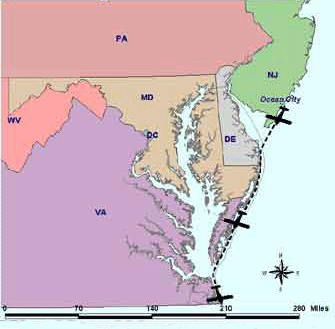
The flight path for EPA mid-Atlantic's aerial surveillance goes from just north of the mouth of the Delaware River, off of New Jersey, south to the Virginia - North Carolina border as shown below.
Mid-Atlantic Coastal Environment
Serving: Delaware, District of Columbia, Maryland, Pennsylvania, Virginia, and West Virginia
https://search.epa.gov/epasearch/epasearch">Contact Us Search: