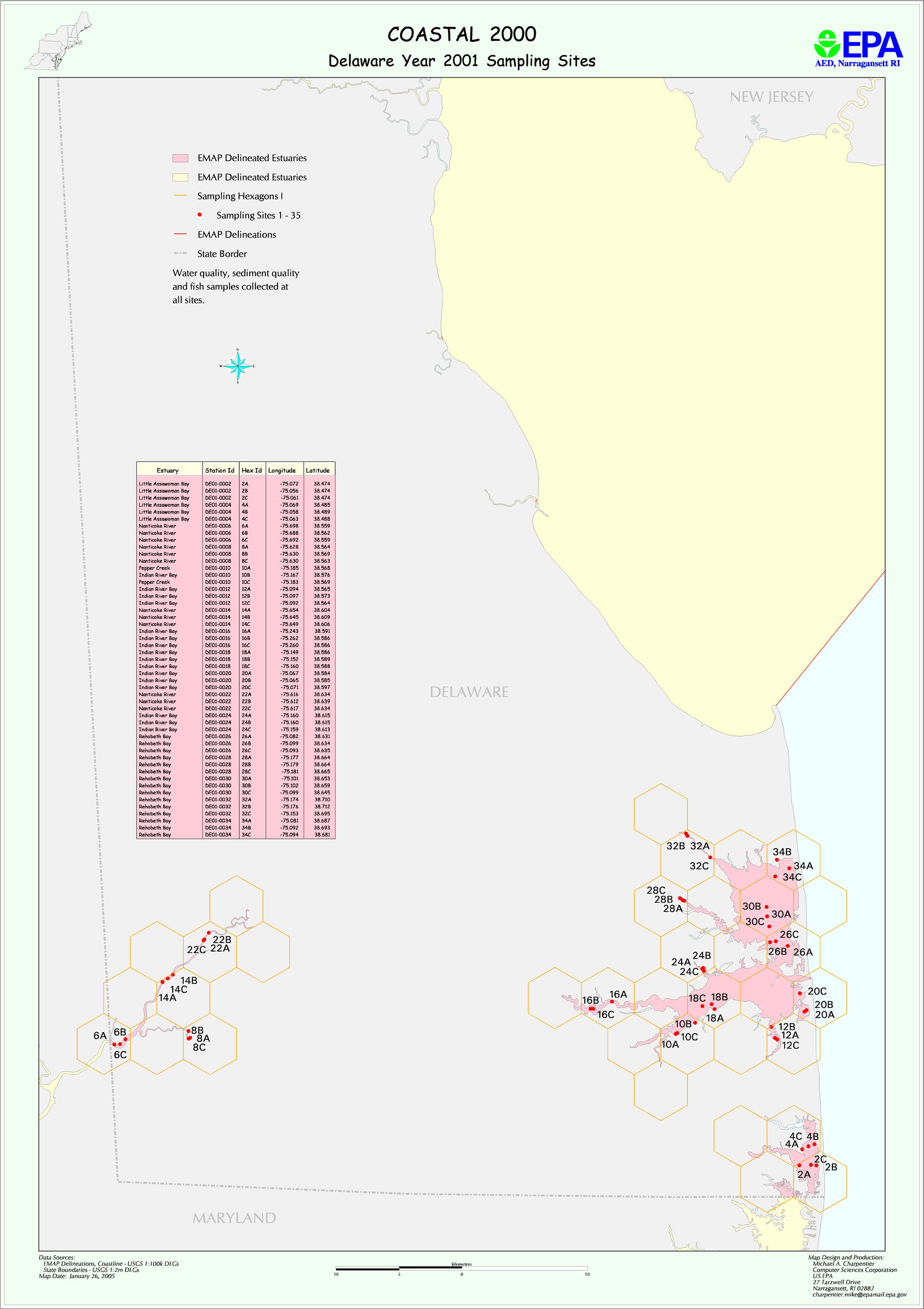
Delaware Inland Bays Phase I Design (2000/2001) Narrative
Delaware Bay sampling followed a two year design for 2000/2001, based on one sampling stratum.
The map files deinb2k.jpg and deinb2k1.jpg show planned the sampling locations for 2000 and 2001 respectively. The file DE2000_2001_stations.xls provides planned latitude/longitudes for all stations. The file DI_areas.xls provides information on station areas.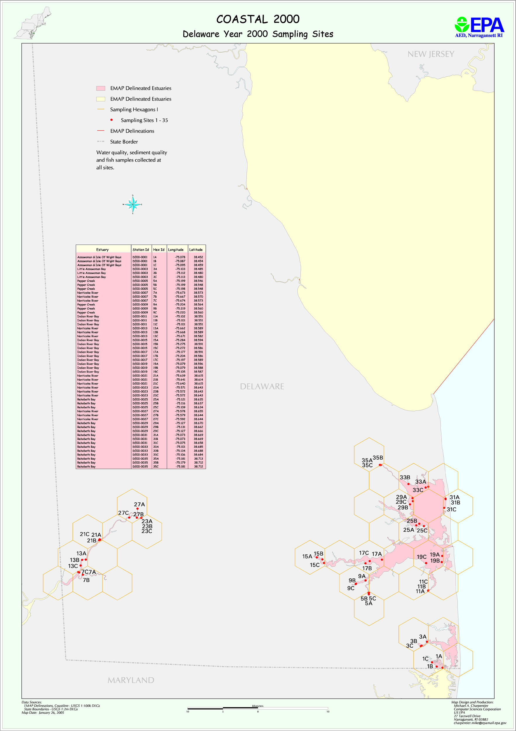