Delaware Bay Phase II Design (2002-2004) Narrative
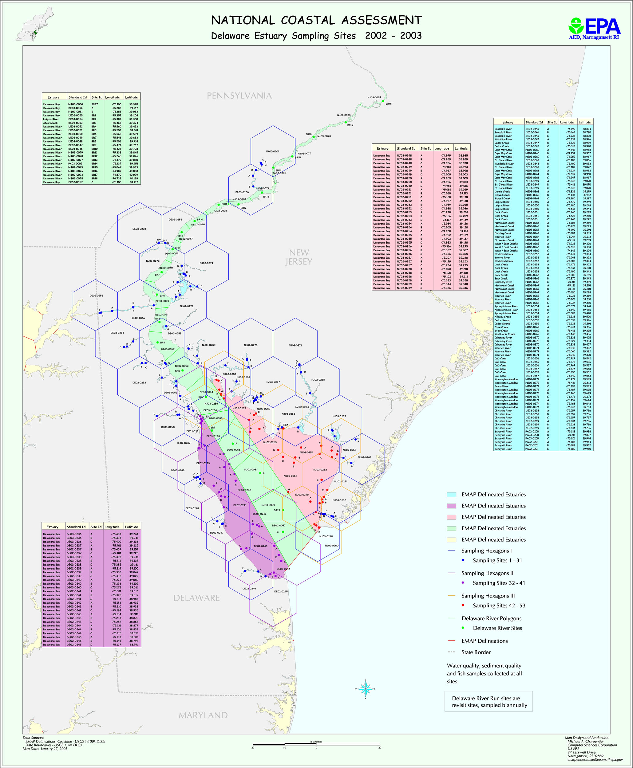
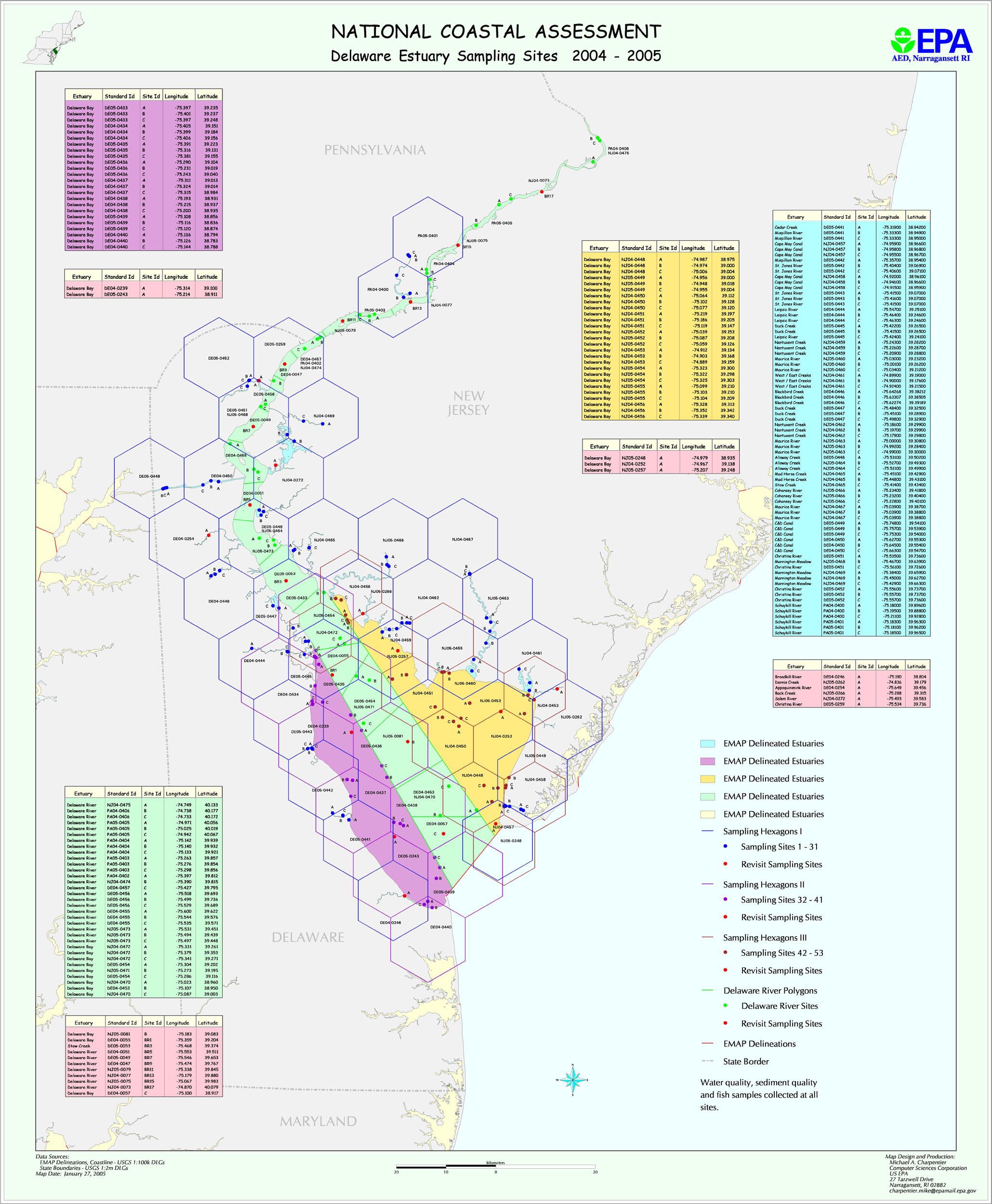
Delaware Bay sampling followed a two year design for 2002/2003, and started on another 2 year design in 2004. The 2004 design was abandoned in 2005, in favor of a GRTS based design. Both these two year designs are similar to the original Year 2000/2001 design, based on four strata (DE East, DE West, Delaware River, and DE Small Systesms).
The map file deestk2.jpg shows planned sampling locations for 2002-2004, and the file deest2k4.jpg shows planned sampling locations for 2004-2005 . (The planned Year 2005 stations were NOT sampled.) The file DBMAP0203.xls provides planned latitude/longitudes for year 2002 and 2003 stations, and the DEEST2K4.xls provides planned lat/longs for the 2004 stations. The file DE2K2PCT.xls provides information on station areas for year 2002 and 2003 stations; the file DE2K4PCT.xls provides information on station areas for year 2004 stations.