Surface Waters Information
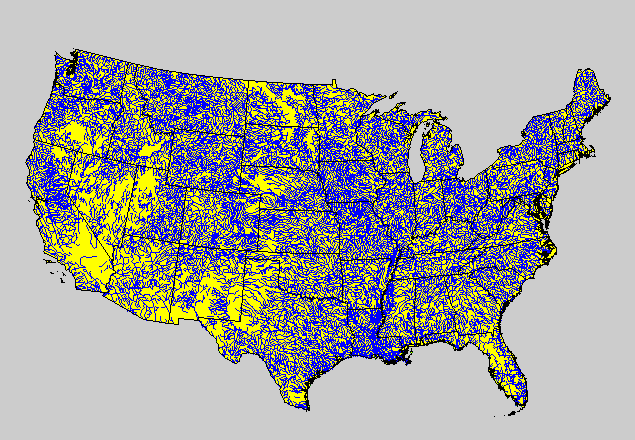 Inland surface waters consist of all the Nation's lakes (other than the Great Lakes), reservoirs, rivers, and streams. Lakes are distinguished from wetlands by depth and by size. A lake is defined as a standing body of water greater than 1 hectare (about 2.5 acres) that has at least 1000 square meters (about 0.25 acre) of open water and is at least 1 meter (about 3 feet) deep at its deepest point. Streams (and rivers) were identified from stream traces on maps and confirmed by field visits. Streams were operationally defined as any first or higher order stream that is represented as a blue line on a U.S. Geological Survey 1:100,000 topographic map.
The target population for Surface Waters resources consisted of all inland lakes (excluding the Great Lakes) and streams in the United States (Figure Above). Lakes and streams constitute different resource categories. Initially, lakes and streams were subdivided into a portion of the population to be selected from the EMAP grid (for example, lakes; <500 hectare) and into another portion that were selected from a list of all lakes or streams greater than a certain size (for example, lakes; >500 hectare). Certain lake and stream characteristics, such as geographic location, elevation, size, length, and ecoregion, will be used to help classify the resource category. Samples were obtained for each lake and stream class to estimate ecological condition.
EMAP's Surface Waters Group is interacting with the U.S. Geological Survey to interface EMAP with the U.S. Geological Survey surface water monitoring networks and the EPA Office of Water, U.S. Fish and Wildlife Service, and State monitoring programs.