Agroecosystems Information
 An agroecosystem is a dynamic association of crops, pastures, livestock, other flora and fauna, soils, water, and the atmosphere. Acroecosystems are contained within larger landscapes, which include uncultivated land, drainage networks, rural communities, and wildlife.
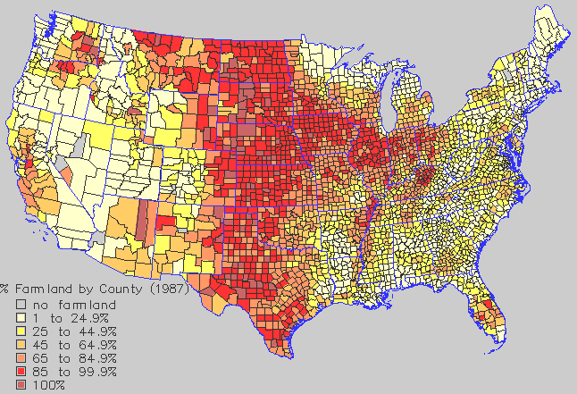
The target population included all agricultural lands and adjoining natural areas in the United States, an area that comprises between 43% and 46.0% (USDA 1992, 355) of total terrestrial acres in the 50 States (Figure at left). The sampling frame for agroecosystems incorporated sampling units used by the U.S. Department of Agriculture's National Agricultural Statistics Service.
EMAP's Agroecosystems Data Group planned to collect data through surveys of growers and by field sampling of cropland to include annual crops, pastures, woody perennial crops, adjacent natural areas, and farm ponds. (Uncultivated rangeland, however, was being studied by Arid Ecosystems.) EMAP performed agroecosystems monitoring in close cooperation with several U.S. Department of Agriculture agencies, such as Agricultural Research Service, National Agricultural Statistics Service, and Soil Conservation Service.