EPA New England Regional Laboratory (Office of Environmental Measurement and Evaluation)
The New England Lakes and Ponds Project (NELP)
The New England Lakes and Ponds Project took place in 2007, providing a consistent and first time comprehensive assessment of the ecological and water quality condition of lakes and ponds across New England. The purpose of this effort was to enhance existing state lake monitoring programs by 1) providing statistically supportable approaches to water body surveys, 2) provide open opportunities for the sharing of technical expertise across state and federal programs, 3) provide for the transfer of new technologies to be applied to current monitoring programs, and 4) allow for public participation and collaboration through all project stages.
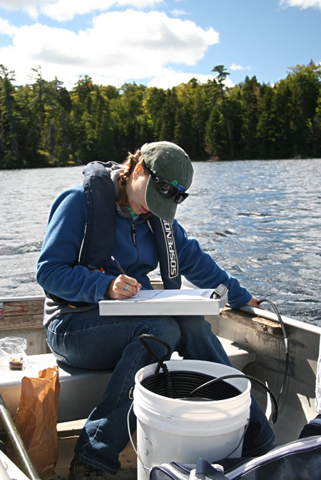
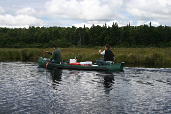
Data Collection Using a Multi-probe Sonde
There are many excellent lake monitoring programs that can be found across the country. Some are initiated by local citizens that live along the water body and others are state lake programs that provide annual monitoring of targeted water bodies for lake management purposes. Despite these efforts, there are many lakes that have little or no monitoring done on them, so existing or historical conditions of these water bodies are unknown. Even with the existence of these monitoring entities, the tools, techniques, sampling schedules and parameters that they monitor are often quite different. These efforts provide good utility for managing individual lakes, but they do not offer insights as to how a population of lakes as a whole is doing. The ability to detect trends in condition is not available (i.e., acid deposition, aquatic invasives). This is analogous to a check-up done on an individual, it tells you a lot about the individual, but tells you nothing about the overall health of the general population.
The New England Lakes and Ponds Project utilized a probabilistic sampling approach, based on a random site selection process that allowed for statistically valid statements to be made about a population of lakes across the region. The approach can be used at various geographic scales, from statewide, to regional, to national levels. In 2007, the NELP project partnered with EPA’s National Aquatic Resource Surveys (NARS) to help implement the same type of randomized lake survey at the national level. Since this time, EPA has completed another National Lakes Assessment in 2012, which is currently being repeated on a five year cycle. The approach used for these surveys provides the opportunity to track trends in water quality and ecological health through time. [Specifics on how random probability based survey designs are implemented can be found here.]
The New England Lakes and Ponds Project, through consensus-building meetings with various federal, state, and citizen monitoring groups, chose the population of lakes that were greater than 4 hectares (10 acres) in size, more than a meter deep, and had some degree of open water absent of emerging or floating aquatic plants. Large lakes such as Lake Champlain, or Moosehead Lake in Maine, were excluded from the study because of logistical constraints and the limited value added to water bodies that have been intensely studied to date. Lakes that fell within the size and depth criteria were selected as the population from which a randomly selected, but spatially balanced sub-sample was taken for the survey.
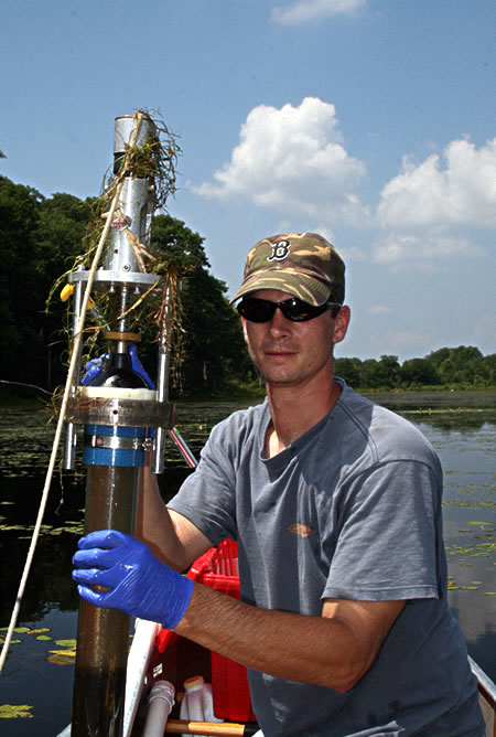
Collecting a Sediment Core Sample
This approach to lake monitoring at a regional scale allowed assessment of the condition of the region's lakes as a population, establishing a common baseline from which to compare future surveys and identify trends in water body condition (i.e., overall are lake conditions getting better or worse?). The project also provided opportunities for transferring technological tools and techniques to assist states, tribes, and citizen lake monitoring programs in enhancing their individual lake programs. The two main goals of this survey was to determine what percentage of the region's lakes are in good, fair, or poor condition, and what were some of the key factors placing stresses on these systems and impacting ecological integrity. These goals are consistent with the larger National Lakes assessment (PDF) (2 pp, 723 K, about PDF) surveys, whose results are being used to determine the condition of lakes across the country. The two projects collaborated closely so that data from each could easily complement or be incorporated in to the other, providing a more statistically robust assessment of condition.
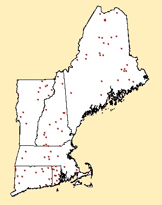
2007 Sampling Sites
Approach
Sixty-eight New England lakes were selected for sampling in the summer of 2007 utilizing the probability-based design protocols. In addition, another 29 lakes were hand selected representing the known “best of the best,” or least disturbed lakes. These lakes are termed reference lakes, and are used as the benchmark for highest quality and best ecological integrity. These lakes provide a reference point from which to measure lake condition. Because reference lakes are usually found in undisturbed and somewhat “unique” areas, these water bodies did not end up being evenly distributed through the region as the randomly selected lakes were.
Ninety-seven lakes in total were sampled in New England in 2007 from an original list of over 1200 lakes. These additional lakes were selected in case state agencies wanted to conduct a probability-based sampling effort within their own borders. State water quality program managers may then make statistically valid and comprehensive assessments of the condition of lakes within their own individual state. The states of Vermont and New Hampshire implemented their own statewide lakes surveys during the 2007 Regional and National Lakes Assessment survey period.
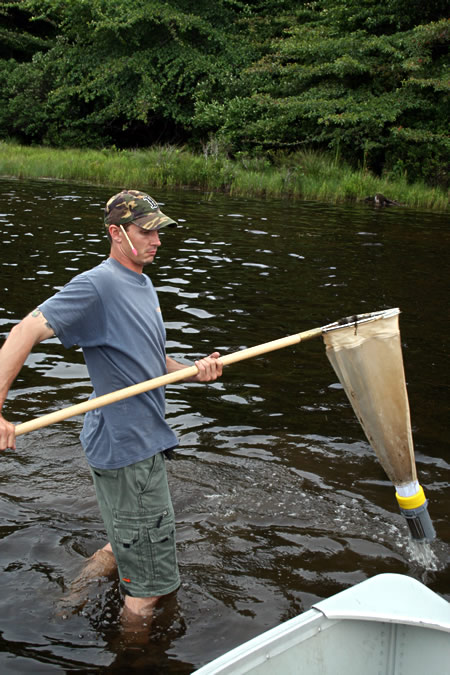
Collecting a Benthic Invertebrate Sample
Indicators
Specific measurements are made of lake characteristics and their associated ecology in order to make assessments of water body condition and overall ecological health. These specific measurements are termed indicators, and provide the basic ingredients for assessment. Indicators are selected because they represent a unique characteristic and/or important component of lake ecology or lake water quality. While indicators are often useful measurements in and of themselves, the real power of indicators comes when they are combined to formulate indices of condition, representing a holistic or comprehensive measurement of lake condition. Much the same as the human health analogy used before; listening to a heartbeat can be informative of one's general health, but combining it with blood work, height and weight, family history, and so on will provide a much more robust and realistic assessment of one's condition.
The New England Lakes and Ponds Project and the National Lakes Assessment use specific indicators to determine the trophic condition of lakes. These indicators provide insights to lake nutrient levels, the ecological integrity of the water body, and the recreational value or recreational potential of the water body. These specific indicators, along with additional indicators specifically for New England, are used to make assessments of the proportion of lakes that are in good, fair, or poor condition for water quality, ecological condition, and recreational use.
Some of the indicators measured through the New England Lakes and Ponds effort are discussed below:
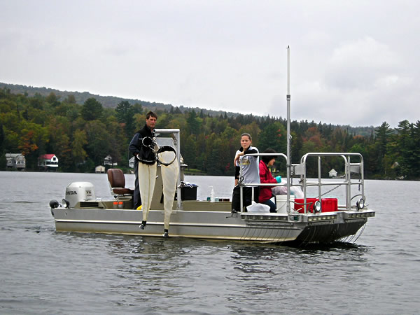
Sampling at Tomhegan Pond, ME
Phytoplankton – Phytoplankton are free floating aquatic algae that may or may not be mobile and that inhabit the light penetrating (euphotic) zone of a lake. They utilize carbon dioxide and release oxygen and are an important food source for zooplankton living within a system. Certain phytoplankton called diatoms will build glass-like cases that, upon the algae's death, will settle to the bottom of a lake and be preserved indefinitely. These “golden algae” are very informative when trying to reconstruct historical lake conditions and can provide a timeline of lake condition through past hundreds of years.
Phytoplankton can become abundant under nutrient rich conditions, often causing poor aesthetic and recreational conditions. Certain species of photosynthetic bacteria can thrive under these conditions, (i.e., cyanobacteria), and cause toxic effects in animals. These micro-organisms are sensitive indicators of increasing nutrient levels entering the water body.
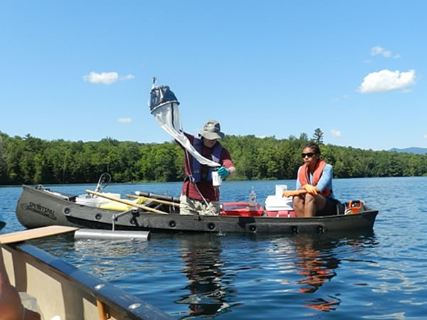
Collecting Zooplankton Samples
Zooplankton - In aquatic systems, the zooplankton are the link between phytoplankton, primary producers that produce energy and derive their food supply from sunlight, and higher trophic organisms that derive their food from the consumption of organisms lower down the food chain (i.e., fish consuming phytoplankton and zooplankton and subsequently being consumed by larger fish-eating fish). The zooplankton can be sensitive indicators of ecosystem imbalances, showing different species compositions, species abundances, and body sizes resulting from nutrient enrichment of the waterbody, or predation by introduced plankton-eating fish (such as baitfish) and many other stressors introduced to the ecosystem.
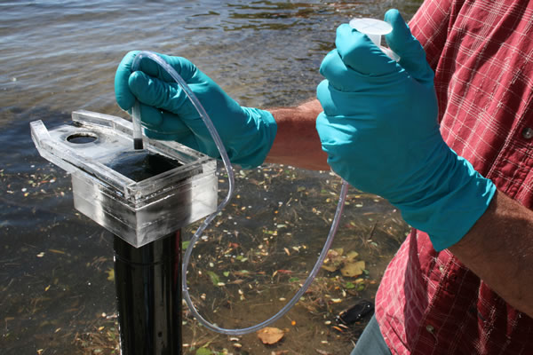
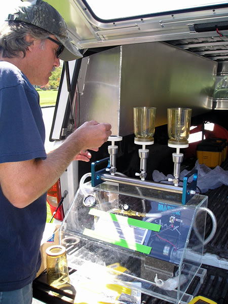
Removing a Portion of a Sediment Core for Mercury Analysis
Lake Sediment – By looking at the composition of lake bottom sediments, one can determine what the historical conditions of the lake and the surrounding watershed were like and make comparisons with present day conditions. Tree pollen, lake algae, and invertebrate communities such as zooplankton go through seasonal changes, dying and ultimately settling in layers at the bottom of a lake. These layers can represent annual patterns much like the growth rings from a tree and provide a timeline of changing conditions within a system. As an example, increased nutrient input, as from agricultural or storm water runoff, can greatly accelerate algae growth in lakes and will be reflected in the amount and types of algal diatoms found in the lake bed sediments. One can make determinations as to the present condition of the lake from the most recently deposited topmost sediment layers as compared to pre-human times from deeper sediment layers. Comparing the differences between the layers can determine if management actions are needed to improve the conditions of the lake.
Preparing a Water Sample for Chlorophyll a Analysis
Water Chemistry – Analysis of the water chemistry of a lake helps in determining its nutrient related trophic status, current lake conditions, and if the water body is under stress. High nutrient inputs of phosphorus or nitrogen to a lake can add to the proliferation of widespread algal blooms or plant growth, which in turn can cause stresses in the biological community and make the water body unpleasant or unsuitable for human uses. The water chemistry parameters for the regional and national surveys were carefully selected through consensus-building meetings at regional and national levels, ensuring that the most informative indicators were selected. Details of these indicators can be found here (PDF) (104 pp, 11.1 MB, about PDF).
Habitat – Lake habitat assessments are designed to reflect the complexity of a lake's shoreline, littoral, and sub-littoral habitats, and the impacts that may be affecting it. The habitat protocol utilized for the national and regional lakes surveys involved assessing more than 30 different parameters at ten different habitat stations randomly selected, but equally spaced around the perimeter of the lake. At each habitat station, a survey plot was evaluated consisting of a 15x15 meter riparian zone extending from the shoreline back away from the lake, and a 15 meter wide section along the shoreline extending 10 meters out into the lake. Details of this habitat methodology can be found at the national lakes survey website listed above in the previous paragraph.
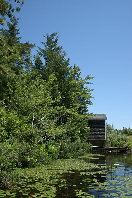
Wallace Pond, MA
Other Indicators – Along with traditional lake monitoring parameters such as dissolved oxygen and temperature profiles, secchi disc readings (clarity), and chlorophyll measurements, EPA has promoted the development of new methods and technologies to aid in further interpretations of lake condition and ecosystem health.
Debsconeag Lake, ME
An approach to remote sensing for New England lakes to measure water column chlorophyll concentrations and determine the presence of cyanobacteria is being developed in collaboration with the University of New Hampshire. Rather than the utilization of satellite imagery as is common in remote sensing work, measurements are made directly on the lake. Two fiber optic cables are used separately to measure the spectral characteristics of incoming light from the sky and the light that is leaving the waters' surface. The cables direct the light to two hyperspectral radiometers which determine the spectral qualities of light coming from each source. These two measurements are used to calculate reflectance, which describes the difference between the spectral characteristics of the light entering and leaving the water. Reflectance signatures vary as a result of differences in absorption and scattering occurring in the water column, features which can be related to constituents of interest such as phytoplankton and colored dissolved organic matter (CDOM). Phytoplankton communities in lakes can be further described by the type and concentrations of pigments they contain, such as chlorophyll a (all phytoplankton) and phycocyanins (cyanobacteria), as long as the pigments have distinct effects on reflectance.
Dicks Pond, MA
The application of this "on-lake" remote sensing technique is anticipated to provide a quick and cost effective approach to determining chlorophyll a and cyanobacteria concentrations in surface waters, once again minimizing costs of wet chemistry sample collections and analytical laboratory support. Satellite remote sensing imagery (i.e., Landsat, MODIS) has been used historically to determine water quality conditions in surface waters, but existing satellite sensors have inherent drawbacks which prevent its effective application for monitoring New England lakes. Few satellite sensors possess the combination of spatial resolution, spectral information and frequency of overflights necessary for their use in method development.
Other work that has taken place through the lakes project include DNA sequencing of zooplankton for positive species identification, regional sediment diatom modeling, development of electronic data capture technology to enhance accuracy and reduce data processing time, and development of on-line databases and tools for data interpretation.
Useful Links
- New England Lakes and Ponds Project Brochure (PDF) (2 pp, 288 K, about PDF)
- Survey of the Nation's Lakes, Clean Lakes, US EPA
- Maine Lakes, Bureau of Land and Water Quality, Maine Department of Environmental Protection

- Lakes and Ponds, Connecticut Department of Environmental Protection
- Lakes and Ponds Management and Protection Section, Water Quality Division, Vermont Department of Environmental Conservation
- Watershed Management Bureau, New Hampshire Department of Environmental Services