Jump to main content or area navigation.

Contact Us

Region 1: EPA New England

Wadeable Streams

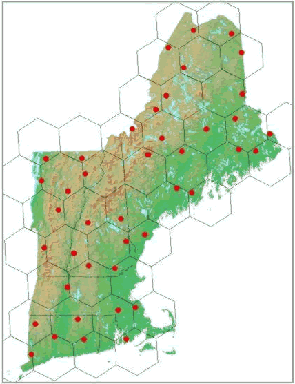
This report contains data from a monitoring study of New England's wadeable streams. It includes water chemistry analyses, in-stream and riparian habitat assessments, fish community assessments, macro-invertebrate collections, physical chemistry measurements, and photo documentation of forty-two randomly selected stream locations surveyed during July through October, 2001. more »

Access individual stream information by clicking a red dot on the map or a stream name from the list below.

List of sampled streams:

Connecticut
Mill Brook
Pease Brook
Saugatuck River
Steele Brook
Willamantic River
 
Maine
Aegan Brook
Boyden Stream
Carrying Place Stream
Churchill Stream
Depot Stream
Greenleaf Brook
Halfway Brook
Hardy Stream
Higgins Brook
Horseshoe Stream
Kennebunk River
Logan Brook
Medomak River
Narraguagus River
New Stream
River DeChute
Schoodic Brook
Snare Brook
Spruce Brook
Togus Stream
Massachusetts
Longwater Brook
Sawmill River
Stop River
 
New Hampshire
Beaver Brook
Beech River
Cocheco River
Dinsmore Pond Stream
Indian River
Warren Brook
 
Rhode Island
Great Swamp Brook
 
Vermont
Black Creek
Mettawee River
Miller Run
Third Branch White River
Willoughby River
Winooski River (east)
Winooski River (west)


Serving Connecticut, Maine, Massachusetts, New Hampshire, Rhode Island, Vermont, & 10 Tribal Nations

Jump to main content.