Pacific Southwest, Region 9
Serving: Arizona, California, Hawaii, Nevada, Pacific Islands, Tribal Nations
Dredging and Sediment Management
| SF-DODS Quick Finder | ||
|---|---|---|
| Dredging & Sediment Home SF-DODS Overview Table 1 Table 4 | Regional Teams & Partners Vessel route to SF-DODS Table 2 | Disposal Sites Reference Area Database Table 3 |
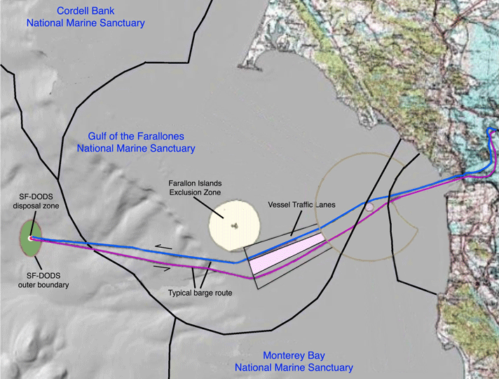
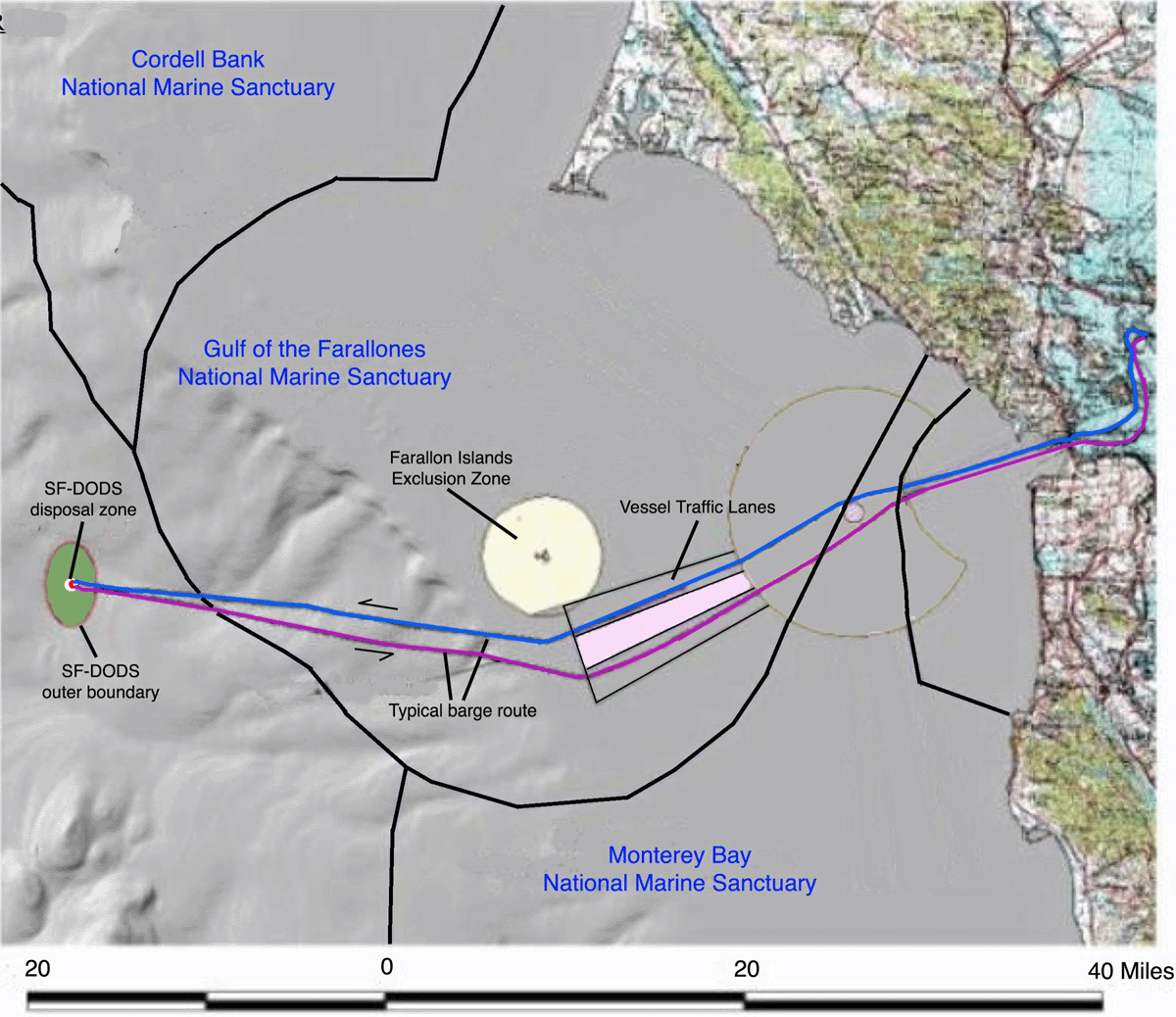
SF Deep Ocean Disposal Site (SF-DODS) Vessel Route
This map shows the route of a typical disposal vessel trip to the SF-DODS. The vessel remains within the established shipping lanes in the vicinity of the Farallon Islands as required.
 Larger version for download (.gif image format, 500K — click to display, then right-click to copy)
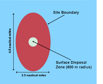
37° 39.0 min N, 123° 29.0 min W (NAD 83)