Collaboration and Partnerships
Note: EPA no longer updates this information, but it may be useful as a reference or resource.
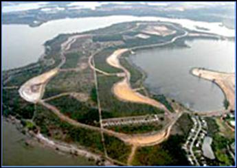
Watershed Improvement Summary-Lake Apopka (FL)
EPA Region 4 - Atlanta
Geographic location or area of activity: Lake Apopka, Florida, approximately 15 miles northwest of Orlando.
Description of activity: Lake Apopka is the fourth largest lake in Florida. It forms the headwaters of the Harris chain of lakes and the Ocklawaha River. It is over 30,000 acres in size, with a drainage basin of 119,773 acres. Approximately 30% of the lake is fed by the Gourd Neck Spring; the remainder is direct rainfall and stormwater runoff. The only surface water outflow from Lake Apopka is the Apopka-Beauclair Canal, which flows north into Lake Beauclair and the Harris chain. Discharge from the canal is controlled at the Apopka-Beauclair Lock and Dam, which influences lake stage.
The lake has undergone cultural eutrophication and significant hydrologic alteration since the late 1800s. The rate accelerated in the 1940s when the 19,000 acre sawgrass marsh along the north end of the lake was diked, ditched and drained for agriculture. Because of the surrounding dike and subsidence, the farmlands were lower than the Lake, which periodically required pumping water from the farmlands to adjacent waterbodies for flood control. Farming practices have used the lake as both a source of irrigation water and receiving water for disposal of excess water. Sewage from the town of Winter Garden and wastewater from citrus processing plants also contributed to historic nutrient loads into Lake Apopka. In 1947, a hurricane destroyed much of the lake’s aquatic vegetation. One month later, the first of many recorded algae blooms occurred.
Restoration of Lake Apopka has been supported by several watershed efforts, including the 1993 Surface Water Improvement and Management (SWIM) Plan for Lake Apopka and most recently, Basin Management Action Plan (BMAP) development. The 1999 Florida Watershed Restoration Act outlines an innovative process for implementing total daily maximum loads (TMDLs) by creating BMAPs with participation local stakeholders. In August 2007, the Upper Ocklawaha BMAP was completed. This plan identifies water quality restoration goals (TMDL targets), management actions (programs and projects), an implementation strategy (funding, timelines, etc.) and an adaptive management approach based on water quality monitoring.
The BMAP addresses a wide variety of pollutant sources in the watershed. For Lake Apopka, the primary focus was on nutrient removal via a marsh flow-way system, management of urban stormwater, management of agricultural nutrient loading and restoration of the historic agricultural areas on the north side of the lake. Those management actions considered technically feasible, financially viable and environmentally beneficial were included in the BMAP. Use of these criteria resulted in a list of management actions that integrates a wide variety of programs and activities sponsored by members of the Working Group.
An adaptive management approach is also included in the BMAP to identify and make modifications when circumstances change or when feedback mechanisms indicate that a more effective strategy is needed. Tracking implementation, monitoring water quality and pollutant loads and periodic Working Group meetings to share information and expertise are key components of the adaptive management approach.
This group met nearly monthly from June 2004 through June 2006, with three subsequent meetings through the end of 2007. Through a consensus-based process, they jointly developed the BMAP, with guidance provided by the Department of Environmental Protection and significant support from the St. Johns River Water Management District. In addition, a number of special briefings and presentations were carried out as needed for city councils, county commissions, elected official liaisons from local governments, special interest groups, community organizations and others.
The estimated cost of the management actions included in the Upper Ocklawaha BMAP for Lake Apopka totals more than $125 million. Funding sources range from local stormwater fees to regional and state cost-share grants and legislative appropriations.
Local partners: 22 local governments; six state agencies; Florida Department of Environmental Protection; St. Johns River Water Management District.
Activity URL: ftp://ftp.dep.state.fl.us/pub/water/BMAP/Upper_Ocklawaha/
Lake Apopka