Green Landscaping: Greenacres
Natural Landscaping Tool Kit
THE NATURAL LANDSCAPING ALTERNATIVE:
An Annotated Slide Collection - Slide
6
|
|
|
|
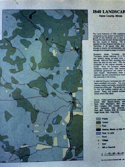
A knowledge of conditions prior to the region's settlement in the mid-1800's can provide a good foundation for the planning of natural landscaping. Soil maps provide indications of the natural communities existing at that time. In addition, surveyor's records and other historical documents provide clues to what plants and ecosystems were present. Agricultural and urban development practices have often altered hydrologic and soil conditions, but these can sometimes be partially restored through site development.
This map of Kane County, Illinois, based on historical records, portrays the distribution of prairie, timber, fields, wetlands, and water bodies existing during the early 1840's.