ReefLink Database
Coastal Engineering
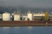
The Coastal Engineering sector is responsible for the design, construction, and maintenance of engineering projects along the coast, including ports, harbors, docks, and marinas needed by boats, ships, and other water transportation, as well as to facilitate recreational activities (such as fishing and diving).
CMap

CMap Description
Coastal engineering creates pressures primarily through activities related to the construction and maintenance of ports, harbors, docks, & marinas. Development may require shoreline armoring or dredging activities, which can directly impact coastal vegetation and alter patterns of water flow. Coastal engineering projects and the physical infrastructure they create benefit from shoreline protection, as well as indirectly from the existence value of a diverse, healthy reef that provides recreational opportunities, contributes to the cultural identity of the local community, and drives coastal development. Landuse management can reduce impacts of development through use of permitting and zoning. Transportation policies can be used to limit numbers and activities of boats moving in and out of harbors.Citations
More than 50 citations. Click here to load.
| Citation | Year | Study Location | Study Type | Database Topics |
|---|
Management Options
| Management Option | Description | Sources | Database Topics |
|---|---|---|---|
| Corporate Response: Develop Outreach with Shipping Businesses | This option requires the sanctuary to continue to alert shipping businesses about sanctuary regulations. Such regulations may include vessel waste discharge, ATBA, PSSA, etc. The targeted audiences will include importers, exporters, port authorities, commercial fishing companies, ship insurers. This information can be provided to the audience through NOAA nautical charts, trade publications, newsletters, trade shows, and direct mailings. | NOAA Marine Sanctuary Program. 2007. Florida Keys National Marine Sanctuary revised management plan. National Ocean Service, Key West, FL. |
Ballast Discharge; Boating Activities; Boating Regulations; Coastal Engineering; Collaboration & Partnering; Cultural Policies; Decision Support; Docks & Marinas; Environmental Education & Outreach; Finance & Insurance; Infrastructural Policies; Insurance; Manufacturing & Trade; Ports & Harbors; Shipping, Storage, & Warehousing; Transportation; Transportation Policies; Water Resources; Water Transportation; Waterborne Discharges |
| Damage Assessment, Documentation & Response: Respond to Natural Resource Injuries from Coastal Construction & Development | This involves assessing coral, seagrass, and hard bottom substrate that is impacted during coastal construction repair or alternation. If unacceptable damages are occurring this information will be useful in future permit decision making. If infringements have occurred, this information may be useful for compensatory mitigation and liability for restoration of those natural resources injured. | NOAA Marine Sanctuary Program. 2007. Florida Keys National Marine Sanctuary revised management plan. National Ocean Service, Key West, FL. |
Biological Monitoring & Restoration; Civil Engineering & Construction; Coastal Development; Coastal Engineering; Construction Codes & Projects; Docks & Marinas; Dredging Regulations; Dredging, Draining, & Filling; Ecosystem Monitoring & Restoration; Environmental Monitoring & Restoration; Impervious Surfaces; Infrastructural Policies; Infrastructure; Land-Based Civil Engineering; Landscape Changes; Mangroves; Mitigation; Permitting & Zoning; Physical Damage; Physical Variables; Ports & Harbors; Reef Habitat; Remediation; Resource Use Management; Seagrasses; Shoreline Armoring; Special Use Permitting; Utilities; Utility Line Construction & Maintenance; Wetland & Reef Restoration; Wetlands |
| Develop & Distribute Educational Materials: Develop Wayside Exhibits/Signs | Creating wayside exhibits is an easy way to inform the public about sanctuary resources, policies, and boundaries. Wayside exhibits can be signs displayed at popular fishing and recreation areas. Coordination and collaboration among local, state, and federal agencies is essential to ensure there is not duplication in efforts, over-signage, and that consistent information is provided. | NOAA Marine Sanctuary Program. 2007. Florida Keys National Marine Sanctuary revised management plan. National Ocean Service, Key West, FL. |
Beaches & Nature Parks; Docks & Marinas; Education & Information; Environmental Education & Outreach; Ports & Harbors; Resource Use Management |
| Marine Zoning: Sanctuary Preservation Areas (SPAs) | This is a type of Marine Zoning used by the Florida Keys National Marine Sanctuary (FKNMS). SPAs focus on the protection of shallow, heavily used reefs where conflicts occur between user groups, and where concentrated visitor activity leads to resource degradation. They are designed to enhance the reproductive capabilities of renewable resources, protect areas critical for sustaining and protecting important marine species, and reduce user conflicts in high-use areas. This is accomplished through a prohibition of consumptive activities within these areas. They have been chosen based on the status of important habitat, the ability of a particular area to sustain and protect the habitat, the level of visitor use, and the degree of conflict between consumptive and non-consumptive users. The actual size and location of these zones have been determined by examination of user patterns, aerial photography, and ground-truthing of specific habitats. | NOAA Marine Sanctuary Program. 2007. Florida Keys National Marine Sanctuary revised management plan. National Ocean Service, Key West, FL. |
Accidental & Illegal Harvest; Anchoring & Vessel Grounding; Aquaculture; Aquarium & Pet Trade; Aquarium Stock; Artisanal Fishing; Beaches & Nature Parks; Biological Addition; Biological Harvest; Biological Monitoring & Restoration; Boat Movement; Boating Activities; Boating Regulations; Coastal Defense; Coastal Development; Coastal Engineering; Commercial Fisheries; Commercial Fishing Boats; Complex Habitat & Resources; Cruise Ships; Cultural Services; Decision Support; Designated Uses; Dive, Snorkeling, & Swimming Tourism; Dredging Regulations; Dredging, Draining, & Filling; Ecosystem Monitoring & Restoration; Educational & Research Opportunities; Entertainment & Accommodation Services; Environmental Monitoring & Restoration; Finfish & Shellfish Stock; Finfish Harvest; Fisheries & Hunting Policies; Fishing & Harvesting Management; Fishing Sector; Invertebrate Harvest; Landscape Changes; Large Ships; Live Collection; Marine Protected Areas; Oil & Gas Tankers; Ornamental Jewelry & Art; Permitting & Zoning; Physical Damage; Public Administration; Recreational Fishing; Recreational Opportunities; Resource Use Management; Security; Small Boats; Souvenir & Decorative Trade; Supporting Services; Tourism & Recreation; Tourism & Recreation Policies; Trampling; Travel Services & Tour Operators; Trawling & Fishing Gear Damage; Water Resources; Water Transportation |
| Monitor & Research: Survey and Collect Anecdotal Information | Anecdotal information is to be solicited from experts and amateur public participation through surveys and workshops. Persons of interest include fishermen, recreational divers, recreational dive facilities, salvors and other locals with knowledge of marine resources in the area. Information they provide can help identify marine cultural and natural resources and help update resource inventory. | NOAA Marine Sanctuary Program. 2007. Florida Keys National Marine Sanctuary revised management plan. National Ocean Service, Key West, FL. |
Artisanal Fishing; Biological Harvest; Boating Regulations; Coastal Engineering; Collaboration & Partnering; Commercial Fisheries; Contact Uses; Cultural Policies; Cultural Protections; Cultural Services; Decision Support; Designated Uses; Dive, Snorkeling, & Swimming Tourism; Educational & Research Opportunities; Existence Value & Sense of Place; Finfish & Shellfish Stock; Fisheries & Hunting Policies; Fishing & Harvesting Management; Fishing Sector; Marine Products; Permitting & Zoning; Physical Damage; Provisioning Services; Recreational Fishing; Recreational Opportunities; Resource Use Management; Responses; Security & Public Administration Policies; Tourism & Recreation; Tourism & Recreation Policies; Valuation; Water Transportation |
| Monitor & Research: Research Historical Hydrology | This activity involves a historical assessment of the hydrology of the surrounding water area around the sanctuary as it has affected water quality and biological communities within the sanctuary. It will clarify the role of freshwater inflows and water quality from local freshwater bodies. Also, this activity will examine the effects of structural modification and changes in quality, quantity, timing and distribution of freshwater releases from existing structures and will examine land-based practices affecting the water quality of runoff. | NOAA Marine Sanctuary Program. 2007. Florida Keys National Marine Sanctuary revised management plan. National Ocean Service, Key West, FL. |
Applied Chemicals; Chemical Variables; Coastal Development; Coastal Engineering; Dam Construction & Maintenance; Deforestation & Devegetation; Discharge Limitations; Discharges; Ditching & Soil Disturbance; Dredging, Draining, & Filling; Ecosystem Monitoring & Restoration; Environmental Monitoring & Restoration; Environmental Monitoring, Mapping, & Scientific Research; Hydrologic Management; Impervious Surfaces; Infrastructural Policies; Landscape Changes; Landuse Management; Physical Variables; Salinity; Seawater Flow; Shoreline Armoring; Stormwater Management; Surface & Groundwater Flow; Water; Water Depth & Sea Level; Water Transportation; Waterborne Discharges |
| Regulatory Review and Development: Develop Mobile Source Discharge Controls | Pollution discharge controls regulate where different types of discharges are allowed and what acceptable quantities released are. Typically discharge controls target point sources in the form of effluent pipes (#280), but discharges also occur from mobile sources such as boats and ships. There may need to be revisions on where depositing fish, fish parts, bait, cooling water, engine exhaust, deck wash, and effluent can be released. In many areas, these items are often excluded as prohibited, and they should possibly be included. Pollution discharge controls are different from Water Quality Standards (#22) which set acceptable environmental limits and leave it up to the manager to meet those criteria. | NOAA Marine Sanctuary Program. 2007. Florida Keys National Marine Sanctuary revised management plan. National Ocean Service, Key West, FL. |
Artisanal Fishing; Ballast Discharge; Boating Activities; Boating Regulations; Chemical Variables; Coastal Engineering; Commercial Fisheries; Commercial Fishing Boats; Cruise Ships; Discharge Limitations; Discharges; Docks & Marinas; Finfish Harvest; Fishing & Harvesting Management; Fishing Sector; Food & Energy Policies; Large Ships; Littering; Oil & Gas Tankers; Physical Damage; Point & Mobile Source Controls; Point Source Discharges; Ports & Harbors; Recreational Fishing; Small Boats; Tourism & Recreation; Wastewater Discharge; Water Transportation; Waterborne Discharges |
| Regulatory Review and Development: Change Salvaging & Towing Practices | This option seeks to protect natural resources and reduce damage resulting from improper vessel salvage methods. In the past, salvage techniques have caused collateral damage when removing vessels grounded on the reef. These injuries often occur in the immediate area surrounding the grounded vessel but can be avoided with the use of proper salvage techniques developed with reef resources in mind. The principal causes of collateral injuries are dragging a vessel off the reef instead of floating it off; the use of steel towing cables that can drop on or drag across the substrate, impacting and dislodging resources (reef structure, corals, and sponges); and propwash and surge, generated by tugboat propellers, that displace sediment and dislodge organisms. To avoid or minimize collateral injuries, a reconnaissance survey should be conducted while the vessel is grounded to evaluate reef resources in the immediate area surrounding the vessel and determine an appropriate extraction route. Bunker fuel and cargo may need to be offloaded. Floating or buoyed towlines should be used instead of steel cables, and towing activities should be conducted at or near high tide to facilitate floating the vessel. Before and during the extraction, global positioning system (GPS) coordinates at the bow and stern of the vessel should be recorded to assist with future injury assessment. GPS tracking should be operating on the grounded vessel during egress from the site and on all salvage vessels or tugboats involved with the salvage operation. The outbound path for vessel extraction may also need to be buoyed, to help avoid or identify injuries that may occur during the salvage operation. | NOAA Marine Sanctuary Program. 2007. Florida Keys National Marine Sanctuary revised management plan. National Ocean Service, Key West, FL. |
Anchoring & Vessel Grounding; Boat Movement; Boating Activities; Boating Regulations; Coastal Engineering; Collaboration & Partnering; Contact Uses; Decision Support; Dredging Regulations; Dredging, Draining, & Filling; Environmental Education & Outreach; Improved Technology; Infrastructural Policies; Physical Damage; Resource Use Management; Security & Public Administration Policies; Trampling; Transportation; Transportation Policies; Water Transportation |
| Regulatory Review and Development: Evaluate Vessel Grounding Regulations | In many areas, there are already regulations that target prop scarring to seagrasses and the seabed. Current boat grounding regulations should be evaluated to determine if additional regulations would be beneficial. | NOAA Marine Sanctuary Program. 2007. Florida Keys National Marine Sanctuary revised management plan. National Ocean Service, Key West, FL. |
Anchoring & Vessel Grounding; Boating Activities; Boating Regulations; Coastal Development; Contact Uses; Cruise Ships; Cultural Services; Culture; Decision Support; Docks & Marinas; Dredging Regulations; Physical Damage; Ports & Harbors; Recreational Fishing; Recreational Opportunities; Resource Use Management; Seagrasses; Security & Public Administration Policies; Security Policies; Small Boats; Tourism & Recreation; Transportation; Water Resources; Water Transportation; Wetlands |
| Regulatory Review and Development: Evaluate Dredging Regulations | Dredging is oftentimes prohibited with certain exceptions. Dredging regulation often falls under other controls over the alteration of the seabed, discharging or depositing materials. At times dredging is necessary for navigation or other activities, necessitating .permitting mechanisms for allowing otherwise prohibited activities. Revising the regulations to help eliminate negative dredge-and-fill activities within a certain distance of corals would be beneficial because it would help promote the reestablishment of sensitive benthic communities. Reservoirs may require periodic dredging to remove sediment that may have collected. | NOAA Marine Sanctuary Program. 2007. Florida Keys National Marine Sanctuary revised management plan. National Ocean Service, Key West, FL. |
Beach & Land Formation; Beaches & Nature Parks; Biological Monitoring & Restoration; Coastal Engineering; Construction Codes & Projects; Dam Construction & Maintenance; Decision Support; Discharge Limitations; Docks & Marinas; Dredging Regulations; Dredging, Draining, & Filling; Ecosystem Monitoring & Restoration; Hydrologic Management; Mining; Mining Policies; Physical Damage; Point Source Discharges; Ports & Harbors; Provisioning Services; Resource Use Management; Sand & Rock Production; Security & Public Administration Policies; Special Use Permitting; Substrate; Transportation; Utility Line Construction & Maintenance; Water Transportation |
| Restoration: Restore Reef Habitat and Salvage Benthic Inhabitants Injured by Physical Damage | This management approach involves salvaging, maintenance, and re-stabilization or injured resources by management staff and private contractors in order to rescue and provide first aid following physical damage such as vessel groundings. This can be achieved using Reef Medics and other volunteer programs because these groups have experience with vessel navigation and operation, snorkeling, and SCUBA diving. Also, it allows for researchers to collect living coral material when relocation of such organisms is not possible. Salvage and re-stabilization is not limited to the living coral; octocorals, seagrasses, and the non-living framework may all be damaged of destabilized from groundings or other physical impacts. In addition to the habitat's structural integrity, it is important to re-establish aesthetics and ecological functionality. Funds from mitigation and case settlements should be used for this work, as long term costs of restoration and monitoring can be extensive. | NOAA Marine Sanctuary Program. 2007. Florida Keys National Marine Sanctuary revised management plan. National Ocean Service, Key West, FL. Collier, C., Dodge, R., Gilliiam, Gracie, K., Gregg, L., Jaap, W., Mastry, M., and Poulos, N. 2007. Rapid Response and Restoration for coral reef injuries in the southeest Florida. Southeast Florida Coral Reef Initiative. |
Anchoring & Vessel Grounding; Biological Monitoring & Restoration; Biological Monitoring, Mapping, & Scientific Research; Boating Activities; Coastal Engineering; Collaboration & Partnering; Contact Uses; Coral; Cultural Policies; Cultural Services; Culture; Dredging Regulations; Dredging, Draining, & Filling; Ecosystem Monitoring & Restoration; Educational & Research Opportunities; Octocoral; Physical Damage; Reef Habitat; Reef Life; Resource Use Management; Seagrasses; Security & Public Administration Policies; Skeletal Coral; Stony Coral; Trawling & Fishing Gear Damage; Water Transportation; Wetland & Reef Restoration; Wetlands |
| Stormwater BMPs: Structural Stormwater Filtration | This method attempts to reduce the negative impacts of stormwater runoff through implementation of engineering structures that trap or filter impurities out of runoff water. These include but are not limited to, using swales, filter strips, oil/water separators, oil/grit separators, and sand filters. Often structural retrofitting is coupled with biological filters/controls to direct water as desired and to fully reap the benefits of both systems. Structural filters are often incorporated into retention/detention and infiltration systems as well. One disadvantage of structural filters is that they are often higher maintenance as sand and chambers fill and clog with pollutants over time. | NOAA Marine Sanctuary Program. 2007. Florida Keys National Marine Sanctuary revised management plan. National Ocean Service, Key West, FL. Natural Resources Conservation Service. Compost Filter System. Urban BMP's - Water Runoff Management Accessed 3/23/2011. Natural Resources Conservation Service. Dry Swale. Urban BMP's - Water Runoff Management Accessed 3/23/2011. Natural Resources Conservation Service. Median Strip Infiltration Trench. Urban BMP's - Water Runoff Management Accessed 3/23/2011. Natural Resources Conservation Service. Montgomery County Water Quality Inlet. Urban BMP's - Water Runoff Management Accessed 3/23/2011. Natural Resources Conservation Service. Off-Line Infiltration Basin. Urban BMP's - Water Runoff Management Accessed 3/23/2011. Natural Resources Conservation Service. Oil/Water Separators. Urban BMP's - Water Runoff Management Accessed 3/23/2011. Natural Resources Conservation Service. Organic Sand Filter. Urban BMP's - Water Runoff Management Accessed 3/23/2011. Natural Resources Conservation Service. Peat Sand Filter. Urban BMP's - Water Runoff Management Accessed 3/23/2011. Natural Resources Conservation Service. Perimeter Sand Filter. Urban BMP's - Water Runoff Management Accessed 3/23/2011. Natural Resources Conservation Service. Pocket Sand Filter. Urban BMP's - Water Runoff Management Accessed 3/23/2011. Natural Resources Conservation Service. Rockville Water Quality Inlet. Urban BMP's - Water Runoff Management Accessed 3/23/2011. Natural Resources Conservation Service. Sediment Basin (Water Quality Enhancement). Urban BMP's - Water Runoff Management Accessed 3/23/2011. Natural Resources Conservation Service. Side-by-Side Infiltration Basin. Urban BMP's - Water Runoff Management Accessed 3/23/2011. Natural Resources Conservation Service. Surface Sand Filter. Urban BMP's - Water Runoff Management Accessed 3/23/2011. Natural Resources Conservation Service. Underground Sand Filter. Urban BMP's - Water Runoff Management Accessed 3/23/2011. Natural Resources Conservation Service. Underground Trench with Oil/Grit Chamber. Urban BMP's - Water Runoff Management Accessed 3/23/2011. Natural Resources Conservation Service. Under-the-Swale Infiltration Trench. Urban BMP's - Water Runoff Management Accessed 3/23/2011. Natural Resources Conservation Service. Water Quality Volume (WQV) Storage Tank. Urban BMP's - Water Runoff Management Accessed 3/23/2011. Water Environment Research Foundation, American Society of Civil Engineers, U.S. Environmental Protection Agency, Federal Highway Administration, American Public Works Association, editor. 2008. Overview of Performance by BMP Category and Common Pollutant Type. International Stormwater Best Management Practices (BMP) Database [1999-2008]. Leisenring, M., Clary, J., Stephenson, J., and Hobson, P. 2010. International Stormwater Best Management Practices (BMP) Database Pollutant Category Summary: Nutrients. Geosyntec Consultants, Inc. US EPA. EPA Filtration BMPs. National Pollutant Discharge Elimination System Menu of BMPs Accessed 3/25/2011. US EPA. Manufactured Products for Stormwater Inlets. National Pollutant Discharge Elimination System Menu of BMPs Accessed 3/25/2011. US EPA. Alum Injection. National Pollutant Discharge Elimination System Menu of BMPs Accessed 3/25/2011. Natural Resources Conservation Service. 2010. Stormwater Runoff Controls. U.S. Depatrment of Agriculture. Natural Resources Conservation Service. 2005. Solid/liquid Waste Separation Facility. U.S. Depatrment of Agriculture. |
Applied Chemicals; Chemical Variables; City Planning; Civil Engineering & Construction; Coastal Engineering; Construction Codes & Projects; Dam Construction & Maintenance; Discharge Limitations; Discharges; Ditching & Soil Disturbance; Food & Energy Policies; Hydrologic Management; Impervious Surfaces; Improved Technology; Infrastructural Policies; Infrastructure; Land-Based Civil Engineering; Landscape Changes; Landscape Conservation & Restoration; Landuse Management; Non-point Source Controls; Non-point Source Runoff; Physical Variables; Point & Mobile Source Controls; Point Source Discharges; Road Construction & Maintenance; Sediment; Storms & Hurricanes; Stormwater Management; Surface & Groundwater Flow; Toxics; Utilities; Utility Policies; Waste Management; Waste Management Policies; Wastewater Discharge; Waterborne Discharges |
| Water Quality Management: Reduce Pollution & Discharges from Marinas & Live-Aboards | This management option strives to reduce and eliminate the discharge of wastewater and pollution within zones near corals. In many instances, "no-discharge" zones already exist and are simply poorly enforced. In other instances the discharge limits are not stringent enough. Successful regulation requires marinas to be equipped with the proper infrastructure to support transfer of wastewater from vessels to shore-side for treatment. This infrastructure includes: pump-out facilities and mobile pump-out services. | NOAA Marine Sanctuary Program. 2007. Florida Keys National Marine Sanctuary revised management plan. National Ocean Service, Key West, FL. |
Biological Addition; Boating Activities; Boating Regulations; Coastal Engineering; Cyanobacteria; Discharge Limitations; Discharges; Docks & Marinas; Health; Health Policies; Marine Debris; Microorganisms; Nutrient & Contaminant Processing; Nutrients; Pathogens; Physical Damage; Point & Mobile Source Controls; Point Source Discharges; Ports & Harbors; Resource Use Management; Sewage Treatment; Solid Waste Disposal; Waste Management; Waste Management Policies; Wastewater Discharge; Waterborne Discharges |
| Water Quality Management: Treating Effluent Water Through Wetlands | Additional treatment of sewage is often a necessary management option because secondary treatment alone leaves 20,000 times more nutrients in the water than the safe limit for corals. High concentrations of nutrients in the water leads to eutrophication, and coral reefs are more sensitive to nutrient enrichment than any other coastal system. Wetlands are extremely successful at reducing nitrogen levels in water. Using natural wetlands or "living machines" to perform this task can actually be more cost effective than further sewage treatment. Each successive wetland treatment cell of the series can provide incredible levels of denitrification, and thus protect corals from nutrient enrichment. | Center for Watershed Protection. 2008. Guanica Bay watershed management plan. Natural Resources Conservation Service. 2011. National Handbook of Conservation Practices. U.S. Department of Agriculture. Natural Resources Conservation Service. 2003. Waste Treatment Lagoon. CODE 359. U.S. Depatrment of Agriculture. |
Building & Home Construction; Chemical Variables; City Planning; Civil Engineering & Construction; Coastal Development; Coastal Engineering; Deforestation & Devegetation; Discharge Limitations; Discharges; Ditching & Soil Disturbance; Infrastructural Policies; Infrastructure; Land-Based Civil Engineering; Landscape Changes; Landscape Conservation & Restoration; Landuse Management; Mangroves; Nutrient & Contaminant Processing; Nutrients; Physical Variables; Point & Mobile Source Controls; Point Source Discharges; Primary Production; Security & Public Administration Policies; Sewage Treatment; Supporting Services; Surface & Groundwater Flow; Toxics; Utilities; Utility Policies; Waste Management; Waste Management Policies; Wastewater Discharge; Waterborne Discharges; Wetlands |
| Waterway Management: Lagoon Restoration | Many times lagoons/wetlands are filled for urban development, agricultural development, etc. Lagoons/wetlands are a sink for nutrients, sediment, and contaminants. Wetlands close to reef watersheds can be huge contributors to reef health. This is because wetlands intercept surface-water runoff from higher, drier land and retain excess nutrients and pollutants. Also, lagoons are beneficial because they provide habitat for an array of wildlife. Overall, they can greatly reduce the amount nutrient-contaminated water that reaches corals. | Center for Watershed Protection. 2008. Guanica Bay watershed management plan. Natural Resources Conservation Service. 2011. National Handbook of Conservation Practices. U.S. Department of Agriculture. Natural Resources Conservation Service. 2008. Chapter 13, Part 650. Wetland Restoration, Enhancement or Creation. Engineering Field Handbook. U.S. Depatrment of Agriculture. |
Agriculture, Aquaculture, & Forestry Policies; Biological Monitoring & Restoration; Civil Engineering & Construction; Coastal Development; Coastal Engineering; Complex Habitat & Resources; Ecosystem Monitoring & Restoration; Infrastructural Policies; Landscape Changes; Landscape Conservation & Restoration; Landuse Management; Nutrient & Contaminant Processing; Reef Habitat; Reef Inhabitants; Reef Life; Supporting Services; Wetland & Reef Restoration; Wetlands |
| Waterway Management: Remove Previous Canal and Irrigation Infrastructure | Canal and irrigation infrastructure typically includes concrete structures to control the flow of water. These low head dams, bulkheads, concrete footers, and other structures act as constricting forces in channels. This constriction leads to debris becoming lodged and thus changing the erosive forces. In turn, banks become destabilized. Channel erosion then increases along with bed scour and sediment transport. Removing these structures and making banks more gradual has the added benefit of allowing for riparian vegetation to be planted, which acts as a natural buffer. | Center for Watershed Protection. 2008. Guanica Bay watershed management plan. |
Agriculture; Agriculture, Aquaculture, & Forestry Policies; Boat Movement; Boating Activities; City Planning; Civil Engineering & Construction; Coastal Engineering; Construction Codes & Projects; Dam Construction & Maintenance; Deforestation & Devegetation; Discharge Limitations; Discharges; Ditching & Soil Disturbance; Ecosystem Monitoring & Restoration; Environmental Monitoring & Restoration; Food & Raw Materials; Hydrologic Management; Impervious Surfaces; Infrastructural Policies; Irrigation; Land-Based Civil Engineering; Landscape Changes; Landscape Conservation & Restoration; Landuse Management; Non-point Source Controls; Physical Damage; Sediment; Shoreline Protection; Small Boats; Substrate; Surface & Groundwater Flow; Transportation; Water; Water Resources; Water Transportation; Waterborne Discharges |
| Waterway Management: Manage Canal Water Quality | This management option addresses water quality issues that may arise from nearshore, confined areas, specifically dead-end canals. This management response does not focus on wastewater discharges into canals, but instead on the hydrologic structure and orientation of the canal itself. Physical problems with canal orientation can lead to such problems as low flushing and build-up of weed wrack. This is a problem because the build-up of weed wrack consumes oxygen and releases nutrients as it decays. When combined with low flushing and circulation, dead end canals have decreased oxygen concentrations, accelerated eutrophication, and accumulate organic materials, pollutants and sediment. To improve the current canal system, management can inventory and map canals to identify high risk hotspots and candidates for future canal restoration projects. Canals are typically constructed to best suit the water access needs of local homes and businesses. Preventing high risk canals from being constructed, or placing certain requirements on their construction through permitting is one way to reduce future problem spots. Some design strategies include: Construct non-linear canals without right-angles and flared inlets oriented to prevailing winds. Instead of dead-ends, canals should include a flow through water exchange system or install mechanical pumps. Canals should be as wide as possible in relation to depth and length. Canal depth should be uniform or progressively shallower away from the parent waterbody, with sloping banks (eliminate requirements for navigable depths to shoreline). Some canal improvement strategies include: Implement weed gates, air curtains, and aeration systems. Direct all stormwater and effluent away from canal systems. Reduce bulkheading and restore native vegetative buffers (#1). Promote diversity of substrates and habitats. | NOAA Marine Sanctuary Program. 2007. Florida Keys National Marine Sanctuary revised management plan. National Ocean Service, Key West, FL. |
Applied Chemicals; Biological Monitoring & Restoration; Boat Movement; Boating Activities; Building & Home Construction; Chemical Variables; City Planning; Civil Engineering & Construction; Coastal Development; Coastal Engineering; Construction Codes & Projects; Decision Support; Deforestation & Devegetation; Discharge Limitations; Discharges; Ditching & Soil Disturbance; Docks & Marinas; Ecosystem Monitoring & Restoration; Environmental Monitoring & Restoration; Fishing Sector; Food & Energy Policies; Hydrologic Management; Improved Technology; Infrastructural Policies; Infrastructure; Land-Based Civil Engineering; Landscape Changes; Landscaping & Household Services; Landuse Management; Non-point Source Controls; Non-point Source Runoff; Nutrient & Contaminant Processing; Physical & Chemical Water Quality Criteria; Physical Damage; Physical Variables; Point & Mobile Source Controls; Point Source Discharges; Ports & Harbors; Provisioning Services; Regulating Services; Seawater Flow; Shoreline Armoring; Shoreline Protection; Small Boats; Surface & Groundwater Flow; Tourism & Recreation; Transportation; Transportation Policies; Utilities; Utility Policies; Waste Management; Waste Management Policies; Wastewater Discharge; Water; Water Depth & Sea Level; Water Resources; Water Transportation; Waterborne Discharges; Wetland & Reef Restoration; Wetlands |
Laws
| Legal Citation | Purpose of Law | Management Organization | Database Topics |
|---|---|---|---|
| 25-Year Permits for Maintenance Dredging in Deepwater Ports; Deepwater Ports Maintenance Dredging and Disposal Manual, 62-045 Florida Administrative Code. | 62-45.001 Authority, Intent and Policy.
(1) This chapter is promulgated under the authority of Sections 403.061(26) and 403.816(1), F.S.
(2) It is the intent of this chapter to establish a permitting system for maintenance dredging in deep water commercial navigation
areas of the ports listed in Rule 62-45.020, F.A.C. This chapter incorporates standards and criteria which recognize the present most
beneficial use of these waters for deep water commercial navigation. Since the implementation of a comprehensive maintenance
dredging management plan is a major factor in determining the adequacy of a long-term maintenance dredging program, it is the
further intent of this chapter to give a position of prominence to such a plan within this permit system.
(3) It is the policy of the Department to provide a regulatory process which will enable the ports to conduct maintenance
dredging in an environmentally sound, expeditious and efficient manner.62-45.020 Scope.
(1) The permit system established by this chapter applies only to the ports of Ft. Pierce, Jacksonville, Miami, Palm Beach,
Panama City, Pensacola, Port Canaveral, Port Everglades, Port Manatee, Port St. Joe, St. Petersburg, and Tampa.
(2) The activities which may be included within a permit issued under this chapter are limited to maintenance dredging and
disposal of the maintenance dredged material.
(3) Applicants for permits under this chapter are limited to the port authorities or private interests using the port for deep water
commercial shipping and the U.S. Army Corps of Engineers. The Department shall not issue separate permits to the port authority or
private interests and the U. S. Army Corps of Engineers when the responsibility of maintenance dredging or the disposal of the
maintenance dredged material from the port is shared by any of the parties. The permit, if issued, shall clearly specify the duties and
responsibilities of each party.
(4) A permit may be issued for any length of time up to 25 years. There shall be no more than one such permit for each of the
ports listed in subsection (1).
(5) The area within which work under this permit system may take place is limited to the federally maintained, port authority
maintained, or private interest maintained navigation channels, turning basins, or harbor berths associated with deep water
commercial navigation and associated dredged material disposal sites. Eligible port maintenance dredging areas are depicted on
NOS Charts Nos. 11491 (Port of Jacksonville), 11478 (Port Canaveral), 11475 (Fort Pierce Harbor), 11466 (Port of Palm Beach),
11468 (Port of Miami), 11470 (Port Everglades), 11413 (Tampa Bay, Northern Part), 11414 (Tampa Bay, Southern Part), 11393
(Port St. Joe), 11391 (Panama City), and 11383 (Port of Pensacola) on file with the Department and adopted here by reference.
Copies are available at cost upon request from the Office of Beaches and Coastal Systems, 3900 Commonwealth Boulevard, MS
300, Tallahassee, Florida 32399-3000. Application to Coral Reefs:Proper, environmentally sound, dredging and disposal of dredged material, as reviewed by permit processers, will limit the amount of sediment and nutrients released to open water. The process will be particularly applicable to coral reefs for the dredging and disposal of Miiami harbor. Legislative Actions: Comments: |
Florida State Department of Environmental Protection Jurisdiction: US State Waters |
Dredging Regulations; Dredging, Draining, & Filling; Large Ships; Nutrients; Oil & Gas Tankers; Ports & Harbors; Resource Use Management; Sediment |
| Administrative fines for damaging State Lands of products thereof, 18-14 Florida Administrative Code. | 18-14.003 Violations.
It shall be a violation of this rule for any person or the agent of any person to knowingly refuse to comply with any provision of
Chapter 253, F.S., willfully violate any provision of Chapter 253, F.S., or to willfully damage state land (the ownership or
boundaries of which have been established by the state) or products thereof, by doing any of the following:
(1) Fill, excavate, or dredge, including prop dredging in a manner which produces a defined channel, on state land without the
lease, license, easement or other form of consent required by the Board.
(2) Remove, in violation of state or federal law, any product from state land without written approval or specific exemption
from the Board or Department.
(3) Discharge contaminants, wastes, effluents, sewage or any other pollutant as defined in Chapter 376 or Chapter 403, F.S.,
on, under or over state land; when such discharge is in violation of Chapter 403 or conditions of a permit issued pursuant to that
chapter, or conditions of a lease or easement issued pursuant to Chapter 253, F.S.
- 37
(4) Maintain, place or build permanent or temporary structures, including, but not limited to, additions to existing structures;
all structures whose use is not water-dependent; sanitary septic systems; fences, docks and pilings; houses; oil rigs; and utility
installations on or over state land without consent or authority from the Board or Department.
(5) Place garbage, refuse, or debris on or over state land without approval by the Board or Department.
(6) Any other willful act that causes damage to state land, or products thereof, when such activity occurs without the required
approval by the Board or Department. Application to Coral Reefs:Controlling and limiting excavation and dredging, as well as discharge of contaminants, wastes, sewage, and other pollutants will assist in keeping sediment and pollutants from reaching the coral reefs and causing degradation of reef organisms.. Legislative Actions: Comments:Administrative Fines for Damaging State Lands or Products Thereof |
Florida State Department of Environmental Protection Jurisdiction: US State Waters |
Anchoring & Vessel Grounding; Ballast Discharge; Coastal Engineering; Commercial Fisheries; Construction Codes & Projects; Dredging, Draining, & Filling; Educational & Research Opportunities; Existence Value & Sense of Place; Fertilizer & Pesticide Use; Nutrient & Contaminant Processing; Oil & Gas Research & Exploration; Petroleum Spills; Recreational Opportunities; Resource Use Management; Sediment; Sewage Treatment; Substrate; Waste Management Policies; Wastewater Discharge |
| American Antiquities Act of 1906, 16 United States Code §§ 431-433. | The Act provides penalties for unauthorized collection, excavation, or destruction of historic or prehistoric ruins, monuments, or objects of antiquity on lands owned or controlled by the United States. It authorized that areas of extrodinary geographical, historical , aesthetic value can be designated national monuments. Application to Coral Reefs:Has been used by Presidential Proclamation in 2001 to expand or create two national monuments; the Virgin Islands Coral Reef Monument and the Buck Island Reef National Monument. The monuments include coral reefs. Legislative Actions: Comments: |
National Park Service Jurisdiction: United States |
City Planning; Coastal Development; Coastal Engineering; Construction Codes & Projects; Coral; Docks & Marinas; Landscape Conservation & Restoration; Marine Protected Areas; Oil & Gas Research & Exploration; Ports & Harbors; Resource Use Management |
| Biscayne Bay Aquatic Preserve, 18-18 Florida Administrative Code. | 18-18.001 Intent.
(1) The Biscayne Bay Aquatic Preserve, the boundaries of which are fully described in Rule 18-18.002, F.A.C., was established for the purpose of preserving and enhancing Biscayne Bay and all natural waterways tidally connected to the bay in an essentially natural condition so that its biological and aesthetic values may endure for the enjoyment of future generations.
(2) These rules shall apply to all lands public and private within the boundaries of the preserve. However, privately owned uplands shall be excluded from these rules except as otherwise provided for herein.
(3) In promulgating and implementing these rules, it is the intent of the Department to construe the provisions of Sections 258.397 and 258.35 through 258.46, F.S., together and to apply the more stringent statutory provisions for the maintenance of the preserve.
(4) The preserve shall be administered and managed in accordance with the following goals:
(a) To preserve, protect, and enhance Biscayne Bay and all natural waterways tidally connected to the bay by reasonable regulation of human activity within the preserve through the development and implementation of a comprehensive management program;
(b) To protect and enhance the waters of the preserve so that the public may continue to enjoy the traditional recreational uses of those waters such as swimming, boating and fishing;
(c) To coordinate with federal, state, and local agencies to aid in carrying out the intent of the legislature in creating the preserve;
(d) To use applicable federal, state, and local management programs, which are compatible with the intent and provisions of the Act and these rules, to assist in managing the preserve;
(e) To encourage activities that protect or enhance the biological and aesthetic values of the preserve, including but not limited to the modification of existing manmade conditions towards their natural condition, when reviewing applications or developing and implementing management plans for the preserve;
(f) To preserve and promote indigenous life forms and habitats including but not limited to sponges, soft corals, hard corals, seagrasses, mangroves, mud flats, marine reptiles, game and non-game fish species, marine mammals, tropical marine invertebrates, birds and shellfish;
(g) To acquire additional title interests in land wherever such acquisitions would serve to protect or enhance the biological or aesthetic values of the preserve. Application to Coral Reefs:Biscayne Bay Aquatic Preserve protection of water quality will contribute to a lowering of contaminants leaving the preserve on tides and thus limiting the contaminants that reach off-shore ecosystems including the FKNMS and the reef system within the sanctuary. Legislative Actions: Comments:This chapter establishes the rules to protect the Biscayne Bay Aquatic Preserve, which was established for the purpose of preserving and enhancing Biscayne Bay and all natural waterways tidally connected to the bay in an essentially natural condition so that its biological and aesthetic values may endure for the enjoyment of future generations. |
Florida State Department of Environmental Protection Jurisdiction: Designated Marine Areas |
Accidental & Illegal Harvest; Anchoring & Vessel Grounding; Ballast Discharge; Boat Movement; Coastal Development; Docks & Marinas; Dredging Regulations; Dredging, Draining, & Filling; Environmental Education & Outreach; Existence Value & Sense of Place; Finfish & Shellfish Stock; Finfish Harvest; Hydrologic Management; Landuse Management; Mangroves; Marine Birds; Marine Debris; Nutrients; Point Source Discharges; Recreational Opportunities; Resource Use Management; Seagrasses; Seawater Flow; Sediment; Sewage Treatment; Small Boats; Waste Management Policies; Wastewater Discharge |
| Chapter 10: Open shorelines, 12 Virgin Islands Code. | The seashore has always provided recreation, meditation, and physical therapy to the residents of the USVI. The shoreline provides access to the sea and a way of life for fisherman.The law requires that the public be given access to shorelines of the USVI for use and enjoyment. Application to Coral Reefs:The limitation on barriers, obstructions, and retraints to beach access will have a minor role in protecting coral reefs because sedimentation that would have been associated with that minor construction will not occur. Legislative Actions:No person, firm, corporation, association or other legal entity shall create, erect, maintain, or construct any obstruction, barrier, or restraint of any nature whatsoever upon, across or within the shorelines of the USVI as defined in this section, which would interfere with the right of the public individually and collectively. to use and enjoy any shoreline. Comments: |
US Virgin Islands, Department of Planning and Natural Resources, Division of Environmental Protection Jurisdiction: US Virgin Islands |
Coastal Development; Coastal Engineering; Construction Codes & Projects; Dredging, Draining, & Filling; Existence Value & Sense of Place; Fish; Mangroves; Marine Vertebrates; Recreational Opportunities; Resource Use Management; Seagrasses |
| Chapter 13: Environmental protection, 12 Virgin Islands Code. | Establishes an environmental protection program for land development to prevent soil erosion and for the conservation of beaches, shorelines, and the coastal zone of USVI. Rules and Regulations were to prevent improper development of land and harmful environmental changes. Application to Coral Reefs:The Earth Change Plan review will indicate any adverse environmental impacts, including those that could effect coral reefs such as sedimentation. Legislative Actions:The law requires an "Earth Change Plan" from the Department of Planning and Natural Resources before any land can be cleared, graded, filled, or otherwise disturbed. Violation from the approved Earth Change Plan is punishable by a fine of $200 per day per violation. Violation of other portions of the Chapter is punishable by $5,000 fine or one year imprisionment per violation. Development in the first tierof the coastal zone requires a coastal zone permit. Comments:Chapter 13 includes comprehensive erosion and sediment control measures applicable to public and private developments including construction and maintenance of streets and roads. |
US Virgin Islands, Department of Planning and Natural Resources, Division of Environmental Protection Jurisdiction: US Virgin Islands |
Building & Home Construction; City Planning; Coastal Development; Complex Habitat & Resources; Construction Codes & Projects; Ditching & Soil Disturbance; Docks & Marinas; Landuse Management; Resource Use Management; Shoreline Armoring |
| Chapter 21: Virgin Islands coastal zone management, 12 Virgin Islands Code. | Protect, maintain, preserve and, where feasible, enhance and restore, the overall quality of the environment in the coastal zone, the natural and man-made resources therein, and the scenic and historic resources of the coastal zone for he benefit of residents of and visitors of the USVI Application to Coral Reefs:The Legislature stated coastal zone protection will conserve ecologically significant resource areas for their contribution to marine productivity and value as wildlife habitats, and preserve the function and integrity of reefs, marine meadows, salt ponds, mangroves and other significant natural areas. The legislation will also maintain or increase coastal water quality through control of erosion, sedimentation, runoff, siltation and sewage discharge. Legislative Actions:Any violation of the chapter will be grounds for revocation or suspension of coastal zone permit and an order to cease and desist. Any person who violates any provision of the chapter shall be subject to a civil fine not to exceed $10,000 per day. Exemplary damages may be assessed at the discretion of the court. Comments:Section 908 of the law shows Coastal Zone Boundaries. Section 909 shows areas of special concern. |
US Virgin Islands, Department of Planning and Natural Resources, Division of Environmental Protection Jurisdiction: US Virgin Islands |
Coastal Development; Coastal Engineering; Construction Codes & Projects; Dredging Regulations; Mangroves; Marine Protected Areas; Resource Use Management; Seagrasses; Shoreline Armoring |
| Coastal Zone Management Act of 1972, as amended through 2004,. | A voluntary national program to encourage coastal states to develop and implement coastal zone management plans and requires that "any federal activity within or outside of the coastal zone that affects any land or water use or natural resource of the coastal zone" shall be "consistent to the maximum extent practicable with the enforceable policies" of a state's coastal zone management plan. The law includes an Enhancement Grants program for protecting, restoring, or enhancing existing coastal wetlands or creating new coastal wetlands. It also establishes the National Estuarine Research Reserve System, guidelines for estuarine research, and financial assistance for land acquisition. Application to Coral Reefs:Protection of coastal areas can have an indirect influence on coral reef preservation and conservation by the use of environmentally sound construction and development by limiting runoff of contaminants and sediment that could have an adverse effect on inshore coral reefs if present. Legislative Actions:The 1985 amendments (PL 99-272) established the National Estuarine Reserve Research System a State-Federal process for designating national reserves and guidelines for estuarine research.The 1990 amendments (PL 101-508) established new Enhancement Grants for eight specific areas, including protecting, restoring or enhancing existing coastal wetlands or creating new coastal wetlands and assessing the cumulative effects of coastal development on coastal wetlands and fishery resource. Also, the 1990 statute established a new Coastal Nonpoint Source Pollution Control Program. The 1998 and 2004 (PL 105-383 and PL 108-456) established a program for the prevention and control of harmful algal blooms and hypoxia, and included authorization for a representative of the Department of Interior to assess the economic and ecological impacts of algal blooms and hypoxia. Comments:If implemented, the programs for economic, ecological and control of harmful algal blooms and hypoxia would be useful for coral reef issues. |
National Oceanic and Atmospheric Administration/US Fish and Wildlife Service Jurisdiction: United States |
Building & Home Construction; City Planning; Civil Engineering & Construction; Coastal Development; Construction Codes & Projects; Docks & Marinas; Economic Markets & Policies; Infrastructural Policies; Mangroves; Permitting & Zoning; Ports & Harbors; Seagrasses; Shoreline Armoring; Surface & Groundwater Flow |
| Conceptual Agency Review, 62-029 Florida Administrative Code. | This chapter is limited in application to dredge and fill permit applications for projects in the geographical territory of the Northwest Florida Water Management District which, pursuant to Section 373.4145, F.S., are to be reviewed and processed under the rules authorized and adopted under Sections 403.91-.929, F.S. (1984 Supp.), as amended.
(1) The purpose of this rule is to establish those procedures applicable to review of requests for conceptual agency review pursuant to Section 380.06(9), F.S., for projects that undergo development of regional impact review (DRIs).
(2) Conceptual agency review is a licensing action and approval or denial shall constitute final agency action.
(3) Under this rule, applicants who must obtain construction or operation permits for potential sources of water pollution or for dredging and filling activities may apply for conceptual agency review of certain aspects of a proposed development, including the location, densities, intensity of use, character and major design features. Application to Coral Reefs:Limited to projects in Northwest Florida. Legislative Actions:The legislation applies only to dredge and fill projects in the area of the Northwest Florida Water Mkanagement District. Comments:The purpose of this rule is to establish those procedures for dredge and fill permit applications for projects in the geographical territory of the Northwest Florida Water Management District that require conceptual agency review of certain aspects of a proposed development, including the location, densities, intensity of use, character and major design features. |
Florida State Department of Environmental Protection Jurisdiction: |
Docks & Marinas; Dredging, Draining, & Filling; Ports & Harbors; Sediment; Shoreline Protection |
| Delineation of the landward extent of wetlands and surface waters, 62-340 Florida Administrative Code Annotated (2000). | The Rule's intent is to provide a unified statewide methodology for the delineation of the extent of wetlands to satisfy the mandate of Section 373.421, F. S. Application to Coral Reefs:Preservation of wetlands will allow them to continue to function as buffers for sediment and contaminant control keeping them from reaching estuarine and marine waters and eventually habitats including coral reefs. Legislative Actions:The Rule is administrative and methodological for delineation purposes. Comments: |
Florida Department of Environmental Protection Jurisdiction: State Coastal Waters; US State Waters; Designated Marine Areas |
Agriculture, Aquaculture, & Forestry Policies; Coastal Development; Dam Construction & Maintenance; Docks & Marinas; Dredging Regulations; Drinking Water Supply; Energy Policy & Development; Finfish & Shellfish Stock; Fish; Invertebrates; Landuse Management; Molluscs; Pipelines; Ports & Harbors; Road Construction & Maintenance; Sediment; Sewage Treatment; Shoreline Armoring; Small Boats; Solid Waste Disposal; Utility Line Construction & Maintenance; Wetlands |
| Dredge and Fill Activities, 62-312 Florida Administrative Code. | This part provides the requirements and procedures for obtaining permits and jurisdictional declaratory statements from the Department pursuant to Sections 403.91 through 403.929, F.S. Dredging or filling which is grandfathered by subsections 403.913(6), (8) and (9), F.S., is governed by Rules 62-312.150 and 62-312.160, F.A.C. The requirements of this part are in addition to and not in lieu of the water quality standards which are required by other portions of these sections. Except for the definitions contained in Rule 62-312.020, F.A.C., which shall also apply to activities regulated under Part IV of Chapter 373, F.S., the provisions of this Part shall only apply to activities in the geographical territory of the Northwest Florida Water Management District and to activities grandfathered under Sections 373.414(9), (11), (12)(a), (13), (14), (15) and (16), F.S.
Specific Authority 373.414(11)-(16), 373.4145, 403.805(1) FS. Law Implemented 373.409, 373.413, 373.414(9), (11), (12)(a), (13), (14), (15), (16), 373.4145, 373.416, 373.418, 403.061, 403.813, 403.814 FS. History�New 12-10-84, Amended 8-7-85, Formerly 17-12.010, 17-312.010, Amended 10-3-95. Application to Coral Reefs:The permit reviewers will require BMP for dredge and fill activities. This will include siltation reduction methods that will keep sediment, nutrient and other contaminants from leaving the work site and getting into the water column and potentially reaching sensitive ecosysten, including coral reefs. Legislative Actions: Comments:This part provides the requirements and procedures for obtaining permits and jurisdictional declaratory statements from the Department for dredge and fill activities. |
Florida State Department of Environmental Protection Jurisdiction: State Coastal Waters; US State Waters |
Complex Habitat & Resources; Cruise Ships; Dredging Regulations; Dredging, Draining, & Filling; Large Ships; Nutrients; Oil & Gas Tankers; Physical & Chemical Water Quality Criteria; Ports & Harbors; Sediment; Toxics |
| Environmental resource permitting procedures, 62-343 Florida Administrative Code Annotated (2003). | The rule provides the procedural requirements for processing environmental resource permits and obtaining formal determinations of the landward extent of wetlands and surface waters. Application to Coral Reefs:Requiring permits for projects related to environmental resources will indirectly protect environmental habitats. The permits are related to stormwater managemnt systems including discharges to wetlands. The permit conditions can limit toxics, nutrients and sediment that would be discharged to the environment if the rule were not in place. Legislative Actions:The rule is procedural and does not have fines or penalties. Comments: |
Florida Department of Environmental Protection Jurisdiction: State Coastal Waters |
Agriculture, Aquaculture, & Forestry Policies; Building & Home Construction; Construction Codes & Projects; Dam Construction & Maintenance; Docks & Marinas; Dredging Regulations; Dredging, Draining, & Filling; Finfish & Shellfish Stock; Landuse Management; Mangroves; Nutrient & Contaminant Processing; Oil & Gas Research & Exploration; Permitting & Zoning; Point Source Discharges; Ports & Harbors; Road Construction & Maintenance; Seagrasses; Sediment; Surface & Groundwater Flow; Waste Management Policies; Wastewater Discharge; Wetlands |
| Environmental Resource Permitting, 62-330 Florida Administrative Code Annotated (2005). | Under the Chapter, DEP exercises its independent authority under Part IV, Chapter 373, F.S., to regulate surface water management systems, including activities in, on or over wetlands or other surface waters. The term "surface water management system" or "system" include stormwater mangement systems, dams, impoundments, reservoirs, appurtenant works, or works, or any combination thereof, and includes dredging and filling. "Dredging" means excavation, by any means, in surface waters or wetlands Application to Coral Reefs:Regulating stormwater management systems, dams, reservoirs and dredging will contribute to controlling contaminates from entering estuarine and marine environments and protect ecosystems including coral reefs., Legislative Actions:Individual permits will contain the conditions for environmental protection. Comments: |
Florida Department of Environmental Protection Jurisdiction: State Coastal Waters; Designated Marine Areas |
City Planning; Construction Codes & Projects; Dam Construction & Maintenance; Docks & Marinas; Dredging Regulations; Dredging, Draining, & Filling; Mangroves; Nutrient & Contaminant Processing; Pipelines; Ports & Harbors; Resource Use Management; Road Construction & Maintenance; Sediment; Surface & Groundwater Flow; Utility Line Construction & Maintenance; Wastewater Discharge |
| Estuaries Protection Act of 1968, 16 United States Code §§ 1221-1226. | Authorizes the Secretary of Interior in cooperation with other federal agencies and the states, to study and inventory estuaries of the united states, including land and water of the Great Lakes, and to determine whether such areas should be acquired for protection. The Secretary is also requied to encourage state and local governments to consider the importance of estuaries in their planning activities relative to federal natural resources grants. Application to Coral Reefs:Established the congressional policy on the values of wetlands and the need to conserve their natural resources. Protection of wetlands provide coral reefs with an indirect benefit as the wetland serves the functions of nutrient removal and sediment containment Legislative Actions: Comments: |
Secretary of Interior in conjunction with other federal agencies and States Jurisdiction: United States |
Building & Home Construction; Collaboration & Partnering; Discharges; Docks & Marinas; Environmental Education & Outreach; Existence Value & Sense of Place; Fertilizer & Pesticide Use; Hydrologic Management; Landscape Changes; Mangroves; Nutrient & Contaminant Processing; Ports & Harbors; Recreational Opportunities; Seagrasses; Waterborne Discharges; Wetlands |
| Florida Aquatic Preserves, 18-20 Florida Administrative Code. | 18-20.001 Intent.
(1) All sovereignty lands within a preserve shall be managed primarily for the maintenance of essentially natural conditions, the propagation of fish and wildlife, and public recreation, including hunting and fishing where deemed appropriate by the Board, and the managing agency.
(2) Aquatic preserves which are described in Part II of Chapter 258, Florida Statutes, were established for the purpose of being preserved in an essentially natural or existing condition so that their aesthetic, biological and scientific values may endure for the enjoyment of future generations.
(3) The preserves shall be administered and managed in accordance with the following goals: (a) To preserve, protect, and enhance these exceptional areas of sovereignty submerged lands by reasonable regulation of
human activity within the preserves through the development and implementation of a comprehensive management program; (b) To protect and enhance the waters of the preserves so that the public may continue to enjoy the traditional recreational uses of those waters such as swimming, boating, and fishing; (c) To coordinate with federal, state, and local agencies to aid in carrying out the intent of the Legislature in creating the preserves; (d) To use applicable federal, state, and local management programs, which are compatible with the intent and provisions of the act and these rules, and to assist in managing the preserves; (e) To encourage the protection, enhancement or restoration of the biological, aesthetic, or scientific values of the preserves, including but not limited to the modification of existing manmade conditions toward their natural condition, and discourage
activities which would degrade the aesthetic, biological, or scientific values, or the quality, or utility of a preserve, when reviewing applications, or when developing and implementing management plans for the preserves; (f) To preserve, promote, and utilize indigenous life forms and habitats, including but not limited to: sponges, soft coral, hard corals, submerged grasses, mangroves, salt water marshes, fresh water marshes, mud flats, estuarine, aquatic, and marine reptiles, game and non-game fish species, estuarine, aquatic and marine invertebrates, estuarine, aquatic and marine mammals, birds, shellfish and mollusks; (g) To acquire additional title interests in lands wherever such acquisitions would serve to protect or enhance the biological,
aesthetic, or scientific values of the preserves; (h) To maintain those beneficial hydrologic and biologic functions, the benefits of which accrue to the public at large. (4) Nothing in these rules shall serve to eliminate or alter the requirements or authority of other governmental agencies, including counties and municipalities, to protect or enhance the preserves provided that such requirements or authority are not inconsistent with the act and this chapter. Application to Coral Reefs:By maintaining coastal aquatic preserves in their natural condition, mangrove forests, wetlands and submerged aquatic vegetation will perform the functions of being sediment traps and removing some contaminants such as nutrients. Therefore, they will not reach marine ecosystems including coral reefs. Legislative Actions: Comments:Aquatic preserves which are described in Part II of Chapter 258, Florida Statutes, were established for the purpose of being preserved in an essentially natural or existing condition so that their aesthetic, biological and scientific values may endure for the enjoyment of future generations. All sovereignty lands within a preserve shall be managed primarily for the maintenance of essentially natural conditions, the propagation of fish and wildlife, and public recreation, including hunting and fishing where deemed appropriate by the Board, and the managing agency. |
Florida State Department of Environmental Protection Jurisdiction: State Coastal Waters |
Building & Home Construction; Coastal Development; Docks & Marinas; Dredging, Draining, & Filling; Educational & Research Opportunities; Environmental Education & Outreach; Existence Value & Sense of Place; Landuse Management; Mangroves; Marine Birds; Ports & Harbors; Recreational Opportunities; Resource Use Management; Seagrasses; Waste Management Policies |
| General permit for activities seaward of the coastal construction control line, 62B-34 Florida Administrative Code Annotated (2010). | To implement the provisions of Section 161.053(19) F. S. providing General Permits for activities performed seaward of the Coastal Construction Control line. Persons wishing to use one or more of the General Permits as set forth in Part II of this rule chapter shall be subject to the notice provisions of subsection 62B-34.030(4) F. A. C. before any activity is conducted as authorized herein.The general conditions provided pursuant to Section 62-B34-0.50, F. A. C. , shall apply to all of the General Permits issued under this rule chapter. Strict compliance with all of the terms, conditions, requirements, limitations, and restrictions applicable to a desired General Permit under this rule chapter is required to qualify for such a permit. Application to Coral Reefs:The rule requires erosion control BMP. Therefore, sediment from construction will not enter the marine environment and damage coral reefs. Legislative Actions:Civil fines are applicable for work done that was not authorized in the permit. Comments: |
Florida Departrment of Environmental Protection Jurisdiction: State Coastal Waters |
Beaches & Nature Parks; Coastal Defense; Coastal Development; Coastal Engineering; Complex Habitat & Resources; Construction Codes & Projects; Docks & Marinas; Dredging, Draining, & Filling; Landscape Conservation & Restoration; Landuse Management; Mangroves; Ports & Harbors; Resource Use Management; Seagrasses; Sediment; Shoreline Armoring |
| Joint Coastal Permits and Concurrent Processing of Proprietary Authorizations, 62B-049 Florida Administrative Code. | This chapter implements the provisions of Section 161.055, F.S., by combining the regulatory requirements of the coastal construction program (Section 161.041, F.S.) with the environmental resource (or wetland resource) permit program (Part IV of Chapter 373, F.S.) to establish the joint coastal permit program. Activities that would have required both a coastal construction permit and an environmental resource (or wetland resource) permit, are now authorized by a single joint coastal permit. In addition, this chapter provides for concurrent review of any activity requiring a joint coastal permit that also requires a proprietary authorization for use of sovereign submerged lands owned by the Board of Trustees of the Internal Improvement Trust Fund. This chapter also establishes procedures for processing applications for joint coastal permits and the linked proprietary authorizations. In the event that there is a conflict between the procedural requirements of this chapter and other procedural rules promulgated pursuant to the referenced statutes, then this chapter shall govern. The standards and criteria for issuance of joint coastal permits include the criteria for environmental resource or wetland resource permits pursuant to Chapter 62-312, F.A.C., and the rules adopted under Chapter 62-330, F.A.C., the coastal construction criteria pursuant to Chapter 62B-41, F.A.C., and any specific criteria for issuance of a joint coastal permit listed in this chapter. The criteria for the associated proprietary authorizations are found in Chapters 18-18, 18-20, 18-21, F.A.C.
Specific Authority 161.055, 373.427 FS. Law Implemented 161.041, 161.055, 373.427 FS. History�New 10-12-95, Amended 2-19-98, 5-17-07. Application to Coral Reefs:Requiring a permit with regulatory review of the construction project, in a joint review of wetland and submerged land issues, will assist in minimizing potential adverse environmental impacts from the work and such potential detrimental portions of the project (e.g. sedimentation) will not enter the marine environment resulting in ecosystem damage. Legislative Actions: Comments:This chapter implements the provisions of Section 161.055, F.S., by combining the regulatory requirements of the coastal construction program (Section 161.041, F.S.) with the environmental resource (or wetland resource) permit program (Part IV of Chapter 373, F.S.) to establish the joint coastal permit program. Activities that would have required both a coastal construction permit and an environmental resource (or wetland resource) permit, are now authorized by a single joint coastal permit. In addition, this chapter provides for concurrent review of any activity requiring a joint coastal permit that also requires a proprietary authorization for use of sovereign submerged lands owned by the Board of Trustees of the Internal Improvement Trust Fund. This chapter also establishes procedures for processing applications for joint coastal permits and the linked proprietary authorizations. |
Florida State Department of Environmental Protection Jurisdiction: State Coastal Waters |
Building & Home Construction; Coastal Development; Docks & Marinas; Mangroves; Ports & Harbors; Resource Use Management; Seagrasses; Shoreline Armoring; Shoreline Protection |
| Mangrove Trimming and Preservation Act, 403.9321-403.9333 Florida Administrative Code Annotated (1996). | It is the intent of the Legislature to protect and preserve mangrove resources valuable to our environmentand economy from unregulated removal, defoliation, and destruction. Application to Coral Reefs:Protection and preservation of wetland systems, including mangroves, allow the systems to act as buffers to remove nutrients and sediment that could reach coral reefs and cause damage. Legislative Actions:Permits are required prior to any trimming. A Professional Mangrove Trimmer must be present when work is being performed. Penalties can include restoration and/or mitigation. Comments: |
Florida Department of Environmental Protection Jurisdiction: State Coastal Waters; US State Waters; Designated Marine Areas |
Agriculture, Aquaculture, & Forestry Policies; Apex Fish Predators; Building & Home Construction; Coastal Development; Construction Codes & Projects; Docks & Marinas; Dredging Regulations; Dredging, Draining, & Filling; Finfish & Shellfish Stock; Landuse Management; Lobster, Crab, & Shrimp; Marine Birds; Non-Monetary Valuation; Nutrients; Ports & Harbors; Resource Use Management; Sediment; Shoreline Protection |
| Marine Turtle Conservation Act of 2004, 16 United States Code § 6601. | The law was created to aid in the conservation of sea turtles and their nesting habitats in foreign countries by providing funds for the conservation of nesting areas, sea turtles in in their nesting habitats, and dealing with threats to sea turtle survival. Application to Coral Reefs: Legislative Actions: Comments: |
National Oceanic Atmospheric Administration/National Marine Fisheries Service/US Fish and Wildlife Service Jurisdiction: United States |
Building & Home Construction; Coastal Development; Coastal Engineering; Designate Protected Species; Docks & Marinas; Educational & Research Opportunities; Existence Value & Sense of Place; Fishing & Harvesting Management; Funding & Incentives; Ports & Harbors; Resource Use Management; Sea Turtles |
| Mitigation Banking, 62-342 Florida Administrative Code. | (1) The Department recognizes that, in certain instances, adverse impacts of activities regulated under Part IV of Chapter 373, F.S., can be offset through the utilization of mitigation credits from a permitted Mitigation Bank. This rule provides criteria for this mitigation alternative to complement existing mitigation criteria and requirements. This chapter is supplemental to and does not supersede any other criteria and requirements in rules promulgated under Part IV of Chapter 373, F.S.
(2) The Department intends that Mitigation Banks be used to minimize mitigation uncertainty associated with traditional mitigation practices and provide greater assurance of mitigation success. It is anticipated that the consolidation of multiple mitigation projects into larger contiguous areas will provide greater assurance that the mitigation will yield long-term, sustainable, regional ecological benefits. Mitigation Banks shall be consistent with Department endorsed watershed management objectives and emphasize restoration and enhancement of degraded ecosystems and the preservation of uplands and wetlands as intact ecosystems rather than alteration of landscapes to create wetlands. This is best accomplished through restoration of ecological communities that were historically present. The establishment and use of Mitigation Banks in or adjacent to areas of national, state, or regional ecological significance is encouraged, provided the area in which the Mitigation Bank is proposed to be located is determined appropriate for a Mitigation Bank and the Mitigation Bank meets all applicable permitting criteria.
(3) Nothing in this chapter shall affect the mitigation requirements set forth in any Mitigation Bank agreement or any permit issued under Chapter 84-79, Laws of Florida, or Part IV of Chapter 373, F.S., prior to February 2, 1994. If a permittee wishes to substantially modify a Mitigation Bank previously established by agreement or permit, the permittee must comply with this chapter. Additionally, some Mitigation Banks may be subject to the version of this section existing prior to July 1, 1996, under subsections 373.4136(9) and (10), F.S., and will not be affected by amendments adopted after that date. This chapter does not prohibit an applicant from proposing project-specific, pre-construction on-site or off-site mitigation, without establishing a Mitigation Bank. Application to Coral Reefs:Mitigation banking in coastal wetlands, as presented in the Chapter, can provide large areas of functioning wetlands. The wetlands can function as sediment and nutrient traps keeping sediment and nutrients from entering coastal waters and damaging marine ecosystems including coral reefs. Legislative Actions: Comments:Establishes the regulations and permitting requirements for mitigation banks. |
Florida State Department of Environmental Protection Jurisdiction: US State Waters |
Biological Monitoring & Restoration; Building & Home Construction; Coastal Development; Construction Codes & Projects; Docks & Marinas; Educational & Research Opportunities; Nutrient & Contaminant Processing; Ports & Harbors; Shoreline Armoring; Waste Management Policies |
| Rivers and Harbors Act of 1899, 33 United States Code § 1252. | This law prohibits the discharge of any type of refuse matter in U.S. waters without permission (section 13). In addition, the excavation, fill, or alteration of the course, condition, or capacity of any port, channel, river, or other areas within the limits of this law is prohibited. This law prohibits the construction or alteration of a structure in wetlands of the U.S. (sections 9 and 10). Construction in wetlands and waters of the U.S. requires a permit from the U.S. Army Corps of Engineers. Application to Coral Reefs:Under section 10, excavation or fill within navigable waters requires approval of the Chief of Engineers and concerns about contaminated sediments with dredge and fill projects in navigable waters is addressed within the permitting process. Indirect protection of coral reefs is offered by the Act and its prohibition of dumping refuse into navigable waters and the process of anaylzing sediment in proposed dredge and fill operations. Legislative Actions:Violations of the law are punished under section 309 of the Clean Water Act and section 205 of National Fishing Enhancement Act. Fines imposed for violation will not be less than $10,000 per violation or more than $25,000 per violation. Comments:Many states, including Florida, require additional permits for constuction of docks, piers, wharfs, jetties and other structures in navigable waters and wetlands in addition to the Corps of Engineers permit. Authority to issue permits for discharge of refuse matter under section 13 was modified by the amendments to Federal Water Pollution Control Act of 1972 and established the National Pollutant Discharge Elimination System Permit process. The Act was initially established to protect interstate commerce in navigable waters. The permit review process involves factors including economics, aethetics, general envitonmental concerns, historical values, water quality, and fish and wildlife impact before project approval is granted. |
US Army Corps of Engineers (COE), and US Coast Guard Jurisdiction: United States |
Coastal Development; Coastal Engineering; Construction Codes & Projects; Ditching & Soil Disturbance; Docks & Marinas; Dredging Regulations; Dredging, Draining, & Filling; Landuse Management; Large Ships; Marine Debris; Marine Protected Areas; Oil & Gas Tankers; Permitting & Zoning; Point & Mobile Source Controls; Political Pressure; Ports & Harbors; Resource Use Management; Sediment; Transportation Policies; Waste Management Policies |
| Rules and Procedures for Application for Coastal Construction Permits, 62B-041 Florida Administrative Code. | No coastal construction shall be conducted without a permit issued by the Department under this chapter, unless it is determined that the coastal construction does not fall within the requirements of section 161.041, F.S., or unless the interior tidal water body is exempted by the Department pursuant to subsection 161.041(1), F.S. Application to Coral Reefs:Requiring a permit with regulatory review of the construction project will assist in minimizing potential adverse environmental impacts from the work and such potential detrimental portions of the project (e.g. sedimentation) will not enter the marine environment resulting in ecosystem damage. Legislative Actions: Comments:No coastal construction shall be conducted without a permit issued by the Department under this chapter, unless it is determined that the coastal construction does not fall within the requirements of section 161.041, F.S., or unless the interior tidal water body is exempted by the Department pursuant to subsection 161.041(1), F.S. |
Florida State Department of Environmental Protection Jurisdiction: State Coastal Waters |
Building & Home Construction; Coastal Development; Docks & Marinas; Dredging Regulations; Dredging, Draining, & Filling; Ports & Harbors; Resource Use Management; Seawater Flow; Sediment |
| Rules and Procedures for Coastal Construction and Excavation, 62B-033 Florida Administrative Code (2008). | (1) The beach and dune system is an integral part of the coastal system and represents one of the most valuable natural resources in Florida, providing protection to adjacent upland properties, recreational areas, and habitat for wildlife. A coastal construction control line (CCCL) is intended to define that portion of the beach and dune system which is subject to severe fluctuations caused by a 100-year storm surge, storm waves, or other forces such as wind, wave, or water level changes. These fluctuations are a necessary part of the natural functioning of the coastal system and are essential to post-storm recovery, long term stability, and the preservation of the beach and dune system. However, imprudent human activities can adversely interfere with these natural processes and alter the integrity and functioning of the beach and dune system. The control line and 50-foot setback call attention to the special hazards and impacts associated with the use of such property, but do not preclude all development or alteration of coastal property seaward of such lines.
(2) In order to demonstrate that construction is eligible for a permit, the applicant shall provide the Department with sufficient information pertaining to the proposed project to show that adverse and other impacts associated with the construction have been minimized and that the construction will not result in a significant adverse impact.
(3) After reviewing all information required pursuant to this rule chapter, the Department shall:
(a) Deny any application for an activity which either individually or cumulatively would result in a significant adverse impact including potential cumulative effects. In assessing the cumulative effects of a proposed activity, the Department shall consider the short-term and long-term impacts and the direct and indirect impacts the activity would cause in combination with existing structures in the area and any other similar activities already permitted or for which a permit application is pending within the same fixed coastal cell. The impact assessment shall include the anticipated effects of the construction on the coastal system and marine turtles. Each application shall be evaluated on its own merits in making a permit decision; therefore, a decision by the Department to grant a permit shall not constitute a commitment to permit additional similar construction within the same fixed coastal cell.
(b) Deny any application for an activity where the project has not met the Department�s siting and design criteria; has not minimized adverse and other impacts, including stormwater runoff; or has not provided mitigation of adverse impacts.
(4) The Department shall issue a permit for construction which an applicant has shown to be clearly justified by demonstrating that all standards, guidelines, and other requirements set forth in the applicable provisions of Part I, Chapter 161, F.S., and this rule chapter are met, including the following:
(a) The construction will not result in removal or destruction of native vegetation which will either destabilize a frontal, primary, or significant dune or cause a significant adverse impact to the beach and dune system due to increased erosion by wind or water;
(b) The construction will not result in removal or disturbance of in situ sandy soils of the beach and dune system to such a degree that a significant adverse impact to the beach and dune system would result from either reducing the existing ability of the system to resist erosion during a storm or lowering existing levels of storm protection to upland properties and structures;
(c) The construction will not direct discharges of water or other fluids in a seaward direction and in a manner that would result in significant adverse impacts. Forthe purposes of this rule section, construction shall be designed so as to minimize erosion induced surface water runoff within the beach and dune system and to prevent additional seaward or off-site discharges associated with a coastal storm event.
(d) The construction will not result in the net excavation of the in situ sandy soils seaward of the control line or 50-foot setback;
(e) The construction will not cause an increase in structure-induced scour of such magnitude during a storm that the structure-induced scour would result in a significant adverse impact;
(f) The construction will minimize the potential for wind and waterborne missiles during a storm;
(g) The activity will not interfere with public access, as defined in Section 161.021, F.S.; and
(h) The construction will not cause a significant adverse impact to marine turtles, or the coastal system.
(5) In order for a manmade frontal dune to be considered as a frontal dune defined under Section 161.053(6)(a)1., F.S., the manmade frontal dune shall be constructed to meet or exceed the protective value afforded by the natural frontal dune system in the immediate area of the subject shoreline. Prior to the issuance of a permit for a single-family dwelling meeting the criteria of Section 161.053(6)(c), F.S., the manmade frontal dune must be maintained for a minimum of 12 months and be demonstrated to be as stable and sustainable as the natural frontal dune system.
(6) Sandy material excavated seaward of the control line or 50-foot setback shall be maintained on site seaward of the control line or 50-foot setback and be placed in the immediate area of construction unless otherwise specifically authorized by the Department.
(7) Swimming pools, wading pools, waterfalls, spas, or similar type water structures are expendable structures and shall be sited so that their failure does not have adverse impact on the beach and dune system, any adjoining major structures, or any coastal protection structure. Pools sited within close proximity to a significant dune shall be elevated either partially or totally above the original grade to minimize excavation and shall not cause a net loss of material from the immediate area of the pool. All pools shall be designed to minimize any permanent excavation seaward of the CCCL.
(8) Major structures shall be located a sufficient distance landward of the beach and frontal dune to permit natural shoreline fluctuations, to preserve and protect beach and dune system stability, and to allow natural recovery to occur following storm-induced erosion. Where a rigid coastal structure exists, proposed major structures shall be located a sufficient distance landward of the rigid coastal structure to allow for future maintenance or repair of the rigid coastal structure. Although fishing piers shall be exempt from this provision, their foundation piles shall be located so as to allow for the maintenance and repair of any rigid coastal structure that is located in close proximity to the pier.(9) If in the immediate area a number of existing major structures have established a reasonably continuous and uniform construction line and if the existing structures have not been unduly affected by erosion, except where not allowed by the requirements of Section 161.053(6), F.S., and this rule chapter, the Department shall issue a permit for the construction of a similar structure up to that line.
(10) In considering applications for single-family dwellings proposed to be located seaward of the 30-year erosion projection pursuant to Section 161.053(6), F.S., the Department shall require structures to meet criteria in Section 161.053(6)(c), F.S., and all other siting and design criteria established in this rule chapter.
(11) In considering project impacts to native salt-tolerant vegetation, the Department shall evaluate the type and extent of native salt-tolerant vegetation, the degree and extent of disturbance by invasive nuisance species and mechanical and other activities, the protective value to adjacent structures and natural plant communities, the protective value to the beach and dune system, and the impacts to marine turtle nesting and hatchlings. The Department shall restrict activities that lower the protective value of natural and intact beach and dune, coastal strand, and maritime hammock plant communities. Activities that result in the removal of protective root systems or reduce the vegetation�s sand trapping and stabilizing properties of salt tolerant vegetation are considered to lower its protective value. Construction shall be located, where practicable, in previously disturbed areas or areas with non-native vegetation in lieu of areas of native plant communities when the placement does not increase adverse impact to the beach and dune system. Planting of invasive nuisance plants, such as those listed in the Florida Exotic Pest Plant Council�s 2005 List of Invasive Species � Categories I and II, will not be authorized if the planting will result in removal or destruction of existing dune-stabilizing native vegetation or if the planting is to occur on or seaward of the dune system. A copy of this list is available on the Internet at www.fleppc.org; or can be obtained by writing to the Department of Environmental Protection, Bureau of Beaches and Coastal Systems, 3900 Commonwealth Boulevard, Mail Station 300, Tallahassee, Florida 32399-3000; or by telephoning (850) 488-7708. Special conditions relative to the nature, timing, and sequence of construction and the remediation of construction impacts shall be placed on permitted activities when necessary to protect native salt-tolerant vegetation and native plant communities. A construction fence, a designated location for construction access or storage of equipment and materials, and a restoration plan shall be required if necessary for protection of existing native salt-tolerant vegetation during construction.
(12) Special conditions relative to the nature, timing, and sequence of construction shall be placed on permitted activities when necessary to protect marine turtles and their nests and nesting habitat. In marine turtle nesting areas, all forms of lighting shall be shielded or otherwise designed so as not to disturb marine turtles. Tinted glass or similar light control measures shall be used for windows and doors which are visible from the nesting areas of the beach. The Department shall suspend any permitted construction when the permittee has not provided the required protection for marine turtles and their nests and nesting habitat. Application to Coral Reefs:Regulation of coastal construction through permit review and modification will protect coastal ecosystems from degradation and loss and in doing so protects other marine ecosystems including coral reefs. Legislative Actions:Chapter 62B-33 Florida Administrative Code, provides the design and siting requirements that must be met to obtain a coastal construction control line permit.Approval or denial of a permit application is based upon a review of the potential impacts to the beach dune system, adjacentproperties, native salt resistant vegetation, and marine turtles. Comments:The Coastal Construction Control Line (CCCL) is an essential element of Florida's coastal management program. It provides protection for Florida's beaches and dunes while assuring reasonable use of private property. Recognizing the value of the state's beaches, the Florida legislature initiated the Coastal Construction Contorl Line Program to protect the coastal system from improperly sited and designed structures which can destabilize or destroy the beach and dune system. Once destabilized, the valuable natural resources are lost, as are its important values for recreation, upland property protection and environmental habitat. Adoption of a coastal construction line establishes an area of jurisdiction in which special siting and design criteria are applied for construction and related activities.These standards may be more stringent than those already applied in the rest of the coastal building zone because of the greater forces expected to occur in the more seaward zone of the beach during a storm event. |
Florida State Department of Environmental Protection Jurisdiction: State Coastal Waters; Designated Marine Areas |
Beach & Land Formation; Building & Home Construction; City Planning; Civil Engineering & Construction; Coastal Development; Construction Codes & Projects; Cruise Ships; Docks & Marinas; Dredging Regulations; Dredging, Draining, & Filling; Hydrologic Management; Landuse Management; Mangroves; Marine Protected Areas; Oil & Gas Tankers; Pipelines; Ports & Harbors; Resource Use Management; Seagrasses; Seawater Flow; Sediment; Shoreline Armoring; Shoreline Protection; Storms & Hurricanes; Tourism & Recreation Policies; Water Depth & Sea Level |
| Sovereign submerged lands management, 18-21 Florida Administrative Code Annotated (2006). | To manage, protect, and enhance sovereignty lands so that the public may continue to enjoy traditional uses, including, but not limited to, navigation, fishing and swimming, public drinking water supply, shellfish harvesting, public recreation, and fish and wildlife propagation and management. Application to Coral Reefs:Permitting activities on submerged lands owned by Florida will improve water quality which will indirectly protect reef systems. Legislative Actions:These rules are to implement the administration and management responsibilities of the board and department regarding sovereign submerged lands. Responsibility for environmental permitting of activities and water quality protection on sovereign lands is vested with the Department of Environmental Protection. These rules are considered cumulative. Comments: |
Florida Department of Environmental Protection Jurisdiction: State Coastal Waters |
Anchoring & Vessel Grounding; Aquaculture; Beach & Land Formation; Coastal Defense; Commercial Fisheries; Construction Codes & Projects; Docks & Marinas; Dredging Regulations; Dredging, Draining, & Filling; Energy Policy & Development; Existence Value & Sense of Place; Oil & Gas Research & Exploration; Pipelines; Point Source Discharges; Ports & Harbors; Recreational Fishing; Recreational Opportunities; Resource Use Management; Seawater Flow; Sediment; Shoreline Protection; Trawling & Fishing Gear Damage |
| Surface water quality standards in table format, 62.302.500 Florida Administrative Code Annotated (2008). | This section of Chapter 62-302 presents the water quality standards in a tabular format for each class of waters of the State. Application to Coral Reefs: Legislative Actions: Comments: |
Florida Department of Environmental Protection Jurisdiction: State Coastal Waters; US State Waters |
Agriculture, Aquaculture, & Forestry Policies; Building & Home Construction; Chemical Variables; Coastal Development; Coastal Engineering; Complex Habitat & Resources; Construction Codes & Projects; Dam Construction & Maintenance; Deforestation & Devegetation; Ditching & Soil Disturbance; Docks & Marinas; Finfish & Shellfish Stock; Landuse Management; Mangroves; Permitting & Zoning; Ports & Harbors; Resource Use Management; Road Construction & Maintenance; Seagrasses; Sediment; Shoreline Armoring; Utility Line Construction & Maintenance |
| Surface water quality standards, 62-302 Florida Administrative Code Annotated (2008). | The Chapter establishes the minimum concentrations of contamination that are allowable to protect the designated uses of a waterbody. Designated uses include public drinking water supplies, propagation of fish and wildlife, agricultural, recreation, industrial, and navigation. Application to Coral Reefs:Protecting surface waters by limiting the concentration of pollutants that can be present will control the concentrations of those pollutants that will reach estuarine and marine environments, thus protecting the associated ecosystems, including coral reefs. Legislative Actions:Penalties are not presented in the Rule. Specific requirements and penalties are addrressed in individual permits. The Rule relies heavily on biocriteria including acute toxicity, chronic toxicity, Shannon-Weaver Diversity Index. Section 400 presents the classes of Florida waters; Class I potable water supplies, Class II shellfish propagation or harvesting, Class III recreation, propagation and maintenance of a healthy, well-balanced population of fish and wildlife, Class IV agricultural water supplies, Class V navigation, utility and industrial use. Comments: |
Florida Department of Environmental Protection Jurisdiction: State Coastal Waters; US State Waters; Designated Marine Areas |
Biocriteria; Biological Monitoring, Mapping, & Scientific Research; Civil Engineering & Construction; Coastal Development; Commercial Fisheries; Complex Habitat & Resources; Dam Construction & Maintenance; Deforestation & Devegetation; Designate Protected Species; Discharge Limitations; Dive, Snorkeling, & Swimming Tourism; Docks & Marinas; Dredging Regulations; Dredging, Draining, & Filling; Drinking Water Supply; Fertilizer & Pesticide Use; Finfish & Shellfish Stock; Fish; Fishing & Harvesting Management; Impervious Surfaces; Invertebrates; Irrigation; Landuse Management; Molluscs; Non-point Source Controls; Non-point Source Runoff; Nutrient & Contaminant Processing; Nutrients; Physical & Chemical Water Quality Criteria; Pipelines; Point & Mobile Source Controls; Point Source Discharges; Ports & Harbors; Recreational Fishing; Sediment; Sewage Treatment; Shoreline Armoring; Small Boats; Tourism & Recreation Policies; Toxics; Waste Management Policies |
| Surface waters of the State, Florida Administrative Code Annotated §§ Chapter 62-301 (1996). | It is the intent of this Chapter to define the landward externt of surface waters of the state. Te findings, declarations, and intentfor this Chapter are the same as those for Chapter 62-302 F. A. C. Application to Coral Reefs:By defining the landward extent of surface waters of the State using dominant plant species, the guidance in the Chapter will include wetlands and transitional zones on many occasions. Through the protection of these areas, filtration of sediment and nutrients will be maintained and two of the harmful parameters for coral reefs will be reduced. Legislative Actions:The Chapter is a guidance document and does not contain penalties. The Chapter provides a list of plant species for use with the guidance as well as the methods of calculating the areas of state waters. Comments: |
Florida Department of Environmental Protection Jurisdiction: State Coastal Waters; US State Waters; Designated Marine Areas |
Arthropods; Ballast Discharge; Beaches & Nature Parks; Biotechnology Research & Development; Building & Home Construction; Coastal Development; Docks & Marinas; Dredging Regulations; Dredging, Draining, & Filling; Finfish & Shellfish Stock; Fish; Fishing & Harvesting Management; Forestry; Invertebrates; Landscape Conservation & Restoration; Landuse Management; Mangroves; Marine Birds; Marine Vertebrates; Molluscs; Non-point Source Runoff; Nutrient & Contaminant Processing; Petroleum Spills; Pipelines; Ports & Harbors; Recreational Fishing; Resource Use Management; Sea Turtles; Seagrasses; Sediment; Shoreline Armoring; Small Boats; Surface & Groundwater Flow; Utility Line Construction & Maintenance; Wastewater Discharge; Wetlands; Whales & Dolphins |
| The DPNR states that wetlands in the Virgin Islands are covered by the Clean water Act and the Endangered and Indigenous Species Act of 1990 (Title 12, Chapter 2, US Virgin Island Code,. | To protect wetlands and wetland species from degradation, loss as a result of dredging and filling. Application to Coral Reefs:Protection of wetlands assists in controlling sedimentation and nutrient runoff from terrstrial locations, thus protecting coral reefs that are influenced by terrestrial sources. Legislative Actions: Comments:The wetlands portion of the USVI Division of Environmental Protection website was under construction at the time of this atlas preparation. However, it appears that DEP works with the USACE and USEPA on matters related to wetlands. |
US Virgin Islands, Department of Planning and Natural Resources, Division of Environmental Protection Jurisdiction: US Virgin Islands |
Building & Home Construction; Coastal Development; Coastal Engineering; Construction Codes & Projects; Dredging Regulations; Dredging, Draining, & Filling; Educational & Research Opportunities; Existence Value & Sense of Place; Mangroves; Nutrient & Contaminant Processing; Recreational Opportunities; Resource Use Management; Seagrasses; Shoreline Armoring; Wetlands |
| Uniform Mitigation Assessment Method, Florida Administrative Code Annotated §§ Chapter 62-345 (2005). | Establishes a methodology that provides a standard procedure for assessing the functions provided by wetlands and other surface waters, the amount that those functions are reduced by a proposed impact, and the amount of mitigation necessary to offset that loss. Application to Coral Reefs:Protecting wetlands provides wetland areas that can act as buffers against nutrients, pollutants and contaminants from reaching habitats including coral reefs. Legislative Actions:The Chapter is administrative and provides methods to assess wetland value and appropriate mitigation to offset impact. Comments: |
Florida Department of Environmental Protection Jurisdiction: State Coastal Waters |
Agriculture, Aquaculture, & Forestry Policies; Building & Home Construction; Civil Engineering & Construction; Coastal Development; Coastal Engineering; Complex Habitat & Resources; Construction Codes & Projects; Dam Construction & Maintenance; Docks & Marinas; Dredging Regulations; Dredging, Draining, & Filling; Finfish & Shellfish Stock; Forestry; Land-Based Civil Engineering; Landuse Management; Mangroves; Nutrient & Contaminant Processing; Oil & Gas Research & Exploration; Pipelines; Ports & Harbors; Recreational Opportunities; Resource Use Management; Road Construction & Maintenance; Seagrasses; Sediment; Shoreline Armoring; Surface & Groundwater Flow; Utility Line Construction & Maintenance; Wetlands |