|
|
Methodology and Interpretation
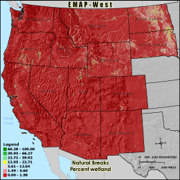
PWETL - Percent wetland
The percentage of wetland cover is calculated by dividing the number of
wetland land cover cells in the 3 km grid cell reporting unit by the total
number cells in the grid cell boundary minus those cells classified as water
(total land area). Forests and wetlands act as filters, removing pollutants
from runoff before it enters streams. Forests and wetlands also provide habitat
for a wide variety of valuable plant and wildlife species.
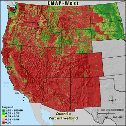
Quantile: Each class contains an approximately equal number (count) of features. A quantile
classification is well-suited to linearly distributed data. Because features are grouped by the number
within each class, the resulting map can be misleading, in that similar features can be separated into
adjacent classes, or features with widely different values can be lumped into the same class. This
distortion can be minimized by increasing the number of classes.
Natural Breaks: Classes are based on natural groupings of data values. Natural break points
are identified by looking for groupings and patterns inherent in the data. The features are divided
into classes whose boundaries are set where there are relatively large jumps in the distribution of
data values.
* EMAP-West Landscape Metrics Metadata (FGDC)
|
|