Nitrogen and Phosphorus Pollution Data Access Tool
Data Access Tool to Help States Develop Strategies to Address Nitrogen and Phosphorus Pollution
As described in EPA's March 16, 2011 memorandum, "Working Effectively in Partnership with States to Address Phosphorus and Nitrogen Pollution through Use of a Framework for State Nutrient Reductions," EPA will work collaboratively with interested and willing states, other partners, and stakeholders to help states develop effective statewide strategies for reducing loadings of nitrogen and phosphorus while they continue developing numeric criteria for these pollutants.
The first elements in EPA's recommended framework are to: 1) prioritize watersheds on a statewide basis for nitrogen and phosphorus loading reductions and 2) set watershed load reduction goals based upon best available information. To support states, other partners, and stakeholders in this important work, EPA has developed this data access tool, providing downloadable data layers and key information on the following:
- the extent and magnitude of nitrogen and phosphorus pollution in our Nation's waters;
- water quality problems or potential problems related to this pollution; and
- potential sources of these pollutants.
Where available, the data layers in this data access tool are national in scope. In some cases, data sets are available only in the Mississippi/Atchafalaya River Basin (e.g., US Geological Survey (USGS) estimated loadings of nitrogen and phosphorus pollution) or for a smaller area or region.
This data access tool and data layers represent the best information currently available, and by making these data layers viewable and downloadable through this data access tool, EPA does not draw any conclusions or make any recommendations or determinations as to sources of nitrogen or phosphorus to our Nation's waters.
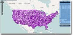
Data Access Tool — This tool provides a geospatial viewer and data downloads.
Tutorial — First time users are encouraged to review this brief tutorial to become familiar with the functions of the Data Access Tool. This tutorial follows the recommended elements of the above March 16, 2011 memorandum to walk through a case study in using the Data Access Tool, and provides narrative text as well as screenshots. The tutorial is divided into two parts: "Part One: How to Use the Data Access Tool" and "Part Two: How to Download Data."
Based on elements of EPA's recommended framework, the data layers available here for viewing and download include the following:
Nitrogen and Phosphorus LoadingsWater Quality Data and Information
- SPARROW Total Nitrogen (N) and Phosphorus (P) Yields:
- Major River Basins
- N Incremental 2002
- P Incremental 2002
- Mississippi Basin
- N Incremental 1992
- N Delivered Incremental 1992
- P Incremental 1992
- P Delivered Incremental 1992
Setting Watershed Load Reduction Goals/Source Control Priorities
- Water Quality Monitoring Sites with Nitrogen/Phosphorus (N/P) (STORage and RETrieval database or STORET)
- Water Quality Monitoring Sites with N/P (National Water Information System or NWIS)
- National Aquatic Resource Survey (NARS) N/P Values
- Newly Updated! Facilities Likely to Discharge N/P to Water
- National Pollutant Discharge Elimination System (NPDES) Concentrated Animal Feeding Operations (CAFO) Summary
- National Land Cover Dataset (NLCD)
- Newly Updated! Waters Listed for N/P Impairments
- Newly Updated! Waters with N/P Total Maximum Daily Loads (TMDLs)
- Newly Updated! Drinking Water Sources
- Coming Soon! Active, Nutrient-Related Clean Water Act Section 319 Projects
Other data layers on this data access tool include:
- State, Tribal, and Hydrologic Boundaries
- States
- American Indian Tribal Lands
- 8-digit Hydrologic Unit Code (HUC8) Watershed
- Mississippi/Atchafalaya River Basin (MARB)
Loadings
- SPARROW (short for SPAtially Referenced Regressions On Watershed attributes) — This GIS-based watershed model integrates statistical and mechanistic modeling approaches to simulate long-term mean annual stream nutrient loads as a function of a wide range of known sources and climatic (precipitation, temperature), landscape (e.g., soils, geology), and aquatic factors affecting nutrient fate and transport.
How to use these data — Generated by the U.S. Geological Survey (USGS), the six geospatial layers discussed here (and provided for viewing and download in the Data Access Tool) can be used to prioritize watersheds for targeting nutrient reduction activities (such as stream monitoring) to the areas that account for a substantial portion of nutrient loads, and to develop state nitrogen and phosphorus pollution reduction strategies. This information is relevant to the protection of downstream coastal waters, such as the Gulf of Mexico, and to local receiving streams and reservoirs.
Specific layers include:
- SPARROW Total Nitrogen (N) and Phosphorus (P) Yields:
- Major River Basins
- N Incremental 2002
- P Incremental 2002
- Mississippi Basin
- N Incremental 1992
- N Delivered Incremental 1992
- P Incremental 1992
- P Delivered Incremental 1992
Major River Basin Models: USGS recently completed syntheses of the results from 12 independently calibrated regional-scale SPARROW models that describe water quality conditions throughout Major River Basins of the conterminous U.S. based on nitrogen and phosphorus sources from 2002. Two data layers - one for nitrogen and one for phosphorus - provide an approximate yet regionally consistent synthesis of the locations of the largest contributing sources. Covering most of the conterminous U.S., these two syntheses have been incorporated into the Data Access Tool to view and download incremental yields for Total Nitrogen and Total Phosphorus. Of note, watershed boundaries used include NHDPlus Exit catchments for the Northeast, and Reach File 1 (RF1Exit)- derived catchments for the remainder of the major drainage basins. Users are encouraged to learn more about these SPARROW nutrient loading models with SPARROW models and data mappers and Regional Assessments of the Nation's Water Quality Improved Understanding of Stream Nutrient Sources through Enhanced Modeling Capabilities.
Mississippi Basin Models: An older version of the SPARROW results (based on nitrogen and phosphorus loads from 1992) is provided by 8-digit Hydrologic Unit Code (HUC) for the Mississippi River Basin. To learn more about these Mississippi Basin SPARROW nutrient loading models, visit Incorporating Uncertainty into the Ranking of SPARROW Model Nutrient Yields from the Mississippi/Atchafalaya River Basin Watershed and Differences in Phosphorus and Nitrogen Delivery to the Gulf of Mexico from the Mississippi River Basin.
Explanation of “incremental yield” versus “delivered incremental yield”:
- Incremental yield is that part of the load per unit area generated within a watershed (measured at the pore point of the watershed).
- Delivered incremental yield is that part of the yield generated within a watershed and delivered to a specified location after factoring in the loss of nutrients in transport to that location (in this case, delivery to the Gulf of Mexico).
Explanation of “load” versus “yield”:
- The load (sometimes referred to as the flux) of a river-borne constituent such as nitrate is the amount (or mass) that passes a given point on the river over a given period.
- The yield of a river-borne constituent is the load per unit drainage area.
- Nutrient load and yield are calculated as follows:
- Nutrient load = streamflow (discharge) x nutrient concentration in streamwater
- Nutrient yield = nutrient load ÷ watershed area
Water Quality Data and Information
- Water Quality Monitoring Data
These data represent the most comprehensive set of water quality information on nitrogen and phosphorus pollution available nationally.
- Water Quality Monitoring Sites with Nitrogen/Phosphorus (N/P) (STORage and RETrieval database or STORET) — EPA's STORET Data Warehouse is a repository that compiles and provides public access to water quality monitoring data. These data include water chemistry data, biological, and physical habitat data. The STORET Data Warehouse is used by state environmental agencies, EPA and other federal agencies, universities, private citizens, and many others for analysis. These organizations, including states, tribes, watershed groups, other federal agencies, volunteer groups and universities, submit data to the STORET Warehouse in order to make their data publicly accessible.
- Water Quality Monitoring Sites with N/P (National Water Information System or NWIS) — The U.S. Geological Survey's (USGS) National Water Information System (NWIS) is a comprehensive and distributed application that supports the acquisition, processing, and long-term storage of water data. NWISWeb serves as the publicly available portal to a geographically seamless set of much of the water data maintained within NWIS.
The USGS collects and analyzes chemical, physical, and biological properties of water, sediment and tissue samples from across the Nation. The NWISWeb discrete sample data base is a compilation of over 4.4 million historical water quality analyses in the USGS district data bases through September 2005. The discrete sample data is a large and complex set of data that has been collected by a variety of projects ranging from national programs to studies in small watersheds. Users should review the help notes and particularly the data retrieval precautions before beginning any retrieval or analysis of data from this data set. Additions of more current data, modifications to ancillary information, and enhanced retrieval options to help users find and appropriately use the data they need are planned for a future release of NWISWeb.
At selected surface-water and groundwater sites, the USGS maintains instruments that continuously record physical and chemical characteristics of the water including pH, specific conductance, temperature, dissolved oxygen, and percent dissolved-oxygen saturation. Supporting data such as air temperature and barometric pressure are also available at some sites. At sites where this information is transmitted automatically, data are available from the real-time data system. Once a complete day of readings are received from a site, daily summary data are generated and made available online. Annually, the USGS finalizes and publishes the daily data in a series of water-data reports.
How to use these data — The water quality data stored in this database presents a snapshot in time so it is important to consider the "period of record" for data captured from any location. The data are of documented quality, meaning that a certain level of metadata, including where, how, why, when and what was monitored must be included with all data submissions. Each sampling result is accompanied by information on where the sample was taken (latitude, longitude, state, county, HUC and a brief site identification), when the sample was gathered, the medium sampled (e.g., water, sediment, fish tissue), the name of the organization that sponsored the monitoring, why the data were gathered, sampling and analytical methods used, the laboratory used to analyze the samples, the quality control checks used when sampling, handling the samples, and analyzing the data, and the personnel responsible for the data.
- National Aquatic Resource Surveys (NARS) N/P values — These values, derived from EPA's NARS provide nitrogen and phosphorus pollutant levels statistically associated with degraded biological condition and may indicate the potential for biological community impacts at or near a monitoring site.
For more information, please consult the National Wadeable Streams Assessment Report and the National Lakes Assessment: Technical Appendix Report.
How to use these data — The national survey (NARS) findings for nutrients in streams and lakes highlight that nutrient pollution is widespread across the United States and impacts biological communities. The NARS analysis examined the range of values for nutrients in least-disturbed sites in a region and used this distribution for nitrogen and phosphorus to separate sites into those having high, medium, or low concentrations of nutrients. Sites identified as "high" were worse (i.e., had higher nutrient concentrations) than 95% of the sites used to define least-disturbed condition. Similarly, the 75th percentile of the least-disturbed distribution was used to distinguish between sites in medium and low condition. This means that sites reported as being as "low" were as good as or better than 75% of the sites used to define least-disturbed condition. A relative risk analysis of the data from this survey found that nationally streams and lakes have more than two times greater risk of having degraded biological communities when nutrient concentrations are high than when they are low. Resource managers may wish to use the NARS N/P values as one line of evidence to gauge the risk to biological integrity in their waters by comparing them to the ambient water quality data for streams and lakes. This evaluation may help prioritize areas for restoration and protection. However, the high values (95th percentile of least disturbed site) only provide information regarding a concentration above which the biological community is twice as more likely to be degraded. These values may not necessarily represent a protective concentration and do not provide information to help gauge the risk of nutrient pollution to the biological integrity of downstream waters. Where a state has adopted numeric nutrient criteria for a waterbody or class of waterbodies, those values would provide a more authoritative comparison value to prioritize areas for restoration and protection.
Setting Watershed Load Reduction Goals/Source Control Priorities
- Newly Updated! Facilities Likely to Discharge N/P to Water — This dataset provides information on nitrogen and phosphorus discharge from facility monitoring reports (2014) and corresponding nitrogen and phosphorus limits from EPA's Discharge Monitoring Report (DMR) Pollutant Loading Tool. Records are provided only for industrial and treatment facilities with National Pollutant Discharge Elimination System (NPDES) permits that, based on their operation, may be discharging nitrogen and phosphorus.
- Point sources are only required to report nitrogen and phosphorus in their effluent if there is a limit or monitoring requirement for these pollutants in their permit.
- States are only required to enter limits data for "major" facilities (e.g., sewage treatment plants that discharge one million gallons of wastewater per day or more) into the Permit Compliance System (PCS) and Integrated Compliance Information System (ICIS)-NPDES. Information for "minor" facilities in these data systems is incomplete
- EPA identified all sewage treatment plants as likely to discharge N/P, regardless of the availability of permit or DMR in PCS and ICIS-NPDES.
How to use these data — Consider the information in each permit: how much nitrogen and/or phosphorus pollution is being discharged? Do loads need to be reduced at this facility to meet load reduction targets? Where this information is not part of the information on the permit, look towards other data sources that can fill in these blanks. Also, consider nitrate discharges and/or other discharges that may lead to algae blooms and the potential for creating disinfection byproducts in 12-digit Hydrologic Units (HUC12s) with large numbers of drinking water sources, public water systems, or with greater population(s) receiving drinking water from public water systems.
- NPDES Concentrated Animal Feeding Operations (CAFOs) Summary – These EPA data indicate locations of agricultural operations where animals are kept and raised in confined situations. CAFOs generally congregate animals, feed, manure and urine, dead animals, and production operations on a small land area. Feed is brought to the animals rather than the animals grazing or otherwise seeking feed in pastures, fields, or on rangeland. Animal waste and wastewater can enter waterbodies from spills or breaks of waste storage structures (due to accidents or excessive rain), and non-agricultural application of manure to crop land.
How to use these data — Each state can have a good picture of the status of developing CAFO permits and where states can focus efforts in targeted watersheds.
- National Land Cover Dataset — These USGS data (2006) provide a comprehensive look at land use. This layer provides states with an estimated breakdown of the percentage of distinct forms of developed (urban), crop and pastureland (agricultural), and forest lands, and will help states focus the right practices on the land in prioritized watersheds.
How to use these data — The summaries are provided by land cover at the 8-digit HUC scale and allow states to determine the types of practices (urban, agricultural, forest, etc.) that should be explored for implementation in each of the priority watersheds. To download the full national land cover layer, see the USGS Land Cover Institute.
- Newly Updated! Waters Listed for N/P Impairments — These EPA data identify water-quality limited segments (i.e., waters that will not meet water quality standards for a particular pollutant even after a technology-based permit is in place). States must develop Total Maximum Daily Loads (TMDLs) for every water body/pollutant combination on the Clean Water Act section 303(d) list.
Section 303(d) nutrient-related impaired waters for which geospatial data are available can be displayed through the geospatial viewer. A one-time snapshot of all section 303(d) nutrient-related impaired waters, not just those for which geospatial data are available, for each state is also provided as a data download. For purposes of identifying nutrient-related impairments, EPA used the following national impairment categories: algal growth, ammonia, noxious aquatic plants, nutrients, organic enrichment/oxygen depletion.
How to use these data — The data can be used to identify the location of nutrient-related impaired waters within each state, either geospatially or by user knowledge/inquiry with state program officials regarding listed waters for which geospatial information are not available. The analysis can be used to prioritize watersheds based on the number or extent (stream miles/area) of section 303(d) listed waters based on nutrient-related causes of impairment, and/or the opportunity to leverage source assessment/identification and load reduction planning associated with the development of TMDLs for these listed waters.
Notes on usage -- If a water body is listed as impaired for multiple nutrient-related impairments, a TMDL may have been established for one (or more) of these pollutants; however, if there are still other nutrient-related impairments, the waterbody remains categorized as impaired (i.e., Category 5) overall. In the geospatial viewer, this scenario is represented by two layers on top of one another (i.e., Waters Listed for N/P Impairments and Waters with N/P Total Maximum Daily Loads); when the Waters with N/P TMDLs layer is deselected, the waterbody still shows up as listed for N/P impairment(s).
- Newly Updated! Waters with N/P Total Maximum Daily Loads (TMDLs) — These EPA data include nutrient-related impaired waters for which a TMDL has been developed.
Waters with TMDLs for nutrient-related impairments for which geospatial data are available can be displayed through the geospatial viewer. A one-time snapshot of all waters with TMDLs for nutrient-related impairments, not just those for which geospatial data are available, for each state is also provided as a data download. For purposes of identifying nutrient-related TMDLs, EPA used the following national impairment categories: algal growth, ammonia, noxious aquatic plants, nutrients, organic enrichment/oxygen depletion.
How to use these data — These data can be used to identify the location of nutrient-related impaired waters with TMDLs within each state. The analysis can be used to prioritize watersheds based on whether or not a TMDL exists that has quantified nutrient load reductions needed to achieve water quality standards.
- Newly Updated! Drinking Water Sources — Public water system (PWS) data reported to the EPA Safe Drinking Water Information System (SDWIS) is summarized on a 12-digit HUC watershed basis in the Nitrogen and Phosphorus Pollution Data Access Tool. Drinking water from both surface and ground water sources (corresponding to surface water intakes and groundwater wells) are reported as a range of values. Data summarized from SDWIS includes number of drinking water sources, as either surface water or groundwater, per 12-digit HUC watershed, and population served by PWS. Please note that PWSs may have multiple sources of drinking water and the populations served by these systems may not be located within the same 12-digit HUC watershed as the sources of drinking water. Displaying the drinking water data in summary form for each watershed maintains PWS security while still informing organizations that would like to prioritize areas for nitrogen and phosphorus reduction to protect drinking water sources.
How to use these data — Drinking water data may be used to help prioritize nitrogen and phosphorus reduction activities in watersheds by highlighting watersheds with the greatest number of drinking water sources or with greater population(s) receiving drinking water from PWSs.
In addition to considering watersheds with high density of drinking water sources, neighboring watersheds with high nitrogen and phosphorus loading may also impact downstream water quality.
In identifying priority watersheds for drinking water protection and nitrogen/phosphorus reductions, another useful set of information can come from the state and local source water protection programs for each watershed. Each state has previously performed an assessment of the potential contaminant threats to each public drinking water supply source (whether ground water or surface water), and delineated the area around each water source where protection efforts and loading reductions would have the biggest impact. State source water assessment and protection information may be available from the state source water protection program, or the local PWS. EPA’s Local Drinking Water Information provides more information on state source water programs. Additional source water protection partners may be found in the Source Water Collaborative Exit.
Coming Soon! Active, Nutrient-Related Clean Water Act Section 319 Projects — These EPA data provide information about the nutrient-related Clean Water Act Section 319 projects currently underway that have reported on load reductions for nutrients. Active projects do not include those that are marked as discontinued, never initiated, completed, or accepted by EPA. Nutrients include the following pollutants: algal growth/chlorophyll, ammonia, Biochemical Oxygen Demand (BOD), dissolved oxygen (low), nitrate, nitrogen, nutrients, phosphorus, sedimentation-siltation, suspended solids, Total Kjeldahl Nitrogen, and phosphate.
This layer includes all of the active nutrient-related projects (open projects that have one or more BMPs implemented to achieve nutrient load reductions), and provides the following information:
- State
- Drainage Area name
- Project Title
- Project Number
- Grant Number
- Fiscal Year Grant Awarded
- Total §319(h) funds for the project
- Total project budget
- Status*
- Type of Project
- Contact Information (State Project Manager, Phone, Email)*
How to use these data — Possible analyses with these data include setting a baseline for practice implementation and summarizing project outcomes and funding levels at different scales to prioritize implementation focus areas.
State, Tribal, and Hydrologic Boundaries
- States — This layer shows state borders.
How to use these data — Locate a specific state or find the state(s) nearest to you with the state boundaries.
- American Indian Tribal Lands -- This layer represents locations of American Indian tribal lands in the lower 48 states. The areas include all lands associated with federally recognized tribal entities -- federally recognized reservations, off-reservation trust lands, and Census Oklahoma Tribal Statistical Areas.
How to use these data – If your focus area for implementing nitrogen and phosphorus reduction actions lies within American Indian tribal lands boundaries, use this boundary for viewing in context to other geospatial data layers in the Nitrogen and Phosphorus Pollution Data Access Tool.
- 8-digit Hydrologic Unit Code (HUC8) Watersheds — This layer shows 8-digit HUCs. An 8-digit HUC is a watershed at a certain scale.
How to use these data — Locate a specific watershed or find the watershed(s) nearest to you with the 8-digit HUC boundaries.
- Mississippi/Atchafalaya River Basin — This layer shows the boundary of the Mississippi/Atchafalaya River Basin (MARB), which was created by joining the boundaries for the following regions (or 2-digit HUC(s)): Ohio, Tennessee, Upper Mississippi, Lower Mississippi, Missouri, and Arkansas-White-Red.
How to use these data — If your focus area for implementing nitrogen and phosphorus reduction actions lies within the MARB, use its boundary for viewing in context other geospatial data layers in the Nitrogen and Phosphorus Pollution Data Access Tool.
For questions about the Data Access Tool and Nitrogen and Phosphorus Load Data Layers website, Contact Us (or email us at npdat-hq@epa.gov).