Rhode Island Phase II Design (2003/2004) Narrative
Rhode Island began a three-year sampling plan in 2003, after taking a year off from water and sediment sampling (In 2002, the state completed fish surveys for NCA). The three year design begun in 2002 was only utilized for two years: in 2005 they switched over to a GRTS-based (phase III) design.
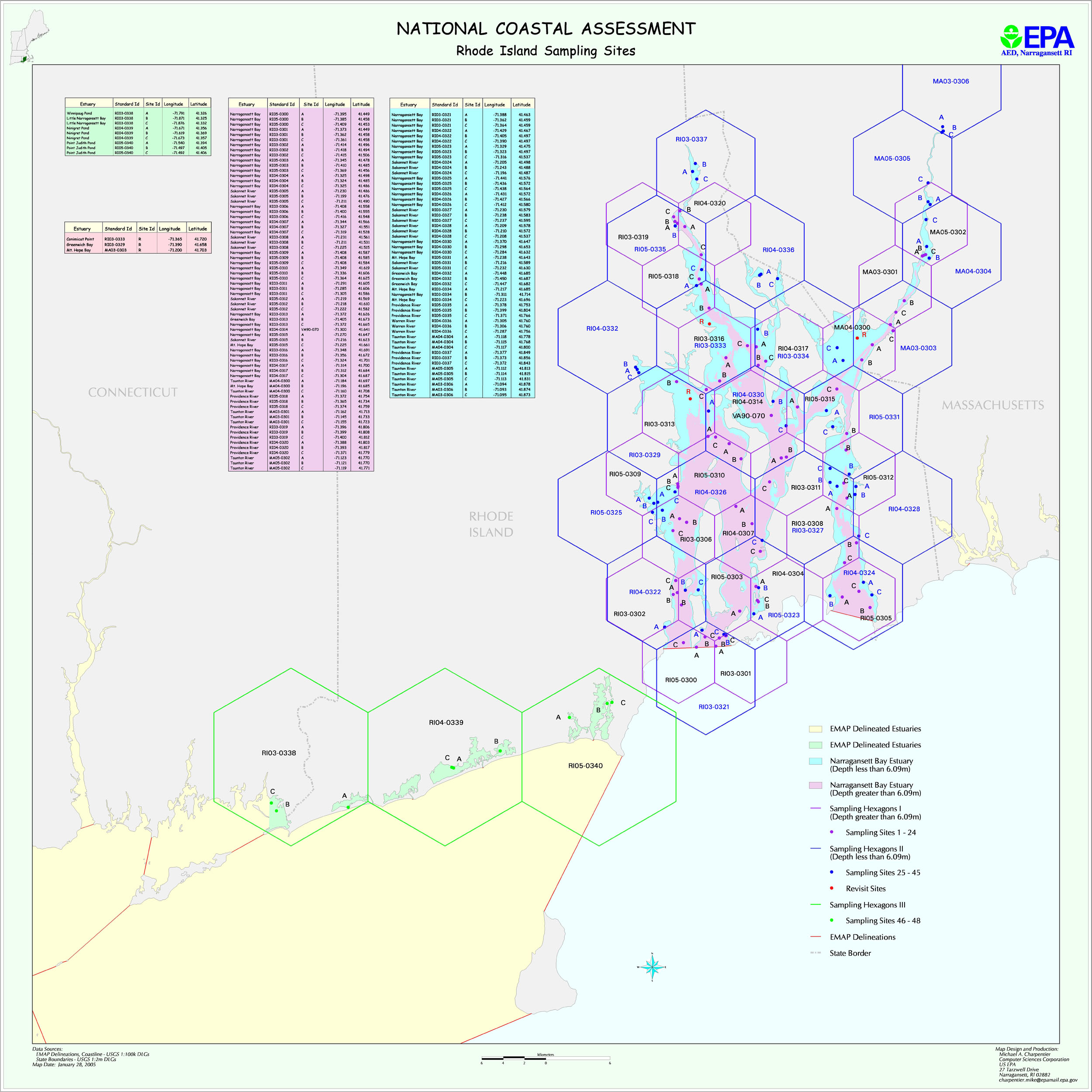
The three-year design is based on three strata representing different water depths- Deep, Shallow, and Coastal Ponds.
The map file ri2k3.jpg shows planned RI sampling locations for 2003-2005. (These planned Year 2005 stations were NOT sampled.) The file RI_03_04_locations.xls provides planned latitude/longitudes for all stations, including the 2005 stations that weren’t sampled. The files RI_03_04_areas.xls provides information on station areas.