New York Phase III GRTS Design (2005/2006) Narrative
New York’s two-year GRTS sampling design for years 2005 and 2006 is based on two strata: Hudson River, and all other New York waters . A randomized GRTS design was used to select fifty stations for sampling over two years.
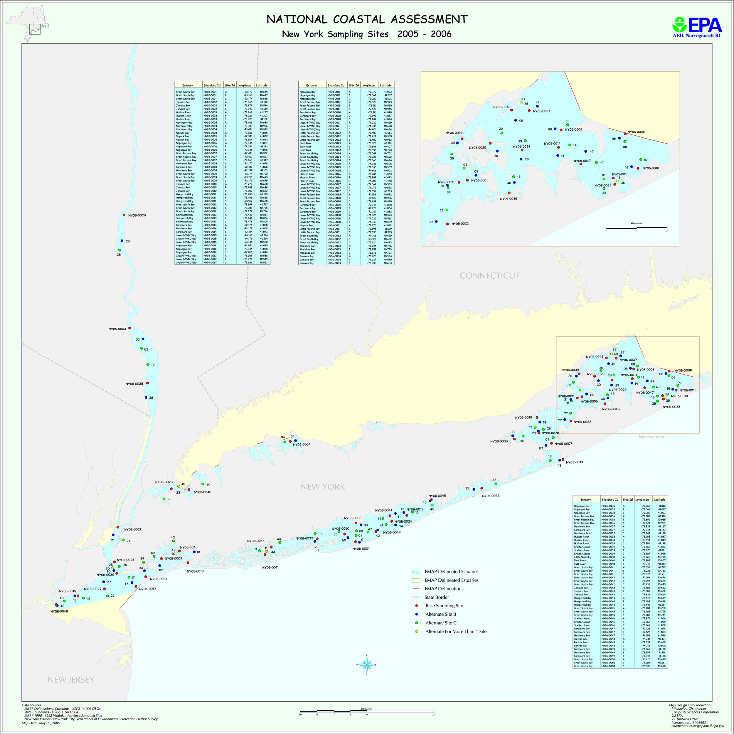
The map file ny2k5.jpg shows planned New York sampling locations for 2005 and 2006. The file NY_Planned_GRTS_locations.xls provides planned latitude/longitudes. and information on station areas. The file NY2005_2006_areas.txt provides information on station areas.