New York Phase I Design (2000/2001) Narrative
New York used a two-year sampling plan in 2000/2001 based on four strata. Fish surveys were conducted at separate stations based on ongoing Long Island Sound Fish Surveys.
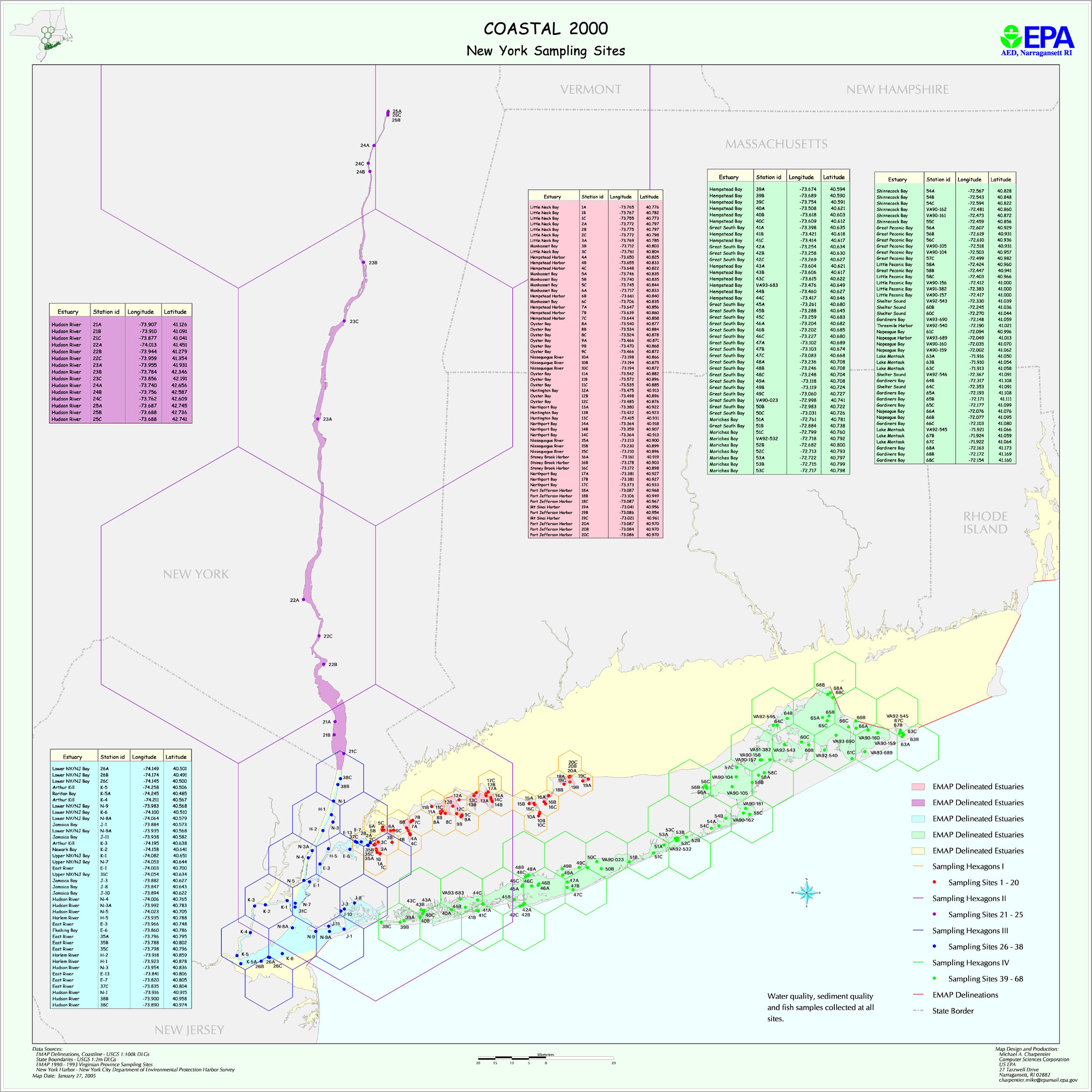
The map file ny2k.jpg shows planned NY water and sediment sampling locations for 2000-2001. The file NYstations.xls provides planned latitude/longitudes for all stations. The file NY_areas.xls provides information on station areas.