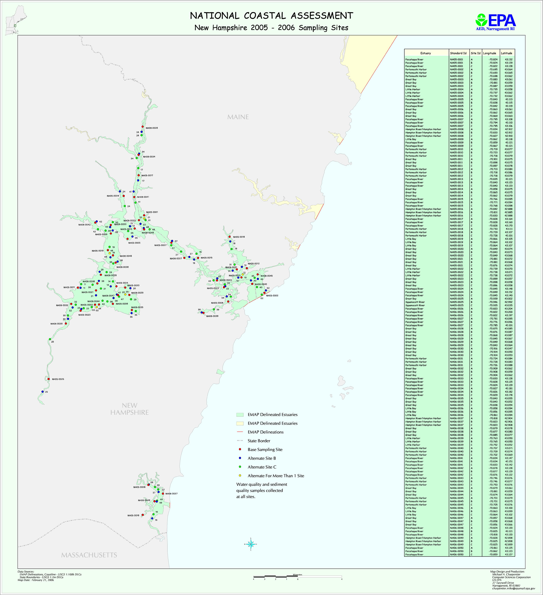
New Hampshire Phase III GRTS Design (2006) Narrative
A two-year GRTS sampling plan was developed for New Hampshire, but the state only used the design in 2006. (New Hampshire’s Year 2005 sampling stations are part of a previous 4-year design.) The GRTS design for New Hampshire is based on one stratum. Fifty station locations were randomly selected in the region that consisting of Great Bay (including some stations in Maine water) and Hampton Harbor.
For statistical weighting, each station was intended to represent 1/50 of the total stratum area.
The map file nh2k5.jpg shows planned New Hampshire sampling locations for both 2005 and 2006 (the 2005 stations were NOT sampled). The file NH_planned_GRTS_locations.xls provides planned latitude/longitudes for all stations. The files NH_2006_areas.txt provides information on station areas.