Maine Phase II Design (2002-2004) Narrative
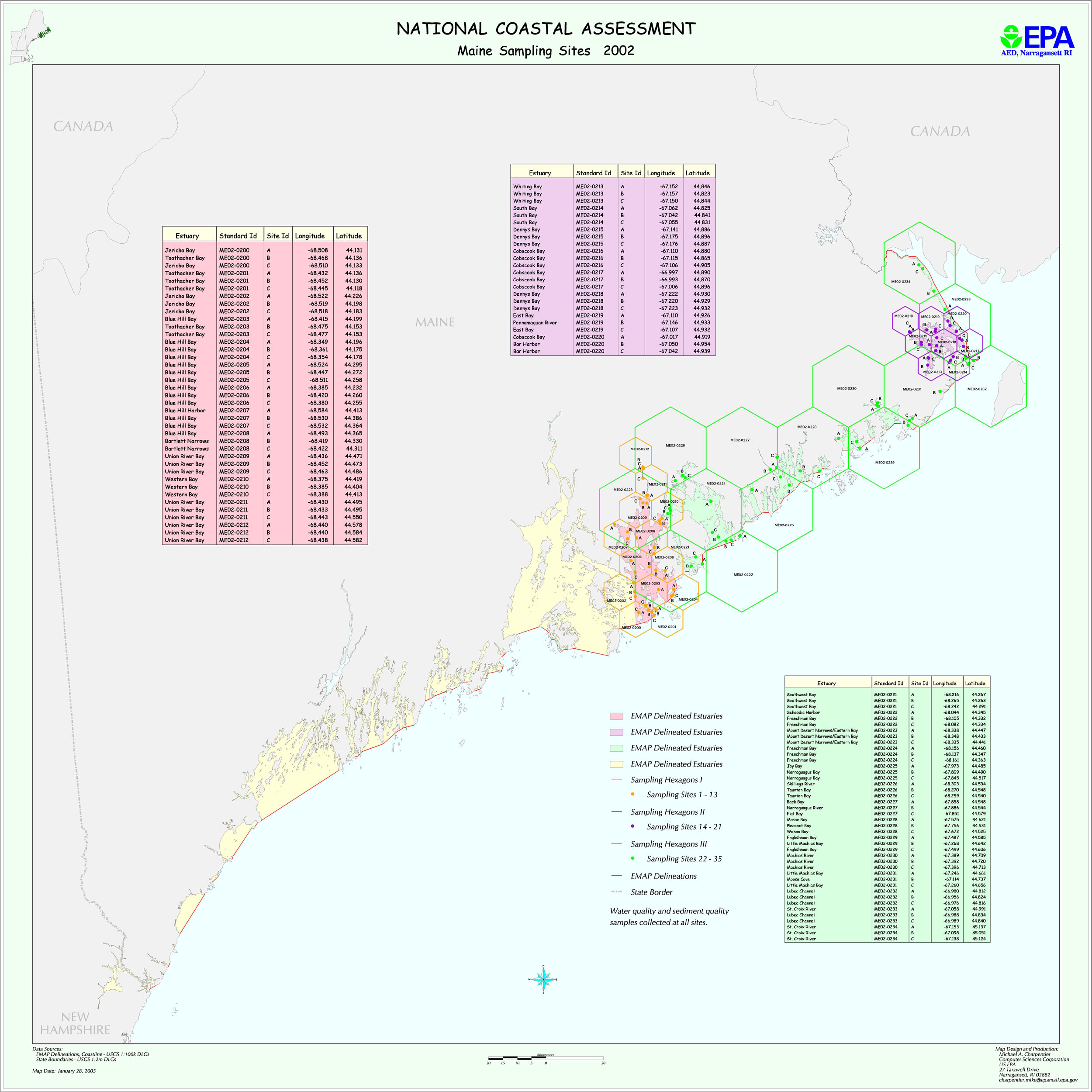
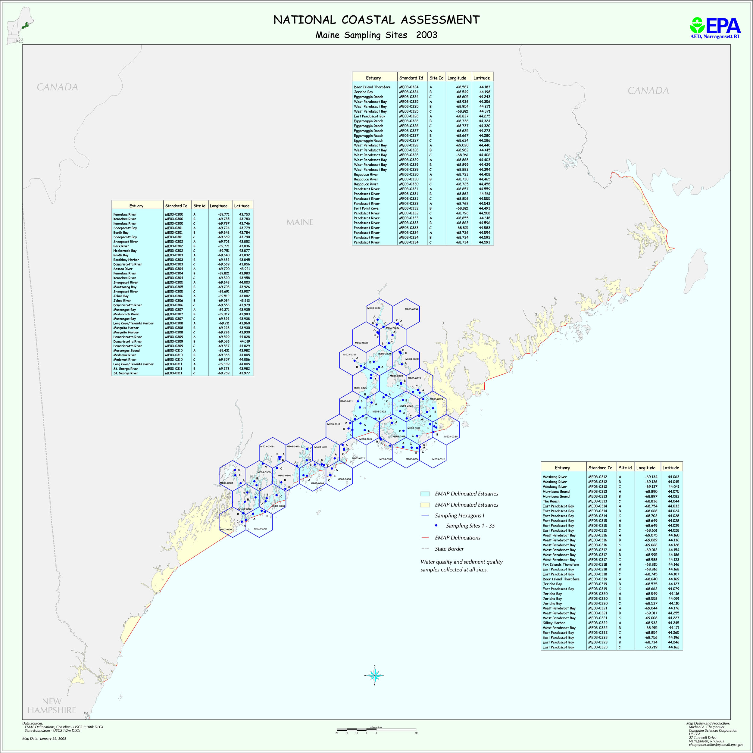
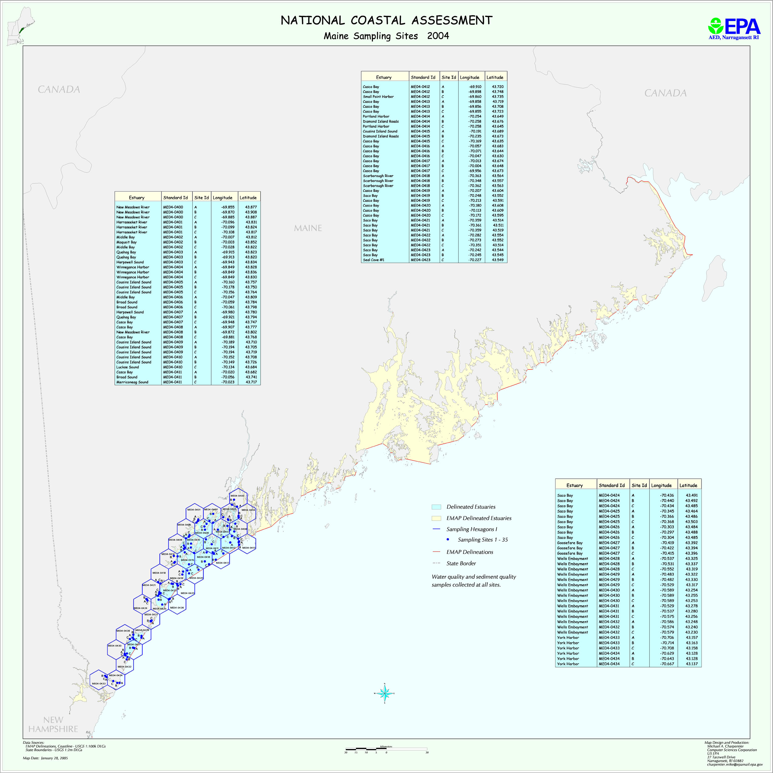
Maine used a three-year sampling plan for 2002-2004. In 2002 the northern-most portion of the coastline was sampled, in 2003 the mid-coast region was sampled, and
2004 the southern part of the state was sampled. The design is stratified, with different levels of intensity in different strata. The Year 2002 stations are distributed among three strata. Year 2003 and 2004 stations are in one stratum each.
There were no planned station revisits in this design.
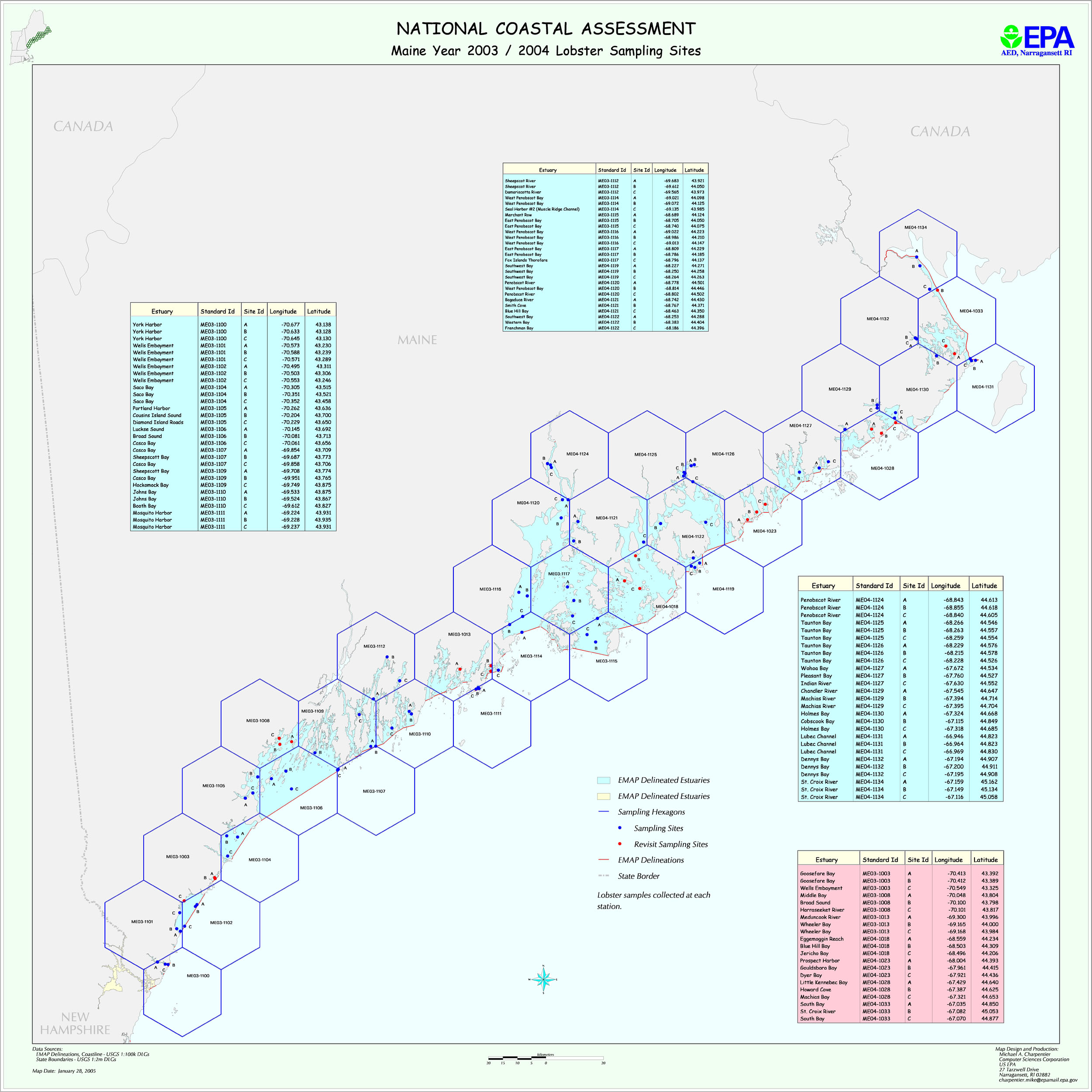
Lobster sampling was based on a single stratum design. The complete coast was sampled in 2002 (35 stations - first time done, no revisits). Then, the southern half of the state was sampled in 2003 and northern half in 2004.(35 stations over two years plus 7 revisits.)
The map files me2k2.jpg, me2k3.jpg, and me2k4.jpg show planned sediment/water sampling location for each year. The files Maine2002_locations.xls, Maine2003_locations.xls, and Maine2004_locations.xls provide planned latitude/longitudes for these stations. The map file melob2k3.jpg shows the year 2003/2004 lobster sites. The files ME02_lobster_locations.xls and ME0304_lobster_location.xls provide station locations. The file ME020304_areas.xls provides information on all station areas.