Maine Phase I Design (2000/2001) Narrative
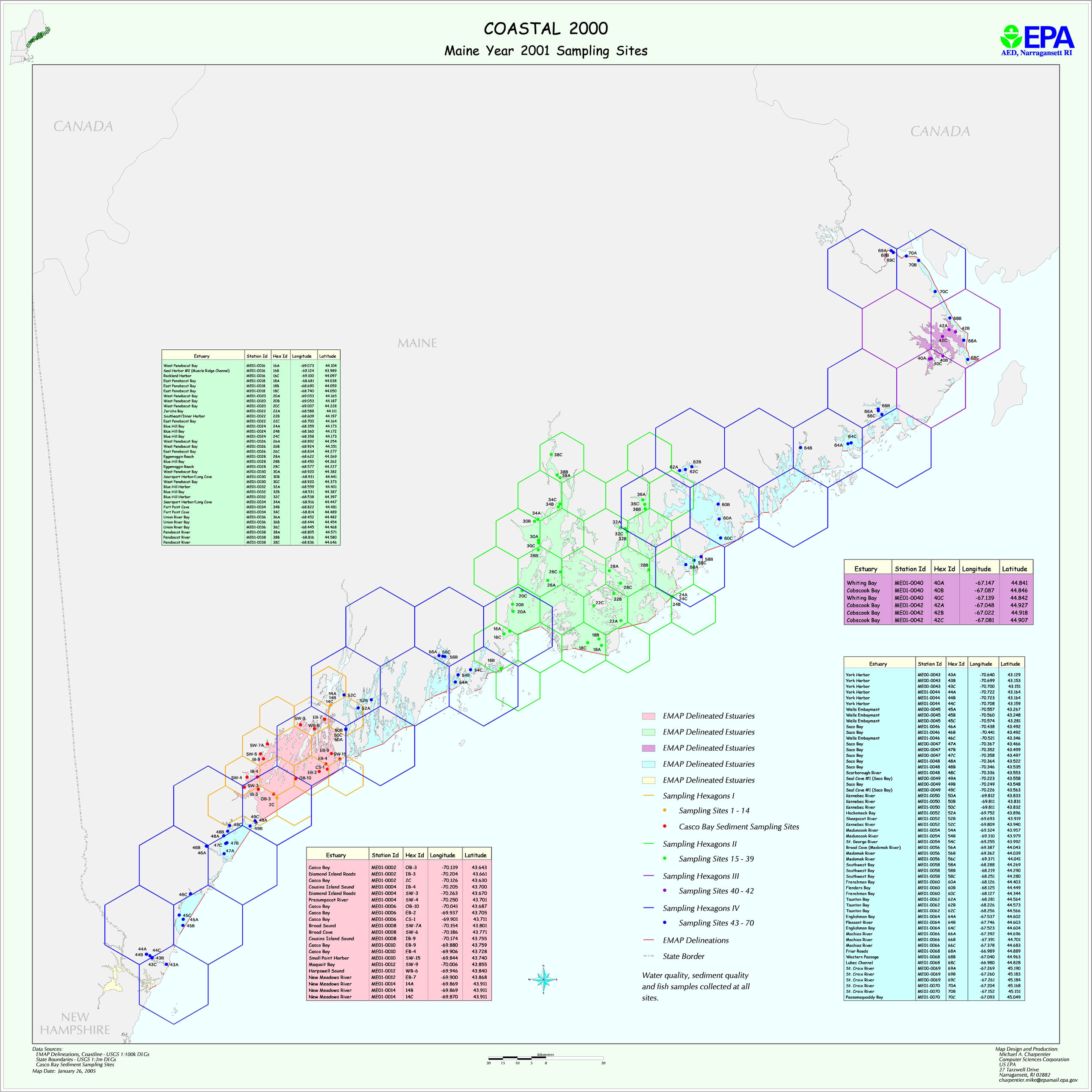
Maine used a two-year sampling plan for 2000-2001. The design is stratified, with different levels of intensity in different strata.In each year, stations are distributed among four strata.The map files me2k.jpg and me2k1.jpg show planned sediment/water sampling location for each year. The files MEsites.xls, and Maine2001_location.xls provide planned latitude/longitudes for these stations. The file Maine_areas.xls provides information on all station areas.