Maryland Phase III GRTS Design (2005/2006) Narrative
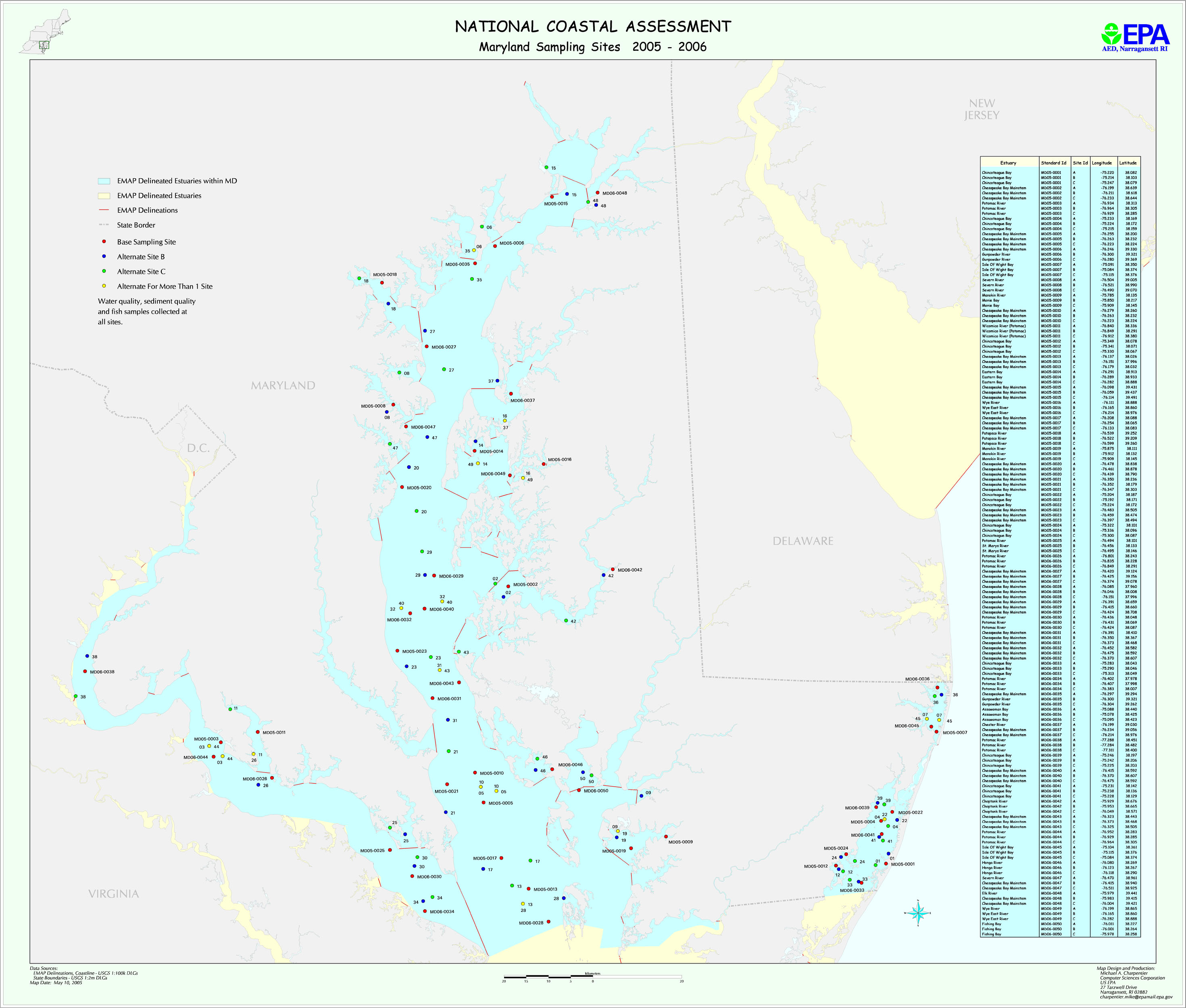
The Maryland two-year GRTS sampling design for years 2005 and 2006 is based on three strata: MD Coast, Chesapeake Bay Mainstem, and Chesapeake Bay Tributaries. A randomized GRTS design was used to select fifty stations for sampling over two years.
The map file md2k5.jpg shows Maryland sampling locations for 2005 and 2006. The file MD_planned_GRTS_locations.xls provides planned latitude/longitudes and information on station areas. The file MD2005_2006_areas.txt provides information on station areas.