Massachusetts Phase II Design (2003/2004) Narrative
Massachusetts began a three-year sampling plan in 2003, after taking a year off from probability-based NCA monitoring. The three year design was only utilized for two years: in 2005 Massachusetts switched over to a GRTS-based (phase III) design.
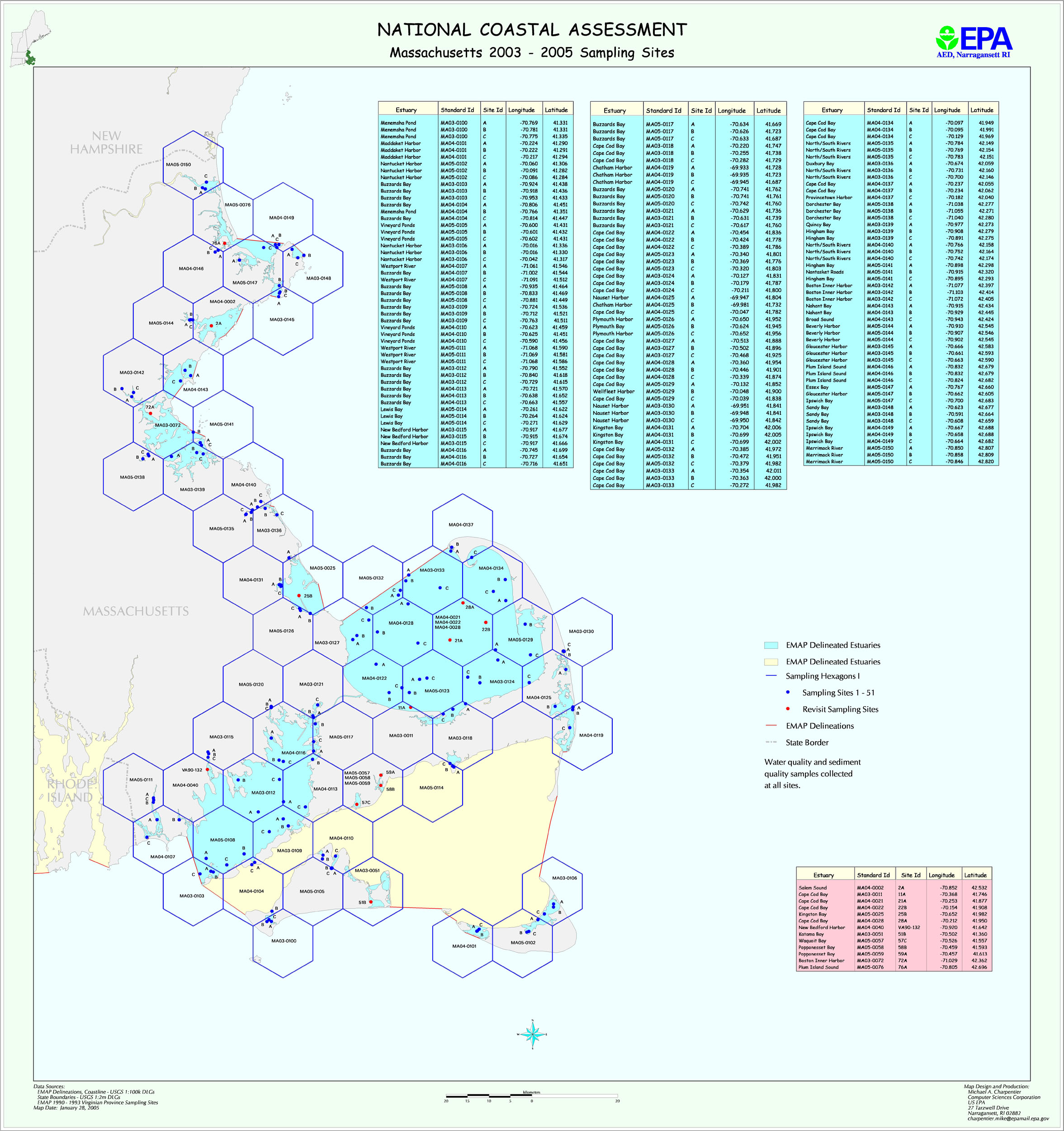
The three-year is based on one stratum covering the entire Massachusetts coastline. Station locations were selected at random in each hexagon, except for 15 hexagons in which previously sampled locations were used as revisit sites.
The map file ma2k3.jpg shows planned Massachusetts sampling locations for 2003-2005. (These planned Year 2005 stations were NOT sampled.) The file MA_03_04_locations.xls provides planned latitude/longitudes for all stations, including the 2005 stations that weren’t sampled. The files MA_03_04_areas.xls provides information on station areas.