Coastal 2003 - Preliminary Rhode Island Data Base
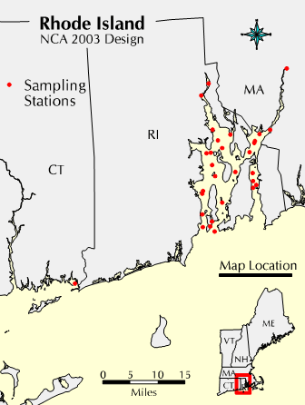
Preliminary Coastal 2003 data (Level 1 QA data) from the state of Rhode Island are available below. To download a data file from this page, click on "View Data", then use your browser's "File" "Save As..." option. All data files are comma delineated CSV files. Click here or on the map to the left to enlarge.
To download data in SAS XPORT format, go to Export Page
For an overview of the database design, key fields, and coded variables Read This (6 pp, 33 Kb, about PDF)
| STATIONS: | Sampling Station Location Data | View Data |
| EVENTS: | Station Visit Data | View Data |
| BOATLOC: | Detailed Sampling Location data | View Data |
| SAMPLOG: | All Samples collected at station | View Data |
| WATRPHYS: | Water Quality Physical Measurements Data | View Data |
| CTDRET: | Water Quality QA Data | View Data |
| NUTSAMPS: | Water Quality Nutrients Sample Information | View Data |
| SEDGRABS: | Sediment Sample Information (no analysis results available) | View Data |
| BENGRABS: | Benthic Sample Information | View Data |
| TISSUE: | Tissue/Anatomical Measurements (fish, etc.) | View Data |
| LOBSTER: | Tissue/Anatomical Measurements (lobster) | View Data |
| FTRAWL: | Fish Trawl Information | View Data |