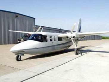
The ASPECT requires two pilots and one operator. The plane collects data at 100 knots (about 115 mph) and cruises at 180-200 knots (200-230 mph). The range is 1,100 nautical miles and it can stay in the air for about 4-6 hours. Data collection occurs between 200-5,000 ft above ground level depending on the mission (chemical, radiological or photo reconnaissance). The plane cruises at 20,000 feet.
ASPECT Uses Three Primary Sensors to look for chemicals and radiation. For chemicals, an infrared line scanner used to image the chemical plume. This infrared line scanner (IRLS) is a modified Raytheon TI Systems RS-800 system and it has optimized optical filters which allow it to detect specific gas species.
The IRLS operates a spinning prism, this coupled with the movement of the aircraft provides an infrared image capable of mapping the chemical plume. At an aircraft speed of 100 knots, the scanner will provide pixel sizes of approximately 2 square feet at an above ground altitude of 2000 feet.
The second type of sensor is a Fourier Transform Infrared Spectrometer (High Speed Infrared Spectrometer) which is used to identify and quantify the composition of the plume. The process involves a telescope that focuses a column of spectral energy into a beam. The beam is then split and one path length is varied.
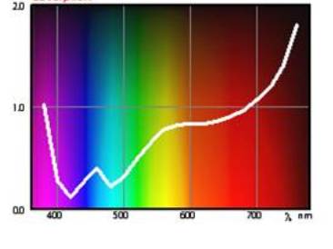
When the beams are combined, it produces a waveform. The waveform can then be fast fourier transformed. The transformation separates the waveform into a spectral graph. Each chemical compound has a unique spectral signature. Scientists looking at this spectral signature can then identify which chemicals are present.
The third type of sensor on ASPECT is a Gamma-Ray Spectrometer which is used to detect radiation. The spectrometer is intended for gamma-ray detection and automatic identification of radioactive isotopes and nuclear materials.
EPA is working on the ASPECT Gamma Emergency Mapper project wchich is designed to improve our airborne gamma-screening and our mapping capability of gamma contamination on the ground. This type of data would be useful following a wide-area radiological dispersion device (RDD or dirty bomb) or improvised nuclear detonation (IND) attack.
ASPECT can provide information to the first responder in a form that is timely (real or near-real time data), useful, and compatible with existing infrastructures such as Google Earth applications.
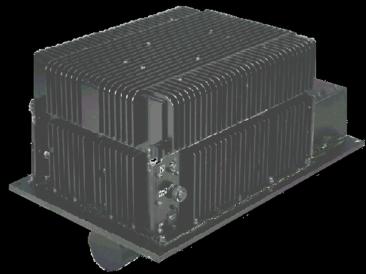
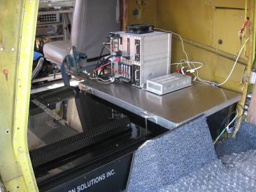
A rear view of the sensor station, where the chemical infrared imager and high speed spectrometer are located.
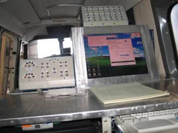
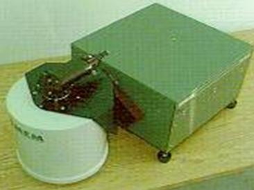
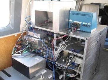
This is the Operator Station. This is where the chemical and radiological images and spectral data are correlated with the GPS. The station also transmits data to the staff on the ground.
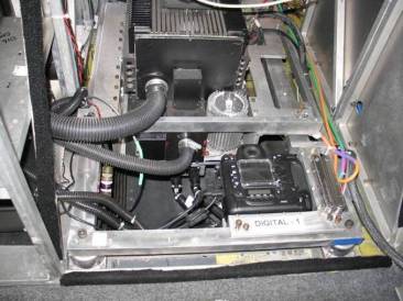
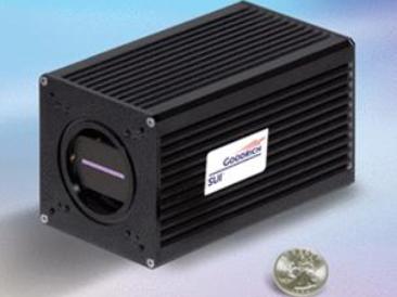
This is what the camera and sensors look like that are below the Operator Station
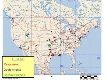
The ASPECT is a valuable EPA resource that can respond to sites all over the country. Because it is the nation’s only 24/7 emergency response aircraft with chemical-plume-mapping capability, it is frequently deployed.
Here are some ASPECT Statistics:
- 41 Emergency Responses
- 6 DHS Special Event Assessment Rating Deployments
- 9 DHS National Special Security Event Deployments
- 4 FEMA Activations
- 12 Special Projects
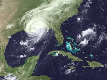
The EPA even used the ASPECT aircraft during hurricanes Katrina and Rita to collect information regarding potential releases of chemical vapors due to storm damage. Figuring out where chemical releases are occuring and what chemicals are involved allows EPA to send our emergency responders to specific danger sites to reduce risk to the community and environment during storms, spills or other incidents.