Pacific Southwest, Region 9
Serving: Arizona, California, Hawaii, Nevada, Pacific Islands, Tribal Nations
First-Ever National Wetlands Condition Assessment
Locating Sampling Sites in Google Earth
You can easily find a sampling location by entering the latitude and longitude of the site into Google Earth. Below is a list of lat/longs for the California sampling sites.
- Open (or downloand and install) Google Earth.

- For the location you want to see, copy its latitude and longitude from the list below, paste into the Google Earth "Fly to" field.
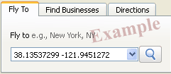
- Click the magnifying glass icon or press Enter.
Download a spreadsheet of this table (.xls), which also includes Site ID numbers and sampling dates.
(Excel XLS viewer ![]() )
)
| Latitude Longitude | County |
|---|---|
| 37.5193534 -122.216979 | San Mateo |
| 33.00118879 -116.553504 | San Diego |
| 33.27438391 -116.747025 | San Diego |
| 33.87787479 -117.745484 | Orange |
| 34.23663307 -119.262647 | Ventura |
| 38.13537299 -121.945127 | Solano |
| 38.13473345 -121.952057 | Solano |
| 37.89412492 -121.758774 | Contra Costa |
| 38.45784165 -121.466424 | Sacramento |
| 36.68460186 -118.232115 | Inyo |
| 37.24173904 -120.809393 | Merced |
| 37.23957456 -120.819432 | Merced |
| 37.2970215 -120.793701 | Merced |
| 38.10732204 -121.954441 | Solano |
| 38.11119825 -121.965098 | Solano |
| 38.11906134 -121.948458 | Solano |
| 38.12994425 -122.342103 | Solano |
| 38.11676212 -122.322822 | Solano |
| 38.13932 -122.339211 | Solano |
| 38.00778963 -122.488637 | Marin |
| 38.12654382 -121.935658 | Solano |
| 38.13181723 -121.953215 | Solano |
| 38.11291574 -121.936883 | Solano |
| 38.16837901 -122.533462 | Sonoma |
| 38.16538922 -122.545057 | Sonoma |
| 38.16413492 -122.553205 | Sonoma |
| 39.25489987 -123.755871 | Mendocino |
| 40.88234552 -124.144702 | Humboldt |
| 37.52065783 -122.220424 | San Mateo |
| 37.53679543 -122.232025 | San Mateo |
| 37.5193534 -122.216979 | San Mateo |
| 36.11837075 -121.466187 | Monterey |
| 33.00118879 -116.553504 | San Diego |
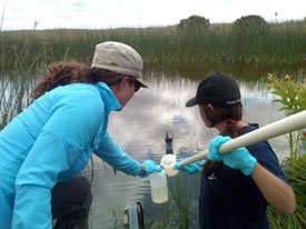
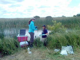
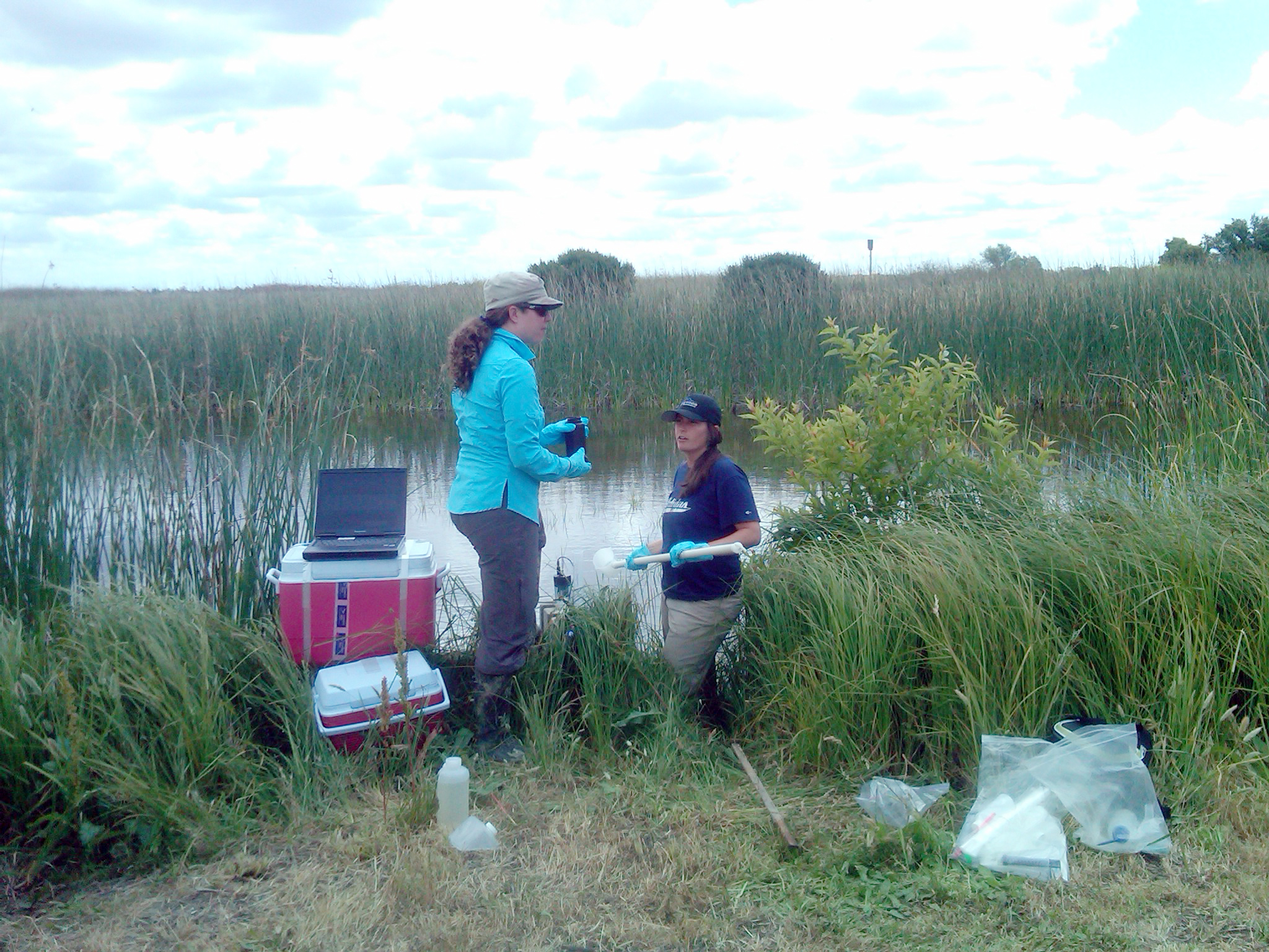
The U.S. Environmental Protection Agency hosted a press availability on June 2, 2011, to highlight a national effort to assess the health of the nation’s wetlands, and an opportunity to provide input on proposed changes to how the government protects wetlands. The media event was held at the Stone Lakes National Wildlife Refuge in Elk Grove, California, where scientists simultaneously sampled nearby wetlands as part of the National Wetlands Condition Assessment (NWCA).
Related Information
Press Contact: Mary Simms
simms.mary@epa.gov
(415) 947-4270
Fact Sheet (PDF) (2pp, 300K)
The NWCA is a collaboration between EPA and its state, tribal, and federal partners representing the first-ever national field survey on the health of the nation’s wetlands. More than 1,000 sites across the country—including 43 in California—are being surveyed to assess indicators of wetland health, including water quality and flow, vegetation, and soils. NCWA sampling locations during the next two months will include wetlands in the following California counties: San Mateo, San Diego, Orange, Solano, Contra Costa, Ventura, Marin, Monterey, Humboldt, San Joaquin, Inyo, Merced, and Mendocino.
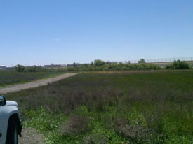
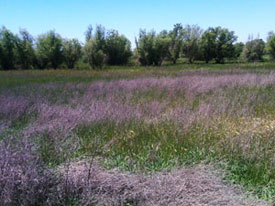
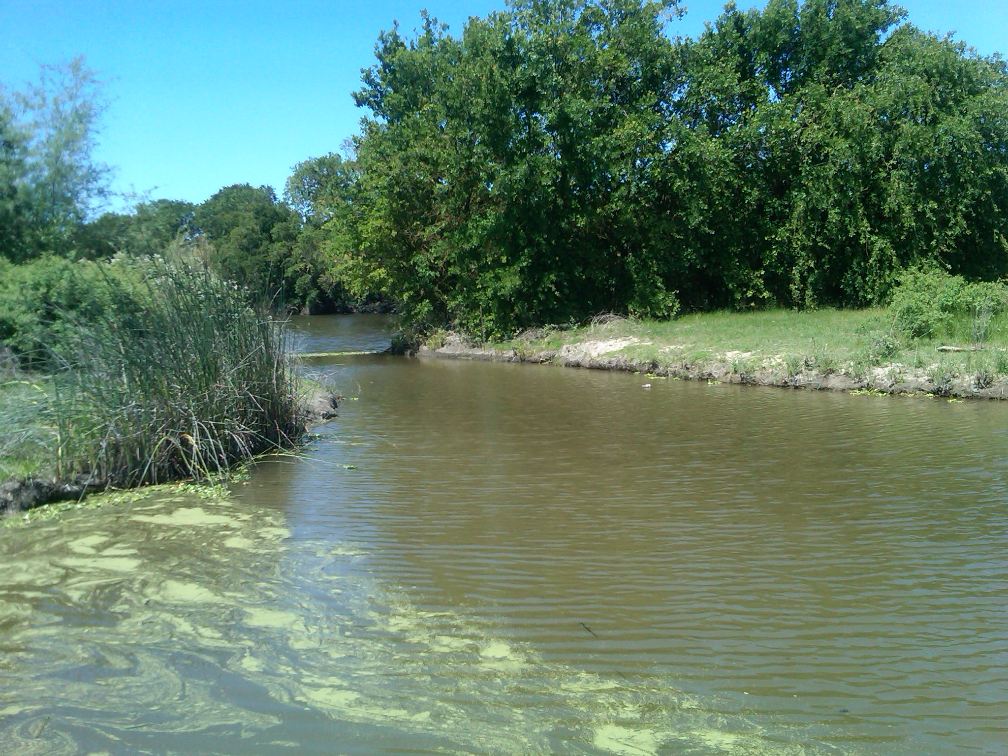
Photos
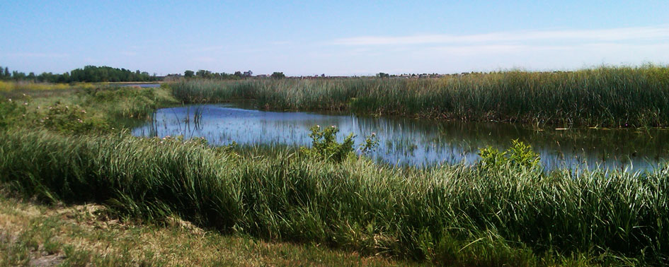
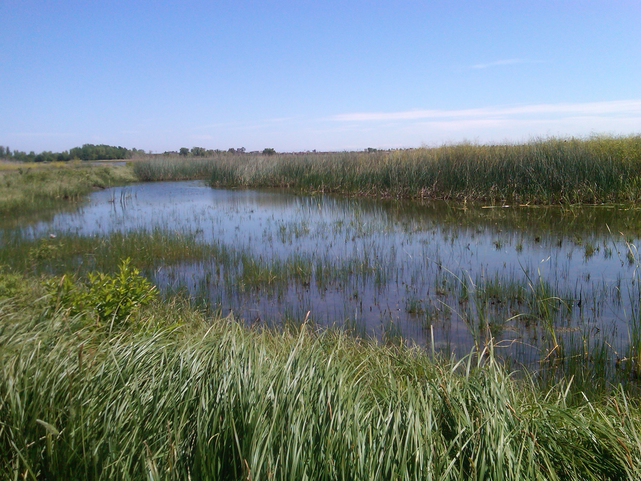
Stone Lake National Wildlife Refuge
Larger version
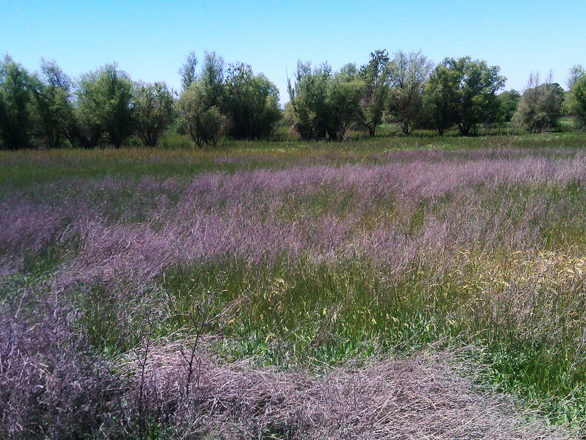
Larger version


Grasslands and dry vernal pools at the Bufferlands sampling site near Sacramento (NWCA 11-1125)
| Pacific Southwest NewsroomPacific Southwest Programs | Grants & FundingUS-Mexico Border | Media Center Careers | About EPA Region 9 (Pacific Southwest)A-Z Index |