GPS - Global Positioning System
What is GPS?
The Global Positioning System (GPS) is a satellite-based navigation system made up of a network of approximately 24 satellites placed into orbit by the U.S. Department of Defense. GPS was originally intended for military applications, but in the 1980s, the government made the system available for civilian use. GPS works free to anyone with a GPS receiver in any weather conditions, anywhere in the world, 24 hours a day.
GPS satellites circle the earth twice a day in a very precise orbit and transmit signal information to earth. GPS receivers take this information and use triangulation to calculate the user's exact location. Essentially, the GPS receiver compares the time a signal was transmitted by a satellite with the time it was received. The time difference tells the GPS receiver how far away the satellite is. Now, with distance measurements from a few more satellites, the receiver can determine the user's position and display it on the unit's electronic map.
A GPS receiver must be locked on to the signal of at least three satellites to calculate a 2D position (latitude and longitude) and track movement. With four or more satellites in view, the receiver can determine the user's 3D position (latitude, longitude and altitude). Once the user's position has been determined, the GPS unit can calculate other information, such as speed, bearing, track, trip distance, distance to destination, sunrise and sunset time and more.
Even with highly accurate atomic clocks to time your position, certain errors do creep into the process of determining your position using GPS. In general, the vertical error is twice the horizontal error. The most significant error is due tovariations in the earth's ionosphere, which affects the speed of GPS radio signals. Another source of error is from water vapor in the troposphere. Both of these errors are, however, fairly small. Additionally, the accuracy of GPS can be improved with DGPS (differential GPS) capabilities, which is the ability of your receiver to read signals from a nearby DGPS beacon receiver or satellite service. Mapping grade receivers can achieve horizontal accuracies of less than 1 meter. Survey grade GPS units can achieve 1-2 centimeter accuracies. With multiple benchmarks, survey grade error can be reduced to .07 of an inch.
FIELDS Team Use of GPS
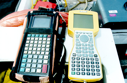
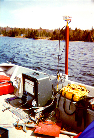
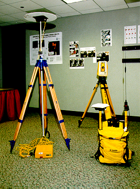
Due to the spatial nature of the FIELDS processes, GPS has been critical to the success of the Team. Nearly every site involving FIELDS Team assistance has relied heavily on the use of GPS. Generally, the FIELDS Team utilizes Trimble Pro XRS mapping grade GPS units with a horizontal accuracy of 1 meter. These units are capable of either real-time correction from Coast Guard transmitting base stations or correction from the Omnistar differential correction subscription service. These units are the workhorses of the FIELDS Team and are used for bathymetric surveys, sample collection, well location identification, aerial photo rectification, and most other field data collection. Because of their design as GIS tools, point, line, and area features are easily converted to GIS layers using the GPS software.
Navigation is also an important element of FIELDS Team GPS use. Once sample designs are generated in the FIELDS Tools, an export to GPS function is used to export the sample locations to the GPS dataloggers. Once in the dataloggers, it is easy to navigate to each point for sample collection. Due to the real-time differential correction of the units, navigation is fairly accurate.