Sediment data
EPA sediment sampling data
Sediment samples for oil-related compounds Sample data from July 30 through August 20, 2010
Posted September 8, 2010
- Enbridge Oil Spill Sediment Samples for oil related compounds (PDF) (263pp, 490K About PDF)
- Enbridge Oil Spill Sediment Samples for oil related compounds (CSV) 1.02MB)
- View EPA surface water sampling locations in Google Earth (.kml format)
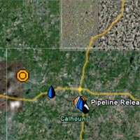
- Sampling locations on an interactive map are linked to sampling data.
- The Google Earth information regarding the Enbridge oil spill response now includes a highlighted area where the Unified Command is working, the operational division boundaries, and more significant landmark information.
- If you don't have Google Earth installed on your computer, you can get the free download here.

Sediment sampling
Sediment samples taken to date indicate that there may be risks to aquatic life from pollutants in sediment at some locations. These levels have a higher potential for serious impacts to sediment-dwelling organisms and are classified as unhealthy. It is unknown whether the sediment contamination resulted from the Enbridge spill or was already present.
Understanding EPA's sediment data
- EPA is overseeing Enbridge’s sampling and monitoring efforts. The sediment sampling process includes the collection of the sample, laboratory analyses and data verification (which ensures high quality data). Sampling also helps to identify areas where sediment can be removed, treated or cleaned up. Sediment sampling locations are not necessarily representative of widespread conditions at Talmadge Creek, Kalamazoo River or Morrow Lake. This is only one tool for examining water quality conditions. Visitors and residents interested in fishing, boating and river conditions are encouraged to contact state and county health agencies or visit their websites for information.