Waste Site Cleanup & Reuse in New England
Peterson/Puritan, Inc.: Photo Slideshow
Back to Peterson/Puritan, Inc. Fact Sheet »
-
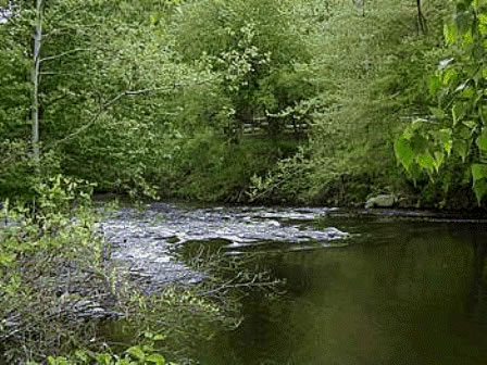
 Blackstone River and Bikeway immediately south of the Martin Street Bridge (Operable Unit 1).
 -
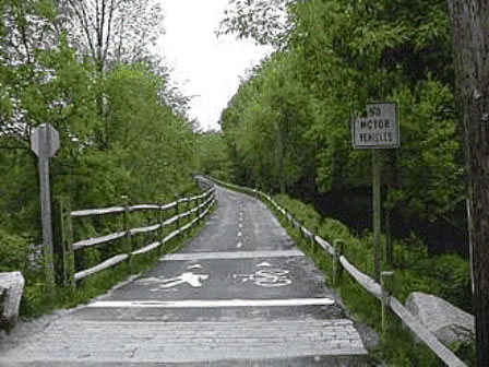
 Rhode Island Blackstone River Bikeway along western edge of OU-1 follows the historic tow path for the Blackstone Canal.
 -
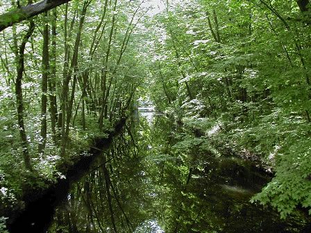
 The Blackstone Canal was completed in 1828 and was designed to provide transportation by barge of goods between Worcester MA and Providence, RI. A series of 49 locks connected an elevation change of 438 ft over a distance of 48 miles. This segment of the Canal from the Ashton Dam to the Pratt Dam and passing through the Site is now a part of the canoe trail established for recreational use within the Blackstone River Heritage Corridor.
 -
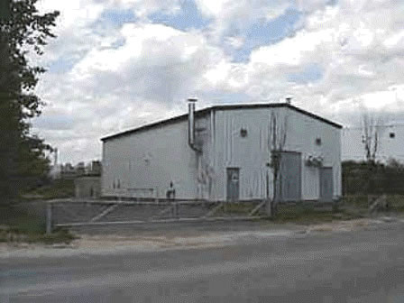
 Ground water treatment plant at CCL's facility, Martin St.
 -
 Looking south from OU-1, towards the J.M. Mills Landfill (OU-2), which rises from the Blackstone River's east bank.
 -
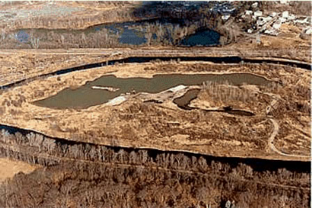
 On top of the J.M. Mills Landfill, OU-2 (exceeding 80 ft. in elevation) looking north. Industrial park within OU-1 in background (right center), Blackstone River in valley below (left).
 -
 1987 photo (looking east) depicting the manipulation of the Blackstone River by private sand and gravel extraction and landfilling operations at the Un-named Island immediately south of the J.M. Mills Landfill and a part of the OU2 investigation. (Large excavator in operation at center of photo; Blackstone River splits its flow around island; access to island is via the Pratt Dam off photo to the right).
 -
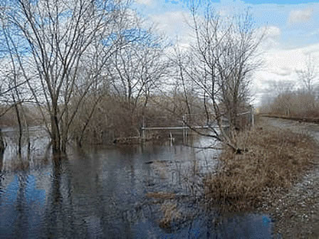
 A view of the south access gate to the J. M. Mills Landfill impacted by occasional flooding along the Blackstone River. On these occasions, the river's flow is in direct contact with the west slope of the landfill. (P&W Railroad passes immediately to the east of the landfill).
 -
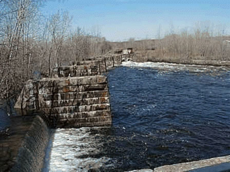
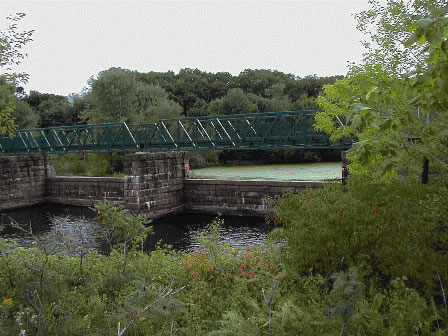
 Overlooking the Pratt Dam from the bike path during a post flood event, this river control structure represents the approximate southern extent of the Site.
 -
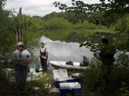
 Sampling for the OU-2 RI/FS includes extensive testing of the water and sediments from ponds, back channels, and the main stem of the Blackstone River.
 -
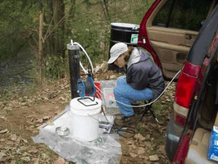
 Ground water sampling conducted in 2003 for the OU-2 RI/FS.
 -
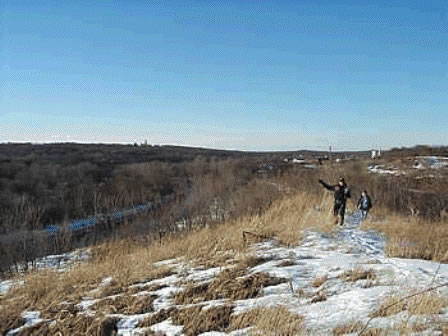
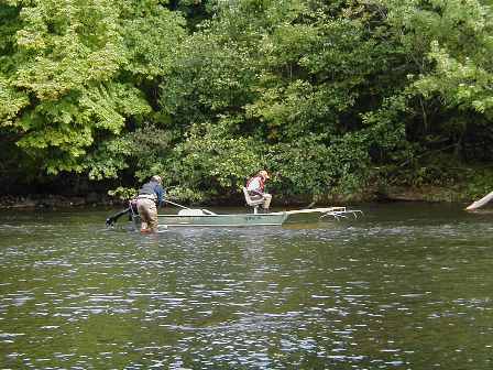
 Fish sampling up river from OU-2.
 -
 In the summer of 2004, a newly constructed bridge spans the Pratt Dam to link the Blackstone River Bikeway from Lincoln to Cumberland, RI.
 -
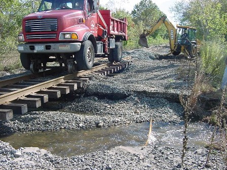
 In October 2005, flood waters from the Blackstone washed out segments of the Providence and Worcester RR line within the site from Martin Street to Mendon Road.
 -
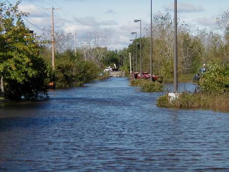
 Here at Martin St. (OU-1), the tell tail signs of flooding were obvious. The Blackstone River flood waters rose to over 6 ft. above flood stage and the discharge was nearly 16,200 cu.ft. per sec. (as recorded at the Woonsocket gage).
 -
 Excessive river bank erosion and flotsam on site as displayed south of Martin St.
 -
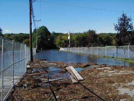
 Access to portions of the Site were temporarily halted until waters had receded. Certain site infrastructures were damaged and were in need of repair or further assessment following the flood.
 -
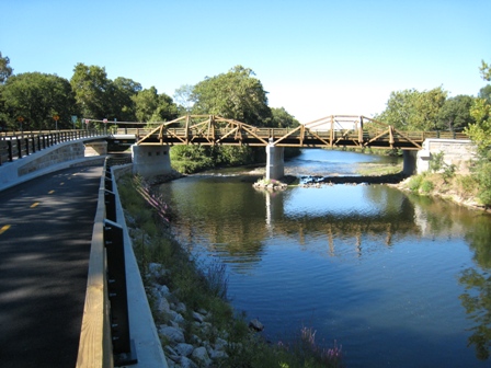
 Recreational uses along the river and canal increased with the opening of the new Martin St. Bridge.
 -
 View of the RI Blackstone River Bikeway and Martin St. Bridge along OU-1 of the Site (Fall 2007).