ReefLink Database
Deforestation & Devegetation
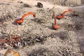
Deforestation and Devegetation are the removal of trees and plants, including clear-cutting, to provide clear land for farms, roads, homes, buildings, and other infrastructure.
CMap

CMap Description
Civil engineering and transportation projects, farms, and forestry practices may require land clearing. Deforestation and devegetation can alter patterns of water flow, accelerating runoff, and the deposit of sediments into coastal waters. Many of the same socio-economic sectors, such as tourism & recreation, which drive coastal development also benefit from reef ecosystem services, including aesthetic value, seafood, and shoreline protection. Construction codes and regulations, transportation policies, and landuse management through planning, permitting, and zoning can influence intensity and distribution of land clearing. Agricultural and forestry practices can be implemented to minimize the need for broad deforestation. Landuse Restoration, such as hydroseeding along roads, can restore vegetation and reduce runoff.Citations
More than 50 citations. Click here to load.
| Citation | Year | Study Location | Study Type | Database Topics |
|---|
Management Options
| Management Option | Description | Sources | Database Topics |
|---|---|---|---|
| Agriculture & Aquaculture: Change Agricultural Cover Crop Practices | Cover crop outreach entails changing agricultural practices in an area to leave vegetation and cover on the soil while growing other crops (e.g. Coffee). Agricultural practices that encourage leaving soil bare are extremely susceptible to erosion (e.g. sun grown Coffee). Cover crop methods and shade-grown crops (e.g. shade-grown Coffee) would reduce the large amount of sediment that is eroding, particularly from high elevations, and ultimately will reduce the amount of sediment that reaches the coral reefs. Options to encourage transition to cover crop practices include outreach to raise awareness of benefits and cost share programs to help farmers with the burden of the extra expense. | Center for Watershed Protection. 2008. Guanica Bay watershed management plan. Natural Resources Conservation Service. 2011. National Handbook of Conservation Practices. U.S. Department of Agriculture. Natural Resources Conservation Service. 2010. Conservation Cover. CODE 327. US Department of Agriculture. |
Agriculture; Agriculture, Aquaculture, & Forestry Policies; Applied Chemicals; Collaboration & Partnering; Cultural Policies; Deforestation & Devegetation; Discharges; Ditching & Soil Disturbance; Environmental Education & Outreach; Food & Energy Policies; Food & Raw Materials; Funding & Donations; Landscape Changes; Non-point Source Controls; Non-point Source Runoff; Responses; Sediment |
| Agriculture & Aquaculture: Grazing Land Management | This management option protects range, pasture and other types of grazing lands for agricultural animals. Special actions should be taken to protect sensitive areas such as streams, wetlands and estuaries if livestock is to have access to these areas. Grazing management practices can be categorized into four types, vegetative stabilization, grazing management systems, access limitations and alternative water supplies. Vegetative stabilization involves reestablishing the vegetative cover on ranges after it has been removed by grazing to reduce erosion rates. Grazing management systems typically reduce the time livestock spend in each pasture to increase the quantity and quality of vegetation in those pastures. Grazing frequency, timing, duration, area allocation, and livestock distribution kind, class, distribution and stocking rates should all be considered in the management system to ensure adequate pasture rehabilitation. Access limitations, such as fencing and stream crossings are used to herd and control livestock movement. Physical disturbance from livestock can increase erosion, so crossings and watering access points should be hardened. Alternative water supplies are an alternative to more sensitive water sources that may be vulnerable to erosion and discharges from grazing areas. | Environmental Protection Agency Office of Water. 1993. Guidance Specifying Management Measures For Sources Of Nonpoint Pollution In Coastal Waters. EPA/840/B-92/002, US EPA, Washington, DC. Natural Resources Conservation Service. 2011. National Handbook of Conservation Practices. U.S. Department of Agriculture. |
Agriculture; Agriculture, Aquaculture, & Forestry Policies; Deforestation & Devegetation; Discharges; Food & Energy Policies; Food & Raw Materials; Food, Beverage, & Tobacco Products; Landscape Changes; Landuse Management; Non-point Source Controls; Non-point Source Runoff; Nutrients; Physical & Chemical Water Quality Criteria; Sediment; Waterborne Discharges |
| Agriculture & Aquaculture: Hydroseeding High Risk Soils | Hydroseeding is a process that creates a slurry of seeds, water, and mulch. This slurry can be applied with the use of trucks, trailers, and even aircrafts. This method is particularly useful because it promotes quick germination and reduces erosion. It is especially beneficial to use this method where there is a vastness of bare soil due to clearing vegetation for roads, homes, and farming. Higher elevations are typically steeper and often experience heavy rainfall, and ultimately an extreme amount of erosion occurs if soil is bare. Erosion from the highlands can fill the reservoirs in the drainage basin with sediment. Using hydroseeding would increase vegetation and ultimately the stabilization of the soil. Also, increased vegetation through hydroseeding would help with infiltration rates because the roots would aerate the soil. | Center for Watershed Protection. 2008. Guanica Bay watershed management plan. Natural Resources Conservation Service. 1999. Temporary Seeding. NRCS Planning and Design Manual. U.S. Depatrment of Agriculture. |
Agriculture; Agriculture, Aquaculture, & Forestry Policies; Biological Monitoring & Restoration; Civil Engineering & Construction; Construction Codes & Projects; Deforestation & Devegetation; Ditching & Soil Disturbance; Ecosystem Monitoring & Restoration; Environmental Monitoring & Restoration; Food & Energy Policies; Food & Raw Materials; Forestry; Infrastructure; Land-Based Civil Engineering; Landscape Changes; Landscape Conservation & Restoration; Landuse Management; Mining; Mining Policies; Reef Life; Sediment |
| Discharge Controls: Carbon Sequestration | Carbon sequestration is the process through which practices remove carbon dioxide (CO2) from the atmosphere. The term "sink" is also used to describe agricultural and forestry lands that absorb CO2, the major global warming gas emitted by human activities. Agricultural and forestry practices can also release CO2 and other greenhouse gases to the atmosphere. In the ocean, phytoplankton are another major carbon sink. | Houghton, R.A. 2002. Magnitude, distribution and causes of terrestrial carbon sinks and some implications for policy. Climate Policy 2:71-88. |
Agriculture; Agriculture, Aquaculture, & Forestry Policies; Algae; CO2; Deforestation & Devegetation; Forestry; Funding & Incentives; Greenhouse Gas Emissions; Infrastructure; Landuse Management; Plankton; Political Pressure; Solid Waste Disposal |
| Forestry Policy: Forestry Management Planning | There are many aspects to properly managing forestry sites to reduce point source and non-point source pollutants. Forestry activities can degrade water quality with several types of pollutants and impacts, including: sediment, nutrients, forest chemicals like pesticides, organic debris from tree litter, increased water temperature and increased streamflow. The Forestry management plan and practices include, but are not limited to: pre-harvest planning, road construction and use, prescribed burning and fire management, brush management, timber harvest, regeneration, and application of forest chemicals. Wetlands Forest Management has additional best practices. | Environmental Protection Agency Office of Water. 1993. Guidance Specifying Management Measures For Sources Of Nonpoint Pollution In Coastal Waters. EPA/840/B-92/002, US EPA, Washington, DC. Natural Resources Conservation Service. 2011. National Handbook of Conservation Practices. U.S. Department of Agriculture. |
Agriculture, Aquaculture, & Forestry Policies; Applied Chemicals; Biological Harvest; Chemical Use Regulations; Civil Engineering & Construction; Deforestation & Devegetation; Discharge Limitations; Ditching & Soil Disturbance; Fertilizer & Pesticide Use; Food & Raw Materials; Forestry; Landscape Changes; Landscape Conservation & Restoration; Landuse Management; Manufacturing & Trade; Non-point Source Controls; Non-point Source Runoff; Nutrients; Physical & Chemical Water Quality Criteria; Point & Mobile Source Controls; Point Source Discharges; Regulating Services; Resource Use Management; Sediment; Supporting Services; Surface & Groundwater Flow; Toxics; Waterborne Discharges; Wetlands; Wood, Plastics, & Chemical Products |
| Forestry Policy: Forestry Streamside Management Areas | There are often surface waters, such as streams and lakes, within forestry areas that require special protection. This management option involves establishing and maintaining management areas (35 to 50 feet) around these surface waters to buffer against changes in temperature, increases in sediments and nutrients, and to provide bank stability. Canopy species in these areas also provide woody debris needed for instream channel structure and aquatic species habitat. | Environmental Protection Agency Office of Water. 1993. Guidance Specifying Management Measures For Sources Of Nonpoint Pollution In Coastal Waters. EPA/840/B-92/002, US EPA, Washington, DC. Natural Resources Conservation Service. 2011. National Handbook of Conservation Practices. U.S. Department of Agriculture. |
Agriculture, Aquaculture, & Forestry Policies; Carbon Storage & Cycling; Civil Engineering & Construction; Construction Codes & Projects; Deforestation & Devegetation; Discharges; Ditching & Soil Disturbance; Food & Raw Materials; Forestry; Impervious Surfaces; Infrastructural Policies; Landscape Changes; Landscape Conservation & Restoration; Landuse Management; Non-point Source Runoff; Point & Mobile Source Controls; Primary Production; Sediment; Surface & Groundwater Flow; Waterborne Discharges; Wood, Plastics, & Chemical Products |
| Landuse Management: Mine Reclamation | Lands disturbed by mining must be reclaimed to their Approximate Original Contour (AOC). Mine operators must backfill, compact, and grade in order to restore the AOC of the land with all highwalls, spoil piles, and depressions eliminated. Spoil material is prone to erosion, and may carry various disturbed toxics into groundwater if not properly managed. Temporary roads and impervious surfaces may have also been constructed for mining purposes. | Natural Resources Conservation Service. 2011. National Handbook of Conservation Practices. U.S. Department of Agriculture. Office of Surface Mining Reclamation and Enforcement. POSTMINING LAND USE: Exceptions to Approximate Original Contour Requirements for Mountaintop Removal Operations and steep Slope Mining Operations. Washington, DC. |
Chemical Use Regulations; Civil Engineering & Construction; Coal Mining; Construction Codes & Projects; Decision Support; Deforestation & Devegetation; Discharge Limitations; Discharges; Ditching & Soil Disturbance; Ecosystem Monitoring & Restoration; Environmental Monitoring & Restoration; Environmental Monitoring, Mapping, & Scientific Research; Food & Raw Materials; Hydrologic Management; Impervious Surfaces; Infrastructural Policies; Land-Based Civil Engineering; Landscape Changes; Landscape Conservation & Restoration; Landuse Management; Manufacturing & Trade; Manufacturing & Trade Policies; Mineral, Rock, & Metal Mining; Mining; Mining Policies; Mitigation; Non-point Source Controls; Non-point Source Runoff; Physical & Chemical Water Quality Criteria; Political Pressure; Remediation; Resource Use Management; Sediment; Surface & Groundwater Flow; Toxics; Valuation; Waterborne Discharges |
| Landuse Management: Temporary Road Planning and Construction | This management option involves minimizing sediment discharges from forestry and other temporary roads through their planning and construction. Since these roads are seasonal or temporary, less time and effort is normally invested in construction. Road construction has four main phases, clearing, leveling, construction and surfacing. Construction timing should be targeted to avoid sensitive spawning periods and during low stream flow at water passes. Road surface drainage shaping requires proper moisture content, surfacing, and grading. Drainage should be installed to reduce the volume and velocity of runoff water passing over sensitive areas. Methods for road surface drainage include: broad-based dip construction, pole culverts, ditch relief culverts, road outsloping and grading, ditch and turnout construction. Roadway runoff should be prevented from flowing directly into watercourses by using turnouts, wing ditches and dips. Brush barriers, silt fences, riprap and filter strips can be used to trap sediment in runoff water. Where roads cross streams it is important to guard against erosion, as such erosion may necessitate road repairs. | Environmental Protection Agency Office of Water. 1993. Guidance Specifying Management Measures For Sources Of Nonpoint Pollution In Coastal Waters. EPA/840/B-92/002, US EPA, Washington, DC. |
Agriculture, Aquaculture, & Forestry Policies; Civil Engineering & Construction; Construction Codes & Projects; Decision Support; Deforestation & Devegetation; Discharge Limitations; Discharges; Ecosystem Monitoring & Restoration; Environmental Monitoring & Restoration; Food & Raw Materials; Forestry; Hydrologic Management; Impervious Surfaces; Infrastructural Policies; Infrastructure; Land & Air Transportation; Land-Based Civil Engineering; Landscape Changes; Landscape Conservation & Restoration; Landuse Management; Mining; Mining Policies; Non-point Source Controls; Non-point Source Runoff; Nutrients; Road Construction & Maintenance; Sediment; Transportation; Transportation Policies |
| Monitor & Research: Research Historical Hydrology | This activity involves a historical assessment of the hydrology of the surrounding water area around the sanctuary as it has affected water quality and biological communities within the sanctuary. It will clarify the role of freshwater inflows and water quality from local freshwater bodies. Also, this activity will examine the effects of structural modification and changes in quality, quantity, timing and distribution of freshwater releases from existing structures and will examine land-based practices affecting the water quality of runoff. | NOAA Marine Sanctuary Program. 2007. Florida Keys National Marine Sanctuary revised management plan. National Ocean Service, Key West, FL. |
Applied Chemicals; Chemical Variables; Coastal Development; Coastal Engineering; Dam Construction & Maintenance; Deforestation & Devegetation; Discharge Limitations; Discharges; Ditching & Soil Disturbance; Dredging, Draining, & Filling; Ecosystem Monitoring & Restoration; Environmental Monitoring & Restoration; Environmental Monitoring, Mapping, & Scientific Research; Hydrologic Management; Impervious Surfaces; Infrastructural Policies; Landscape Changes; Landuse Management; Physical Variables; Salinity; Seawater Flow; Shoreline Armoring; Stormwater Management; Surface & Groundwater Flow; Water; Water Depth & Sea Level; Water Transportation; Waterborne Discharges |
| Monitor & Research: Research and Monitor Wetlands | This management option involves monitoring and research of mangroves, both for biotic and abiotic factors. Some biotic factors include disease, species, invasive species, abundance, age and leaf litter. Important abiotic factors include sedimentation rates, types and causes of turbidity, and soil chemistry. The activity would document changes to the extent of mangrove vegetation by using historical aerial photography and other records. Wetland nutrient and contaminant processing productivity depends on maintaining a balance and not exceeding thresholds. There remain many unknowns in wetland restoration as to optimal capacity and how to achieve this. | NOAA Marine Sanctuary Program. 2007. Florida Keys National Marine Sanctuary revised management plan. National Ocean Service, Key West, FL. |
Biological Monitoring & Restoration; Biological Monitoring, Mapping, & Scientific Research; Carbon Storage & Cycling; Chemical Variables; Climate Regulation; Complex Habitat & Resources; Deforestation & Devegetation; Discharges; Ecosystem Monitoring & Restoration; Educational & Research Opportunities; Environmental Monitoring & Restoration; Environmental Monitoring, Mapping, & Scientific Research; Invasive Species; Mangroves; Nutrient & Contaminant Processing; Nutrients; Physical & Chemical Water Quality Criteria; Physical Variables; Primary Production; Regulating Services; Scientific Research; Seawater Flow; Sediment; Shoreline Protection; Substrate; Supporting Services; Surface & Groundwater Flow; Wetland & Reef Restoration; Wetlands |
| Restoration: Beach Vegatation Restoration | Natural beaches are often host to important costal dune ecosystems. Due to tourism, much of the vegetation that comprises these dune ecosystems may be compromised. The natural vegetation provides an important ecosystem service, with roots providing deep stabilization against physical damage and removal of that sand. Without such vegetation sand and dunes can be completely washed away during hurricanes and other surge events. The dunes themselves offer some protection to nearby inland infrastructure during these same storm events. When the beach past the dunes is for public access it is beneficial to build raised walk-overs over the dune vegetation. This prevents trampling, which leads to dune blowouts. | Natural Resources Conservation Service, editor. 2007. Native Plants for Coastal Dune Restoration: What, When, and How for Florida. US Department of Agriculture. |
Beaches & Nature Parks; Biological Monitoring & Restoration; Culture; Deforestation & Devegetation; Ditching & Soil Disturbance; Ecosystem Monitoring & Restoration; Invasive Species; Landscape Changes; Landscape Conservation & Restoration; Landuse Management; Physical Damage; Regulating Services; Storms & Hurricanes; Tourism & Recreation; Trampling |
| Stormwater BMPs: Biological Stormwater Filtration | This method attempts to reduce the negative impacts of stormwater runoff through implementing engineering techniques that allow natural processes and plants to act as filters. Such techniques would include using grass parking and turf covered swales. Many of these techniques, such as reversed elevations for planted areas in parking lots, can demonstrate benefits both as natural filters and for the vegetation that are used since it eliminates the need to water them with irrigation systems. | NOAA Marine Sanctuary Program. 2007. Florida Keys National Marine Sanctuary revised management plan. National Ocean Service, Key West, FL. Natural Resources Conservation Service. 2011. National Handbook of Conservation Practices. U.S. Department of Agriculture. Natural Resources Conservation Service. Basic Biofiltration Swale. Urban BMP's - Water Runoff Management Accessed 3/23/2011. Natural Resources Conservation Service. Bioretention System. Urban BMP's - Water Runoff Management Accessed 3/23/2011. Natural Resources Conservation Service. Constructed Wetland. Urban BMP's - Water Runoff Management Accessed 3/23/2011. Natural Resources Conservation Service. Filter Strips. Urban BMP's - Water Runoff Management Accessed 3/23/2011. Natural Resources Conservation Service. Reversed Elevations System for Parking Lots and Planting Areas. Urban BMP's - Water Runoff Management Accessed 3/23/2011. Natural Resources Conservation Service. Riparian Forest Buffer. Urban BMP's - Water Runoff Management Accessed 3/23/2011. Natural Resources Conservation Service. Roadway Landscape Treatment System. Urban BMP's - Water Runoff Management Accessed 3/23/2011. Natural Resources Conservation Service. Wet Biofiltration Swale. Urban BMP's - Water Runoff Management Accessed 3/23/2011. Natural Resources Conservation Service. Wet Pond Design. Urban BMP's - Water Runoff Management Accessed 3/23/2011. Natural Resources Conservation Service. Wet Swale. Urban BMP's - Water Runoff Management Accessed 3/23/2011. Water Environment Research Foundation, American Society of Civil Engineers, U.S. Environmental Protection Agency, Federal Highway Administration, American Public Works Association, editor. 2008. Overview of Performance by BMP Category and Common Pollutant Type. International Stormwater Best Management Practices (BMP) Database [1999-2008]. Leisenring, M., Clary, J., Stephenson, J., and Hobson, P. 2010. International Stormwater Best Management Practices (BMP) Database Pollutant Category Summary: Nutrients. Geosyntec Consultants, Inc. |
Applied Chemicals; Building & Home Construction; Chemical Variables; City Planning; Civil Engineering & Construction; Climate; Construction Codes & Projects; Deforestation & Devegetation; Discharge Limitations; Discharges; Ditching & Soil Disturbance; Fertilizer & Pesticide Use; Golf Course Operations; Impervious Surfaces; Infrastructure; Irrigation; Land-Based Civil Engineering; Landscape Changes; Landscape Conservation & Restoration; Landscaping & Household Services; Landuse Management; Non-point Source Controls; Non-point Source Runoff; Nutrient & Contaminant Processing; Physical Variables; Point & Mobile Source Controls; Point Source Discharges; Primary Production; Road Construction & Maintenance; Sediment; Storms & Hurricanes; Stormwater Management; Substrate; Supporting Services; Surface & Groundwater Flow; Toxics; Utilities; Waste Management; Waste Management Policies; Wastewater Discharge; Water; Waterborne Discharges |
| Stormwater BMPs: Rainwater Collection Systems | Creating a rainwater collection system (either through policy change or the initiative of homeowners) would help in many ways. These systems would utilize water in an efficient manner. It would reduce the pressure of water as a finite resource. Water would be collected and utilized before it reaches the ground. Once rain falls to the ground, it picks up nutrients, chemicals, and pathogens on the ground and transports them in the form of runoff. Eventually this contaminated stormwater runoff enters water resources through the drainage basin. Collecting a considerable amount of water would prevent contamination of that water, and allow for it to be usable. Also, it would reduce the amount of water that is lost when it is contaminated as runoff. An overall reduced amount of stormwater runoff would reduce the amount of contaminants that would harm corals. | Center for Watershed Protection. 2008. Guanica Bay watershed management plan. Natural Resources Conservation Service. Cisterns used for water harvesting. Urban BMP's - Water Runoff Management Accessed 3/18/2011. Leisenring, M., Clary, J., Stephenson, J., and Hobson, P. 2010. International Stormwater Best Management Practices (BMP) Database Pollutant Category Summary: Nutrients. Geosyntec Consultants, Inc. |
Applied Chemicals; Building & Home Construction; Chemical Variables; City Planning; Civil Engineering & Construction; Cleaner & Solvent Use; Climate; Construction Codes & Projects; Deforestation & Devegetation; Discharge Limitations; Discharges; Ditching & Soil Disturbance; Drinking Water Supply; Fertilizer & Pesticide Use; Food & Energy Policies; Impervious Surfaces; Infrastructural Policies; Infrastructure; Irrigation; Land-Based Civil Engineering; Landscape Changes; Landscaping & Household Services; Landuse Management; Non-point Source Controls; Non-point Source Runoff; Physical Variables; Point & Mobile Source Controls; Point Source Discharges; Sediment; Shelter; Storms & Hurricanes; Stormwater Management; Substrate; Surface & Groundwater Flow; Toxics; Utilities; Utility Policies; Waste Management; Waste Management Policies; Wastewater Discharge; Water; Water Utilities Policies; Waterborne Discharges |
| Stormwater BMPs: Structural Stormwater Infiltration | This management option attempts to reduce the negative impacts of stormwater runoff through implementation of engineering structures that control the volume of surface water, facilitating faster absorption of the stormwater into the ground. Often these structures are able to infiltrate larger amounts of water faster while reducing exposure to surface sediments and pollutants. | Natural Resources Conservation Service. Combined Infiltration/Detention Basin. Urban BMP's - Water Runoff Management Accessed 3/23/2011. Leisenring, M., Clary, J., Stephenson, J., and Hobson, P. 2010. International Stormwater Best Management Practices (BMP) Database Pollutant Category Summary: Nutrients. Geosyntec Consultants, Inc. Poresky, A., Clary, J., Strecker, E., and Earles, A. 2011. International Stormwater Best Management Practices (BMP) Database. Technical Summary: Volume Reduction. Geosyntec Consultants. US EPA. EPA Infiltration BMPs. National Pollutant Discharge Elimination System Menu of BMPs Accessed 3/25/2011. |
Applied Chemicals; Chemical Variables; City Planning; Civil Engineering & Construction; Climate; Coastal Development; Construction Codes & Projects; Deforestation & Devegetation; Discharge Limitations; Discharges; Ditching & Soil Disturbance; Drinking Water Supply; Fertilizer & Pesticide Use; Hydrologic Management; Impervious Surfaces; Infrastructural Policies; Irrigation; Land-Based Civil Engineering; Landscape Changes; Landuse Management; Non-point Source Controls; Non-point Source Runoff; Point Source Discharges; Sediment; Storms & Hurricanes; Stormwater Management; Substrate; Supporting Services; Surface & Groundwater Flow; Waste Management Policies; Wastewater Discharge; Water; Waterborne Discharges |
| Stormwater BMPs: Structural Stormwater Retention/Detention | This method attempts to reduce the negative impacts of stormwater runoff through implementation of engineering structures that retain runoff water for further treatment or controlled release. Water collection can be selective, targeting the first flush of water, which is typically the most polluted. Water retention has the additional benefit of later release at a place and time when the water is needed (e.g. for irrigation). Rainwater Collection Systems (#11) can be an important water resource in areas where freshwater is limited. | Natural Resources Conservation Service. 2011. National Handbook of Conservation Practices. U.S. Department of Agriculture. Natural Resources Conservation Service. Combined Infiltration/Detention Basin. Urban BMP's - Water Runoff Management Accessed 3/23/2011. Natural Resources Conservation Service. Detention Devices for Dry/Wet Ponds. Urban BMP's - Water Runoff Management Accessed 3/23/2011. Natural Resources Conservation Service. Dry Extended Detention Ponds. Urban BMP's - Water Runoff Management Accessed 3/23/2011. Leisenring, M., Clary, J., Stephenson, J., and Hobson, P. 2010. International Stormwater Best Management Practices (BMP) Database Pollutant Category Summary: Nutrients. Geosyntec Consultants, Inc. Poresky, A., Clary, J., Strecker, E., and Earles, A. 2011. International Stormwater Best Management Practices (BMP) Database. Technical Summary: Volume Reduction. Geosyntec Consultants. Natural Resources Conservation Service. 2010. Stormwater Runoff Controls. U.S. Depatrment of Agriculture. Natural Resources Conservation Service. 2008. Water and Sediment Control Basin. CODE 638. U.S. Depatrment of Agriculture. Natural Resources Conservation Service. Water Volume Management. Urban BMP's - Water Runoff Management Accessed 3/25/2011. |
Agriculture, Aquaculture, & Forestry Policies; Applied Chemicals; Chemical Variables; City Planning; Civil Engineering & Construction; Climate; Coastal Development; Construction Codes & Projects; Deforestation & Devegetation; Discharge Limitations; Discharges; Ditching & Soil Disturbance; Hydrologic Management; Impervious Surfaces; Infrastructural Policies; Infrastructure; Land-Based Civil Engineering; Landscape Changes; Landuse Management; Non-point Source Controls; Non-point Source Runoff; Physical Variables; Point Source Discharges; Sediment; Shoreline Armoring; Storms & Hurricanes; Stormwater Management; Substrate; Surface & Groundwater Flow; Utilities; Utility Policies; Waste Management; Waste Management Policies; Wastewater Discharge; Water; Waterborne Discharges |
| Water Quality Management: Treating Effluent Water Through Wetlands | Additional treatment of sewage is often a necessary management option because secondary treatment alone leaves 20,000 times more nutrients in the water than the safe limit for corals. High concentrations of nutrients in the water leads to eutrophication, and coral reefs are more sensitive to nutrient enrichment than any other coastal system. Wetlands are extremely successful at reducing nitrogen levels in water. Using natural wetlands or "living machines" to perform this task can actually be more cost effective than further sewage treatment. Each successive wetland treatment cell of the series can provide incredible levels of denitrification, and thus protect corals from nutrient enrichment. | Center for Watershed Protection. 2008. Guanica Bay watershed management plan. Natural Resources Conservation Service. 2011. National Handbook of Conservation Practices. U.S. Department of Agriculture. Natural Resources Conservation Service. 2003. Waste Treatment Lagoon. CODE 359. U.S. Depatrment of Agriculture. |
Building & Home Construction; Chemical Variables; City Planning; Civil Engineering & Construction; Coastal Development; Coastal Engineering; Deforestation & Devegetation; Discharge Limitations; Discharges; Ditching & Soil Disturbance; Infrastructural Policies; Infrastructure; Land-Based Civil Engineering; Landscape Changes; Landscape Conservation & Restoration; Landuse Management; Mangroves; Nutrient & Contaminant Processing; Nutrients; Physical Variables; Point & Mobile Source Controls; Point Source Discharges; Primary Production; Security & Public Administration Policies; Sewage Treatment; Supporting Services; Surface & Groundwater Flow; Toxics; Utilities; Utility Policies; Waste Management; Waste Management Policies; Wastewater Discharge; Waterborne Discharges; Wetlands |
| Waterway Management: Remove Previous Canal and Irrigation Infrastructure | Canal and irrigation infrastructure typically includes concrete structures to control the flow of water. These low head dams, bulkheads, concrete footers, and other structures act as constricting forces in channels. This constriction leads to debris becoming lodged and thus changing the erosive forces. In turn, banks become destabilized. Channel erosion then increases along with bed scour and sediment transport. Removing these structures and making banks more gradual has the added benefit of allowing for riparian vegetation to be planted, which acts as a natural buffer. | Center for Watershed Protection. 2008. Guanica Bay watershed management plan. |
Agriculture; Agriculture, Aquaculture, & Forestry Policies; Boat Movement; Boating Activities; City Planning; Civil Engineering & Construction; Coastal Engineering; Construction Codes & Projects; Dam Construction & Maintenance; Deforestation & Devegetation; Discharge Limitations; Discharges; Ditching & Soil Disturbance; Ecosystem Monitoring & Restoration; Environmental Monitoring & Restoration; Food & Raw Materials; Hydrologic Management; Impervious Surfaces; Infrastructural Policies; Irrigation; Land-Based Civil Engineering; Landscape Changes; Landscape Conservation & Restoration; Landuse Management; Non-point Source Controls; Physical Damage; Sediment; Shoreline Protection; Small Boats; Substrate; Surface & Groundwater Flow; Transportation; Water; Water Resources; Water Transportation; Waterborne Discharges |
| Waterway Management: Stream Bank Riparian Plantings | Planting native vegetation and trees in riparian zones helps to reduce erosion within channels. Such vegetation helps anchor the soil and sediment in place. Planting in riparian zones goes in hand with Remove Previous Canal and Irrigation Infrastructure (#274). This management option can be exercised in streams, canals used for boat passage, stormwater drainage ditches, or in agricultural irrigation channels. | Center for Watershed Protection. 2008. Guanica Bay watershed management plan. Natural Resources Conservation Service. 2011. National Handbook of Conservation Practices. U.S. Department of Agriculture. |
Agriculture; Agriculture, Aquaculture, & Forestry Policies; Boat Movement; Boating Activities; Carbon Storage & Cycling; City Planning; Civil Engineering & Construction; Coastal Development; Construction Codes & Projects; Deforestation & Devegetation; Discharge Limitations; Discharges; Ditching & Soil Disturbance; Ecosystem Monitoring & Restoration; Food & Energy Policies; Forestry; Hydrologic Management; Infrastructural Policies; Infrastructure; Irrigation; Landscape Changes; Landscape Conservation & Restoration; Landuse Management; Nutrient & Contaminant Processing; Primary Production; Provisioning Services; Sediment; Stormwater Management; Supporting Services; Surface & Groundwater Flow; Transportation; Utilities; Water; Water Resources; Water Transportation; Waterborne Discharges |
| Waterway Management: Manage Canal Water Quality | This management option addresses water quality issues that may arise from nearshore, confined areas, specifically dead-end canals. This management response does not focus on wastewater discharges into canals, but instead on the hydrologic structure and orientation of the canal itself. Physical problems with canal orientation can lead to such problems as low flushing and build-up of weed wrack. This is a problem because the build-up of weed wrack consumes oxygen and releases nutrients as it decays. When combined with low flushing and circulation, dead end canals have decreased oxygen concentrations, accelerated eutrophication, and accumulate organic materials, pollutants and sediment. To improve the current canal system, management can inventory and map canals to identify high risk hotspots and candidates for future canal restoration projects. Canals are typically constructed to best suit the water access needs of local homes and businesses. Preventing high risk canals from being constructed, or placing certain requirements on their construction through permitting is one way to reduce future problem spots. Some design strategies include: Construct non-linear canals without right-angles and flared inlets oriented to prevailing winds. Instead of dead-ends, canals should include a flow through water exchange system or install mechanical pumps. Canals should be as wide as possible in relation to depth and length. Canal depth should be uniform or progressively shallower away from the parent waterbody, with sloping banks (eliminate requirements for navigable depths to shoreline). Some canal improvement strategies include: Implement weed gates, air curtains, and aeration systems. Direct all stormwater and effluent away from canal systems. Reduce bulkheading and restore native vegetative buffers (#1). Promote diversity of substrates and habitats. | NOAA Marine Sanctuary Program. 2007. Florida Keys National Marine Sanctuary revised management plan. National Ocean Service, Key West, FL. |
Applied Chemicals; Biological Monitoring & Restoration; Boat Movement; Boating Activities; Building & Home Construction; Chemical Variables; City Planning; Civil Engineering & Construction; Coastal Development; Coastal Engineering; Construction Codes & Projects; Decision Support; Deforestation & Devegetation; Discharge Limitations; Discharges; Ditching & Soil Disturbance; Docks & Marinas; Ecosystem Monitoring & Restoration; Environmental Monitoring & Restoration; Fishing Sector; Food & Energy Policies; Hydrologic Management; Improved Technology; Infrastructural Policies; Infrastructure; Land-Based Civil Engineering; Landscape Changes; Landscaping & Household Services; Landuse Management; Non-point Source Controls; Non-point Source Runoff; Nutrient & Contaminant Processing; Physical & Chemical Water Quality Criteria; Physical Damage; Physical Variables; Point & Mobile Source Controls; Point Source Discharges; Ports & Harbors; Provisioning Services; Regulating Services; Seawater Flow; Shoreline Armoring; Shoreline Protection; Small Boats; Surface & Groundwater Flow; Tourism & Recreation; Transportation; Transportation Policies; Utilities; Utility Policies; Waste Management; Waste Management Policies; Wastewater Discharge; Water; Water Depth & Sea Level; Water Resources; Water Transportation; Waterborne Discharges; Wetland & Reef Restoration; Wetlands |
Laws
| Legal Citation | Purpose of Law | Management Organization | Database Topics |
|---|---|---|---|
| National Park Service, Department of Interior,. | To conserve the scenery, natural and historic objects, and wildlife of the National Parks; and to provide for the enjoyment of those resources in a sustainable manner. Regulations provide for the proper use, management, government, and protection of persons, property, and natural and cultural resources within areas under the jurisdiction of the National Park Service. Application to Coral Reefs: Legislative Actions: Comments: |
National Park Service Jurisdiction: United States |
Biological Monitoring, Mapping, & Scientific Research; Boating Regulations; Construction Codes & Projects; Deforestation & Devegetation; Designated Uses; Economic Markets & Policies; Educational & Research Opportunities; Environmental Education & Outreach; Environmental Monitoring, Mapping, & Scientific Research; Existence Value & Sense of Place; Fishing & Harvesting Management; Landuse Management; Mangroves; Marine Debris; Marine Protected Areas; Permitting & Zoning; Political Pressure; Public Administration; Recreational Opportunities; Resource Use Management; Seagrasses; Tourism & Recreation; Tourism & Recreation Policies; Transportation Policies |
| Significant amendments to the National Marine Sanctuaries Act of 1972. Amendments of 1980 were PL 96-332, 1984 were PL98-498, 1988 were Title II of PL 100-627, 1992 were PL 102-587, 1996 were PL 104-283 and for 2000 were PL106-513,. | Title III of the Marine Protection, Reseach and Sanctuaries Act was amended to create the National Marine Sanctuaries Program. The amendments of 1980 mandated the terms of designation to include the geographic area included within the sanctuary and the characteristics of the area that give it conservation, recreational, ecological, or esthetic value, and the types of activities that would be subject to regulation to protect those characteristics. The 1984 amendments required a Resource Assessment Report documenting present and potential use of the area. 1998 amendments established a special use permit for commercial operations, added a section that a vessel or person causing damage to the resources of a sanctuary would be liable for both response and cleanup costs as well as damages for any sanctuary resource destroyed. Amendments of 1992 provided that Title III may be cited as 'The National Marine Sanctuaries Act." Also, federal agencies had to be consistent with the National Environmental Policy Act in commenting on proposed designations. Application to Coral Reefs:Strenghtened the protectinon of marine sanctuaries and their resources. Some specific purposes of the Act that add to coral reef protection include; to identify and designate national marine sanctuaries of the marine environment, to maintain the natural b Legislative Actions: Comments: |
National Oceanic Aatmospheric Administration Jurisdiction: Designated Marine Areas |
Anchoring & Vessel Grounding; Ballast Discharge; Boating Activities; Collaboration & Partnering; Commercial Fisheries; Commercial Fishing Boats; Construction Codes & Projects; Coral; Cruise Ships; Deforestation & Devegetation; Economic Markets & Policies; Educational & Research Opportunities; Environmental Education & Outreach; Environmental Monitoring, Mapping, & Scientific Research; Existence Value & Sense of Place; Finfish & Shellfish Stock; Fishing & Harvesting Management; Large Ships; Mangroves; Nutrient & Contaminant Processing; Oil & Gas Tankers; Physical & Chemical Water Quality Criteria; Recreational Fishing; Recreational Opportunities; Reef Habitat; Reef Inhabitants; Reef Life; Resource Use Management; Seagrasses; Tourism & Recreation Policies; Wetland & Reef Restoration |
| Surface water quality standards in table format, 62.302.500 Florida Administrative Code Annotated (2008). | This section of Chapter 62-302 presents the water quality standards in a tabular format for each class of waters of the State. Application to Coral Reefs: Legislative Actions: Comments: |
Florida Department of Environmental Protection Jurisdiction: State Coastal Waters; US State Waters |
Agriculture, Aquaculture, & Forestry Policies; Building & Home Construction; Chemical Variables; Coastal Development; Coastal Engineering; Complex Habitat & Resources; Construction Codes & Projects; Dam Construction & Maintenance; Deforestation & Devegetation; Ditching & Soil Disturbance; Docks & Marinas; Finfish & Shellfish Stock; Landuse Management; Mangroves; Permitting & Zoning; Ports & Harbors; Resource Use Management; Road Construction & Maintenance; Seagrasses; Sediment; Shoreline Armoring; Utility Line Construction & Maintenance |
| Surface water quality standards, 62-302 Florida Administrative Code Annotated (2008). | The Chapter establishes the minimum concentrations of contamination that are allowable to protect the designated uses of a waterbody. Designated uses include public drinking water supplies, propagation of fish and wildlife, agricultural, recreation, industrial, and navigation. Application to Coral Reefs:Protecting surface waters by limiting the concentration of pollutants that can be present will control the concentrations of those pollutants that will reach estuarine and marine environments, thus protecting the associated ecosystems, including coral reefs. Legislative Actions:Penalties are not presented in the Rule. Specific requirements and penalties are addrressed in individual permits. The Rule relies heavily on biocriteria including acute toxicity, chronic toxicity, Shannon-Weaver Diversity Index. Section 400 presents the classes of Florida waters; Class I potable water supplies, Class II shellfish propagation or harvesting, Class III recreation, propagation and maintenance of a healthy, well-balanced population of fish and wildlife, Class IV agricultural water supplies, Class V navigation, utility and industrial use. Comments: |
Florida Department of Environmental Protection Jurisdiction: State Coastal Waters; US State Waters; Designated Marine Areas |
Biocriteria; Biological Monitoring, Mapping, & Scientific Research; Civil Engineering & Construction; Coastal Development; Commercial Fisheries; Complex Habitat & Resources; Dam Construction & Maintenance; Deforestation & Devegetation; Designate Protected Species; Discharge Limitations; Dive, Snorkeling, & Swimming Tourism; Docks & Marinas; Dredging Regulations; Dredging, Draining, & Filling; Drinking Water Supply; Fertilizer & Pesticide Use; Finfish & Shellfish Stock; Fish; Fishing & Harvesting Management; Impervious Surfaces; Invertebrates; Irrigation; Landuse Management; Molluscs; Non-point Source Controls; Non-point Source Runoff; Nutrient & Contaminant Processing; Nutrients; Physical & Chemical Water Quality Criteria; Pipelines; Point & Mobile Source Controls; Point Source Discharges; Ports & Harbors; Recreational Fishing; Sediment; Sewage Treatment; Shoreline Armoring; Small Boats; Tourism & Recreation Policies; Toxics; Waste Management Policies |
| Total maximum daily loads, 62-304 Florida Administrative Code Annotated (2006). | The Chapter establishes Total Maximum Daily Loads (TMDLs), and their allocations, for waters that have been verified to be impaired by a pollutant pursuant to Chapter 62-303. F.A.C. Application to Coral Reefs:By regulating the amount of pollutants that will be allowed to be discharged into major waterbodies of the state, the amount of pollutants reaching estuarine and then marine environments, and eventually coral reefs, will assist in protecting the reefs and other habitats. Legislative Actions:The planning list of impaired water bodies has been completed. Data on each water bodies has been collected. DEP is in the process of calculating TMDLs for each water body. Comments: |
Florida Department of Envitonmental Protection Jurisdiction: United States; State Coastal Waters |
Agriculture, Aquaculture, & Forestry Policies; Aquaculture; Ballast Discharge; Biomedical Research Policies; Coastal Development; Deforestation & Devegetation; Ditching & Soil Disturbance; Dredging Regulations; Finfish & Shellfish Stock; Impervious Surfaces; Irrigation; Landuse Management; Metals, Electronics, & Machinery Products; Nutrient & Contaminant Processing; Nutrients; Physical & Chemical Water Quality Criteria; Point Source Discharges; Resource Use Management; Sediment; Sewage Treatment; Shoreline Armoring; Solid Waste Disposal; Waste Management Policies; Wastewater Discharge; Wetland & Reef Restoration; Wood, Plastics, & Chemical Products |