Oregon State Databrowser General Information
The primary purpose of the State of Oregon Data Browser is to distribute GIS data pertinent to the USEPA Western EMAP project.
Project Abstract
A brief overview of the WEMAP project and the State of Oregon Study Area.
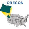
Oregon Geodata
The GIS data for the State of Oregon WEMAP project.
- Images of area
- Metadata
- Data Download
- Arc/Info, ArcView, or ArcExplorer software is needed to use the downloaded GIS data
ATtILA
ATtILA 3.0 (ArcView 3.x Extension) information.
- USER GUIDE - to learn the functionality of ATtILA 3.0
- EXAMPLES - to see ATtILA 3.0 metric outputs
- DOWNLOAD - to get a copy of ATtILA 3.0 (ArcView 3.x Extension)
Download Information
Data disclaimers and responsibility of use.
Contacts and Contributors
People to contact for information about the project and the constributors to the project.