Jump to main content.


  Northwest Oregon Geodata
  HUCs - 10 digit
  Pilot Area
  Hydrography Data Set
 National Land Cover Data 
  GAP Veg
  Regulated Facilities
  Mines
  Roads
  National Elevation Data
  Soils K Factor
  STATSGO Soils
  Census Blocks Groups
  Census Tract
  ZIP Codes
  Land Ownership

Image of Northwest Oregon National Land Cover Data

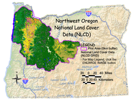
NLCD Metadata    NLCD Data Download    Larger NLCD Image

Northwest Oregon Home | More Databrowsers
Landscape Ecology | Environmental Sciences | Exposure Research | Research and Development


Jump to main content.