|
|
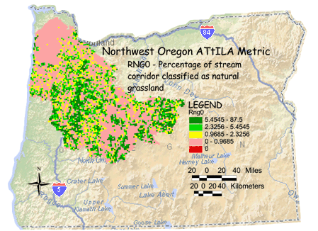
RNG0 - Percentage of stream corridor classified as natural grassland The percentage of natural grassland land cover adjacent to streams is calculated by dividing the number of natural grassland land cover cells underneath stream segments in the grid cell reporting unit and dividing by the stream corridor's total land area (total number cells underneath stream segments minus those classified as water). |
Environmental Sciences: Northwest Oregon
- You are here: EPA Home
- Environmental Sciences
- Northwest Oregon
- Metric Maps/3 KM Grid
- Grass Land/Stream Corridor