 Northern
California Geodata Northern
California Geodata
HUCs
- 10 digit
Pilot
Area
Hydrography
Data Set
National
Land Cover Data
GAP
Veg
Regulated
Facilities
Mines
Roads
National
Elevation Data
Soils
K Factor
STATSGO
Soils
Census
Blocks Groups
Census
Tract
ZIP
Codes
 Land
Ownership Land
Ownership 
|
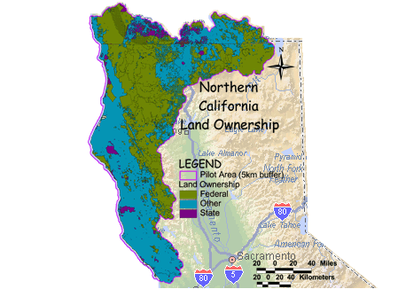
 Land Ownership Metadata
Land Ownership Data
Download Larger
Image Land Ownership Metadata
Land Ownership Data
Download Larger
Image
|