|
|
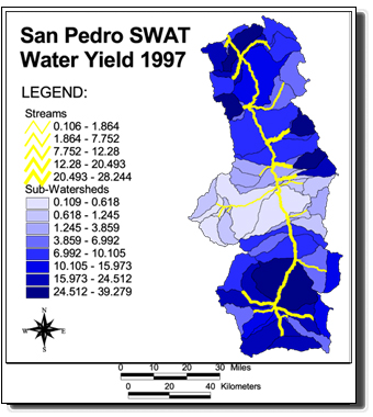
Notice: The AGWA-SWAT output shown above (water yield) is only one of many outputs associated with this dataset. For a complete listing of outputs please consult the attribute information in the metadata.
Disclaimer: The data shown are not observed values
or results from a calibrated model. They are average annual values
derived from an uncalibrated model (SWAT) run through AGWA using all its
default inputs, and a distributed 12-year precipitation record (1960-72) from
7 gauges around the basin. These data are provided for
demonstration purposes only, and should not be used for scientific analysis.
|