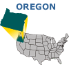
Soils K Factor Metadata

Table of Contents
-
Identification Information
Data Quality Information
Spatial Data Organization Information
Spatial Reference Information
Entity and Attribute Information
Distribution Information
Metadata Reference Information
Download Arcview 3.2 Metadata Extension
IDENTIFICATION_INFORMATION

  Citation:
    Citation_Information:
      Originator:
      Publication_Date:
      Title: Soils K-Factor
      Edition: or_uslek2dd83
      Geospatial_Data_Presentation_Form: Map
      Publication_Information:
        Publication_Place:
        Publisher:
      Other_Citation_Details:
        The Universal Soil Loss Equation (USLE) and its derivative
        the Revised (RUSLE) model are designed to predict long-term
        average annual soil loss. USLE was developed primarily for
        agricultural situations, but revisions for RUSLE have been
        more widely applied. The equation is based on the concept
        that rainfall patterns across a region set up characteristic
        erosion conditions that are mitigated or exacerbated by soil
        type, slope, and land cover conditions.
        The basic equation is: A = R * K * LS * C * P where A is
        long-term average annual soil loss (tons/acre/year), R is the
        rainfall erosivity factor, K is the soil erodibility factor,
        LS is the length-slope factor, C is cover and management
        factor, and P is the support management factor (e.g., strip
        cropping, buffer-strip cropping).
        Over the eastern U.S. R ranges between 75 and 450, and the
        other factors typically range between 0 and 1.
        Conceptually, USLE estimates soil erosion as a reduction in
        potential erosion from rainfall due to soil, slope, and
        land cover characteristics. Soil erodibility factors (K) are
        estimated as part of the Natural Resources Conservation Service
        (NRCS) digital STATSGO soils database. The basic mapping unit
        of STATSGO soils is associated phases of soils series. Each
        soil series typically has a unique K factor. The K factor for
        each map unit was calculated as an area-weighted average of
        its soil components.
      Online_Linkage:
      Larger_Work_Citation:
        Citation_Information:
          Originator:
          Publication_Date:
          Title:
          Publication_Information:
            Publication_Place:
            Publisher:
          Online_Linkage:
  Description:
    Abstract:
      USLE K-factor coefficient times 100 for Oregon, as
      estimated from STATSGO soil map unit coverage, USLE
      Handbook, and other sources.
    Purpose:
      Oregon Geodata Browser Web Site.
    Supplemental_Information:
      K factor (erodibility factor) for the Oregon outer HUC
      boundary estimated
      from Universal Soil Loss Equation (USLE) Using STATSGO
  Time_Period_of_Content:
    Time_Period_Information:
      Range_of_Dates/Times:
        Beginning_Date:
        Ending_Date:
    Currentness_Reference:
  Status:
    Progress: Complete
    Maintenance_and_Update_Frequency: Continually
  Spatial_Domain:
    Bounding_Coordinates:
      West_Bounding_Coordinate: -127.8884
      East_Bounding_Coordinate: -108.1383
      North_Bounding_Coordinate: 50.7173
      South_Bounding_Coordinate: 29.3454
  Keywords:
    Theme:
      Theme_Keyword_Thesaurus: None
      Theme_Keyword: soil erosion
      Theme_Keyword: erodibility
      Theme_Keyword: USLE
      Theme_Keyword: K factor
    Place:
      Place_Keyword_Thesaurus: None
  Access_Constraints:
  Use_Constraints:
    Users are cautioned against treating the K factor values as
    point data specific to a given location on a landscape. The
    K factor grid was developed by area-weighting the array of
    individual STATSGO soil components within a series of soil
    map units delineated within each state, then joining the
    states to the EPA region level. STATSGO is a state-level
    database. As such, the specific K-factor value of a given
    point on the landscape cannot be known with certainty
    because the distribution of soil components within each map
    unit is variable across a state. Finer resolution data can
    be derived from the SSURGO database (for soil survey areas)
    where such data have been released by NRCS. However, SSURGO
    data are only more resolute and still do not provide
    point-specific data.
    Caution must be exercised with the interpretations drawn
    from STATSGO and SSURGO applications. The present version
    of this grid should be considered Draft, for internal use
    only at this time.
  Point_of_Contact:
    Contact_Information:
      Contact_Organization_Primary:
        Contact_Organization: U.S. Environmental Protection Agency
        Contact_Person: Dan Heggem
      Contact_Position: Environmental Sciences Division, Landscape Ecology Branch
      Contact_Address:
        Address_Type: mailing and physical address
        Address:
        City: Las Vegas
        State_or_Province: Nevada
        Postal_Code:
        Country: USA
      Contact_Voice_Telephone: (702) 798-2278
      Contact_Facsimile_Telephone: (702)798-2227
      Contact_Electronic_Mail_Address: HEGGEM.DANIEL@EPAMAIL.EPA.GOV
      Hours_of_Service:
  Native_Data_Set_Environment:
    ESRI Grid format or_uslek2dd83

Top


DATA_QUALITY_INFORMATION

  Attribute_Accuracy:
    Attribute_Accuracy_Report:
  Logical_Consistency_Report:
  Completeness_Report:
  Positional_Accuracy:
    Horizontal_Positional_Accuracy:
      Horizontal_Positional_Accuracy_Report:
    Vertical_Positional_Accuracy:
      Vertical_Positional_Accuracy_Report:
  Lineage:
    Source_Information:
      Source_Citation:
        Citation_Information:
          Originator:
          Publication_Date:
          Title:
          Edition:
          Geospatial_Data_Presentation_Form: map
          Publication_Information:
            Publication_Place:
            Publisher:
          Other_Citation_Details:
          Online_Linkage:
          Larger_Work_Citation:
            Citation_Information:
              Originator:
              Publication_Date:
              Title:
              Publication_Information:
                Publication_Place:
                Publisher:
              Online_Linkage:
      Source_Scale_Denominator:
      Type_of_Source_Media:
      Source_Time_Period_of_Content:
        Time_Period_Information:
          Range_of_Dates/Times:
            Beginning_Date:
            Ending_Date:
        Source_Currentness_Reference:
      Source_Citation_Abbreviation:
      Source_Contribution:
    Source_Information:
      Source_Citation:
        Citation_Information:
          Originator:
          Publication_Date:
          Title:
          Edition:
          Geospatial_Data_Presentation_Form: map
          Publication_Information:
            Publication_Place:
            Publisher:
          Other_Citation_Details:
          Online_Linkage:
          Larger_Work_Citation:
            Citation_Information:
              Originator:
              Publication_Date:
              Title:
              Publication_Information:
                Publication_Place:
                Publisher:
              Online_Linkage:
      Source_Scale_Denominator:
      Type_of_Source_Media:
      Source_Time_Period_of_Content:
        Time_Period_Information:
          Range_of_Dates/Times:
            Beginning_Date:
            Ending_Date:
        Source_Currentness_Reference:
      Source_Citation_Abbreviation:
      Source_Contribution:
    Process_Step:
      Process_Description:
      Source_Used_Citation_Abbreviation:
      Process_Date:
      Source_Produced_Citation_Abbreviation:
      Process_Contact:
        Contact_Information:
          Contact_Person_Primary:
            Contact_Organization: Lockheed Martin Environmental Services
            Contact_Person: Rick Van Remortel
          Contact_Position:
          Contact_Address:
            Address_Type: mailing and physical address
            Address: 980 Kelly Johnson Dr.
            City: Las Vegas
            State_or_Province: Nevada
            Postal_Code: 89119
            Country: USA
          Contact_Voice_Telephone: (702)897-3295
          Contact_Facsimile_Telephone: (702) 897-3285
          Contact_Electronic_Mail_Address: rvanremo@lmepo.com
          Hours_of_Service:

Top


SPATIAL_DATA_ORGANIZATION_INFORMATION

  Direct_Spatial_Reference_Method: Raster
  Raster_Object_Information:
    Raster_Object_Type: Grid Cell
    Row_Count: 68538
    Column_Count: 63337

Top


SPATIAL_REFERENCE_INFORMATION

  Horizontal_Coordinate_System_Definition:
    Geographic:
      Latitude_Resolution:
      Longitude_Resolution:
      Geographic_Coordinate_Units: Decimal Degrees
    Geodetic_Model:
      Horizontal_Datum_Name: North American Datum of 1983
      Ellipsoid_Name: Geodetic Reference System 80
      Semi-major_Axis: 6,378,137
      Denominator_of_Flattening_Ratio: 298.257

Top


ENTITY_AND_ATTRIBUTE_INFORMATION

  Overview_Description:
    Entity_and_Attribute_Overview:
    Entity_and_Attribute_Detail_Citation:

Top


DISTRIBUTION_INFORMATION

  Distributor:
    Contact_Information:
      Contact_Organization_Primary:
        Contact_Organization: U.S. Environmental Protection Agency
        Contact_Person: Dan Heggem
      Contact_Position: Environmental Sciences Division, Landscape Ecology Branch
      Contact_Address:
        Address_Type: mailing and physical address
        Address:
        City: Las Vegas
        State_or_Province: Nevada
        Postal_Code:
        Country: USA
      Contact_Voice_Telephone: (702) 798-2278
      Contact_Facsimile_Telephone: (702) 798-2227
      Contact_Electronic_Mail_Address: HEGGEM.DANIEL@EPAMAIL.EPA.GOV
      Hours_of_Service:
  Resource_Description:
  Distribution_Liability:

Top


METADATA_REFERENCE_INFORMATION

  Metadata_Date: 07/05/2000
  Metadata_Review_Date:
  Metadata_Contact:
    Contact_Information:
      Contact_Organization_Primary:
        Contact_Organization: Lockheed Martin Environmental Services
        Contact_Person: Rick Van Remortel
      Contact_Position:
      Contact_Address:
        Address_Type: Mailing and physical address
        Address: 980 Kelly Johnson Dr.
        City: Las Vegas
        State_or_Province: Nevada
        Postal_Code: 89119
        Country: USA
      Contact_Voice_Telephone: (702) 897-3295
      Contact_Facsimile_Telephone: (702) 897-3285
      Contact_Electronic_Mail_Address: rvanremo@lmepo.com
      Hours_of_Service:
  Metadata_Standard_Name: FGDC CSDGM
  Metadata_Standard_Version: FGDC-STD-001-1998
Top
![[logo] US EPA](../gif/logo_epaseal.gif)