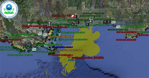
View EPA Data Using Google Earth

Open EPA data in Google Earth (.kmz file) 
- View EPA air, surface water, sediment and waste sampling locations in Google Earth, which are linked to explanations and information throughout this site.
- See EPA air monitoring locations and results for total Volatile Organic Compounds (VOCs) and Particulate Matter (PM).
- Link to EPA data, aerial photography and other information collected by our air sampling plane, the ASPECT.
- Follow EPA's Trace Atmospheric Gas Analyzer (TAGA) bus as it samples the air for toxics
- Get National Geospatial – Intelligence Agency’s (NGA) map of boom locations and daily tracking updates of the oil spill.
- See aerial photography and satellite images from NASA, NOAA and the European Space Agency’s satellite ENVISAT.
- View photos of activities from environmental sampling to cleaning up the beaches
- If you don't have Google Earth installed on your computer, get the free download here.

Close this Window

