Modeling Subsurface Petroleum Hydrocarbon Transport
| Module Home Objectives Table of Contents Previous < Next > |
| 24 of 36 |

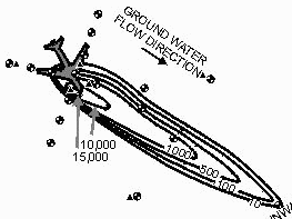
Consider how many wells define the down gradient extent of this plume:
- one well at the toe of the plume
- two wells far outside the contours
- one well in the center of the plume--near the 1000 ug/l contour

|
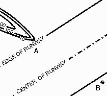
By checking the full size drawing of the site by clicking on the plume drawing above, it can be seen that the down gradient end of the plume is defined by wells on either side of the runway (marked "A" and "B"). It is not possible to know if the plume extends under the runway, simply because the wells are on either side and there is no well to sample beneath the runway. |

|
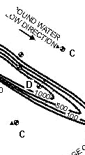
The width of the plume is defined by the wells outside the contour lines (marked "C"). These are far from the assumed edges of the plume. |
Thus the interpretation of this plume is based upon a few wells and there could be other sets of contour lines drawn that would equally well represent the underlying data set. Contour lines could be drawn that extend further from the presumed center of the plume (at "D").
Home | Glossary | Notation | Links | References | Calculators |
