Pacific Southwest, Region 9
Serving: Arizona, California, Hawaii, Nevada, Pacific Islands, Tribal Nations
Federal Facilities
Breakdown of Federal and Tribal Lands in Region 9
The following map shows the land in Region 9 that is owned or managed by federal agencies. Among the 10 EPA regions, Region 9 has the second highest percentage of such land at 53%. Region 10, which includes Alaska, has the highest percentage of federal and tribal land.
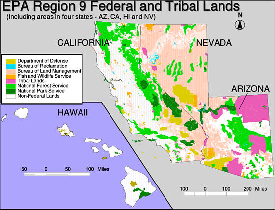
The map above shows the following percentage breakdown of federal and tribal land:
| State | % of Federal Land1 | % of Tribal Land1 | Total % |
| Arizona | 44.6% | 27.9% | 72.5% |
| California | 43.6% | .64% | 44.24% |
| Hawaii | 15.1% | 0% | 15.1% |
| Nevada | 82.9% | 1.7% | 84.6% |
1based on data from U.S. Census Bureau, 2001.
| Pacific Southwest NewsroomPacific Southwest Programs | Grants & FundingUS-Mexico Border | Media CenterCareers | About EPA Region 9 (Pacific Southwest)A-Z Index |